MyTopo
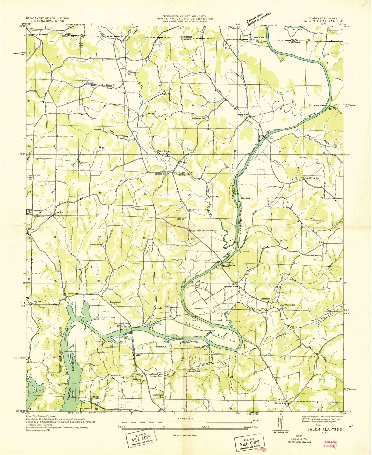
Classic USGS Salem Alabama 7.5'x7.5' Topo Map
Couldn't load pickup availability
Historical USGS topographic quad map of Salem in the states of Alabama, Tennessee. Map scale may vary for some years, but is generally around 1:24,000. Print size is approximately 24" x 27"
This quadrangle is in the following counties: Giles, Limestone.
The map contains contour lines, roads, rivers, towns, and lakes. Printed on high-quality waterproof paper with UV fade-resistant inks, and shipped rolled.
Contains the following named places: Adams Cemetery, Athens Water Treatment Plant, Baptizing Branch, Beasley Spring, Blue Spring, Brown Cemetery, Browning Cemetery, Buck Island, Buck Island Bridge, Buzzard Roost Hollow, Cabbage Ridge, Cartwright School, Cave Spring, Cedar Bluff Spring, Chatman Hollow, Chickasaw Shoals, Clifton, Coffman Branch, Collier Branch, Collier Cemetery, Craig Cemetery, Crooked Branch, Cross Key Church, Cross Key United Methodist Church, Cunningham Cemetery, Davis Branch, Double Branch, Dupree Cemetery, Dupree Hollow, Easter Ferry, Easter Ferry Bridge, Elk River Fish Hatchery, Elkwood Church, Friendship School, Gallus Island, Gardner Hollow, Gaston Cave Spring, Gaston Cemetery, Gaston Church, Gaston Hollow, Gilbertsboro School, Gilbertsborough Post Office, Gipsy, Gipsy Spring, Gourdsville, Gray Cemetery, Gray Ridge, Gray Ridge School, Greenhill School, Grigsby Cemetery, Grigsby Ferry, Happy Hollow, Happy Hollow Church, Hightower Cemetery, Hillside Spring, Horton Hollow, Jenkins Creek, Jones Hollow, Lebanon Church, Legg Cemetery, Leggtown, Leggtown Church, Lighthouse Church, Lovell Chapel, Maple Bridge, Maple School, Maple Store, Maplewood School, Mason Island, Mill Creek, Mitchell Cemetery, Monday Spring, Moore Branch, Mount Moriah Church, Mount Nebo Church, Mount Rozell School, Nelson Cemetery, Patterson Hollow, Red Hill School, Round Bottom, Saint Mark Church, Salem, Salem Cemetery, Salem Church, Salem Spring, Salem Spring Church, Shoal Creek, Smith Cemetery, Smith Hollow, Spencer Store, Sulphur Creek, Turkey Creek, Vaughn Hollow, Walnut Grove Church, Walnut Hill, West Limestone School, West Limestone Volunteer Fire Department, Williams Spring Branch, Winding Stair Bluff, Witty Branch, Witty Cemetery, Witty Creek, ZIP Codes: 35620, 35647