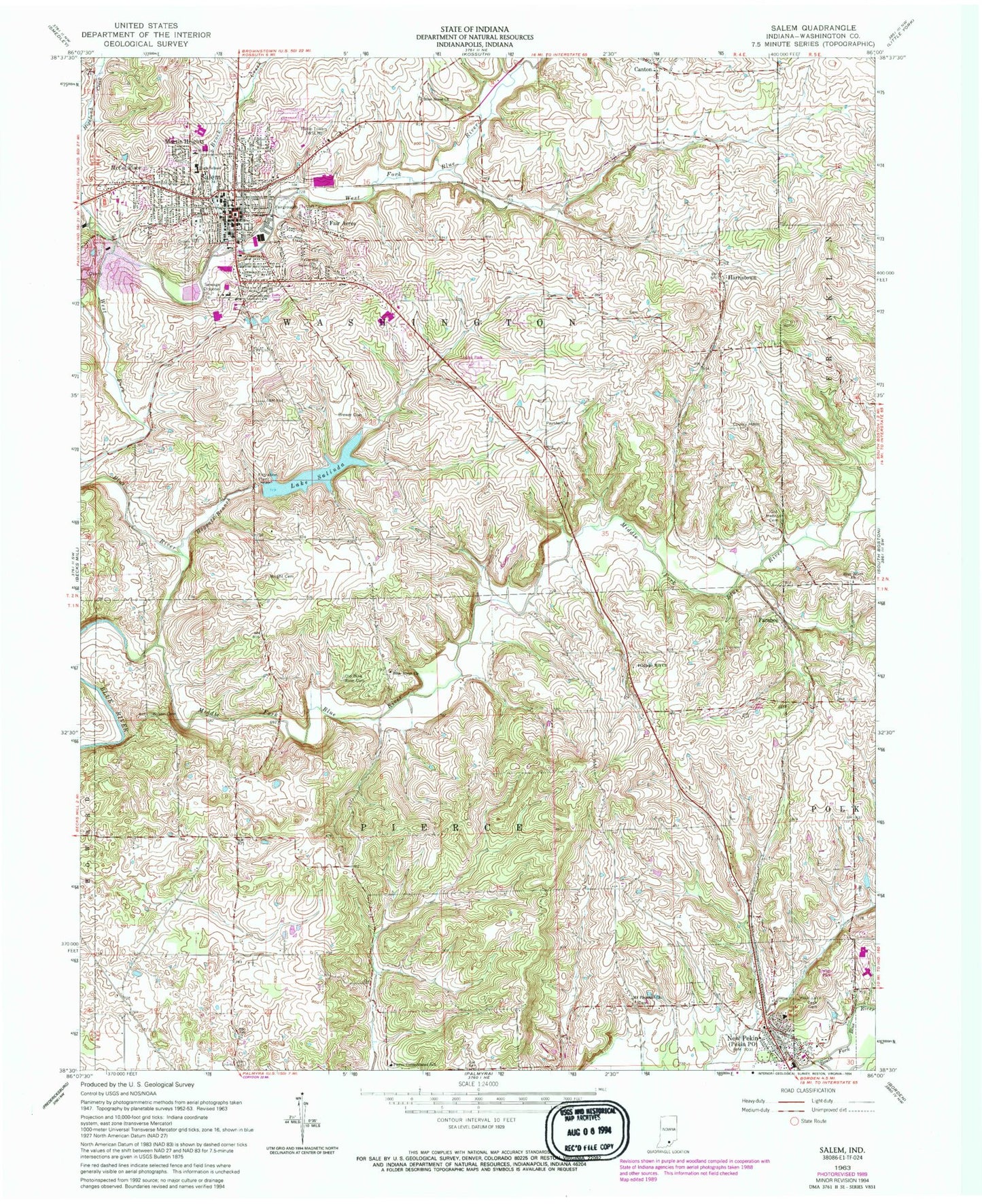
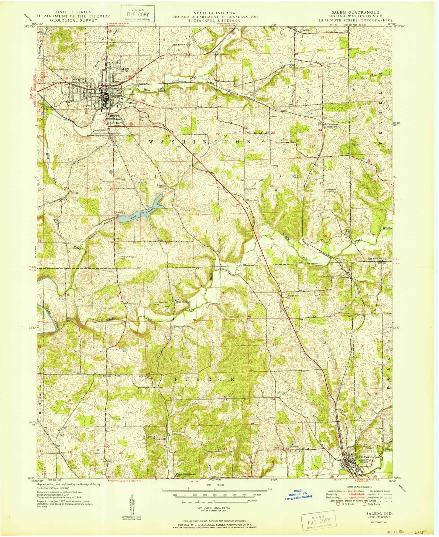
MyTopo
Classic USGS Salem Indiana 7.5'x7.5' Topo Map
Couldn't load pickup availability
Historical USGS topographic quad map of Salem in the state of Indiana. Typical map scale is 1:24,000, but may vary for certain years, if available. Print size: 24" x 27"
This quadrangle is in the following counties: Washington.
The map contains contour lines, roads, rivers, towns, and lakes. Printed on high-quality waterproof paper with UV fade-resistant inks, and shipped rolled.
Contains the following named places: Blue River Church, Blue River Church, Canton, Fair Acres, Farabee, Harristown, Hoggatt Branch, Martin Heights, McCol Place, Mount Pleasant Church, New Pekin, Old Blue River Cemetery, Old Hebron Cemetery, Pierce Consolidated School, Salem, Lake Salinda, Tash Cemetery, West Fork Blue River, Wilson - Mead Cemetery, Wright Cemetery, Blue River Mound, The Grade, WSLM-AM (Salem), WSLM-FM, Hardin Airport, Washington County, Township of Pierce, Township of Washington, Old Blue River Friends Church, Hicksite Church Cemetery, Stalker Cemetery, Norris Cemetery, Paynter Cemetery, Poor Farm Cemetery, Mount Pleasant Church Cemetery, Blue River Baptist Cemetery, New Old Blue River Cemetery, City of Salem, Town of New Pekin, Salem Quarry, Salem Fire Department, Pierce - Polk Township Volunteer Fire Department, Ascension Saint Vincent Salem Hospital, Washington County Sheriff's Office, Salem Police Department, Salem Post Office, Pekin Post Office