MyTopo
Classic USGS Salem New York 7.5'x7.5' Topo Map
Couldn't load pickup availability
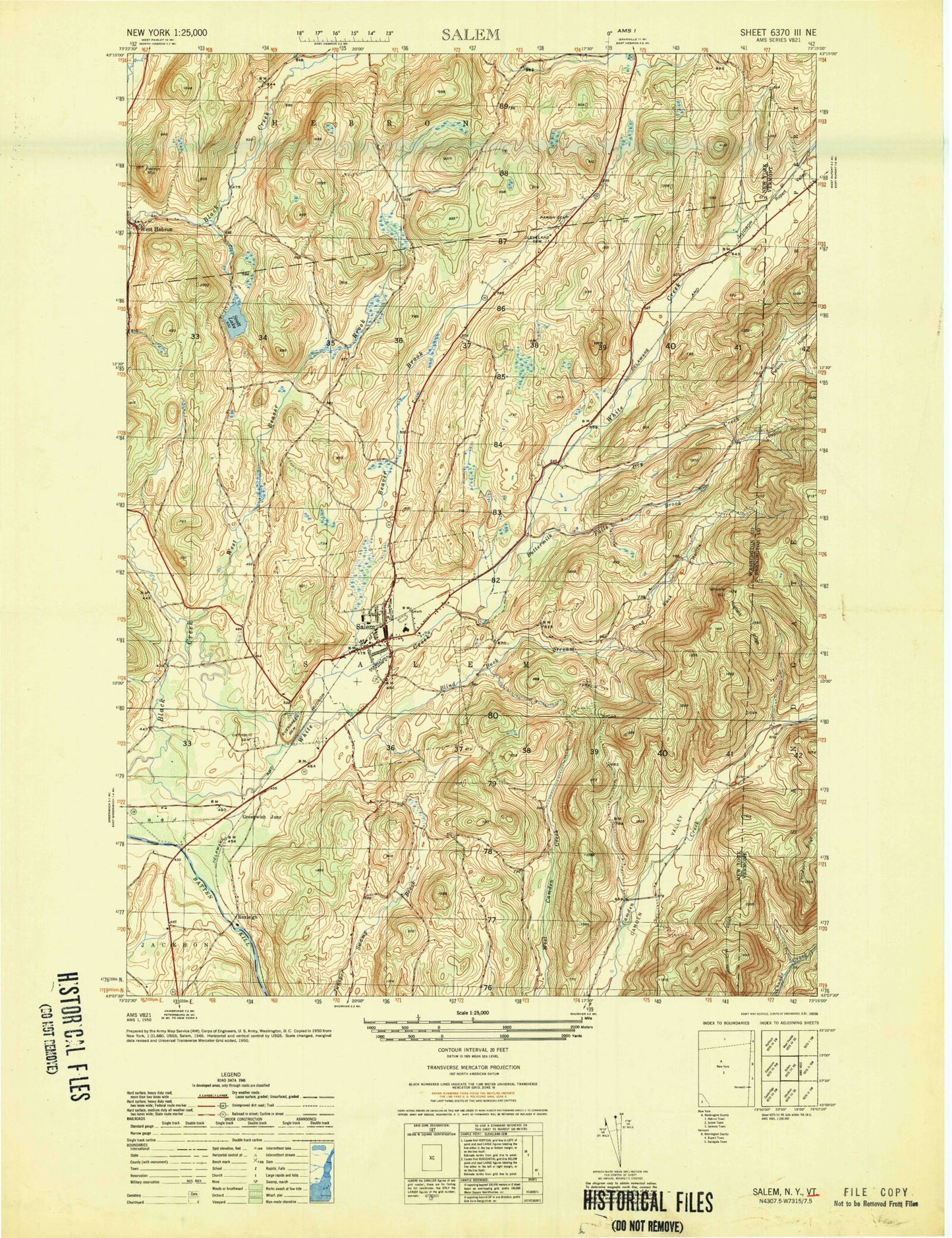
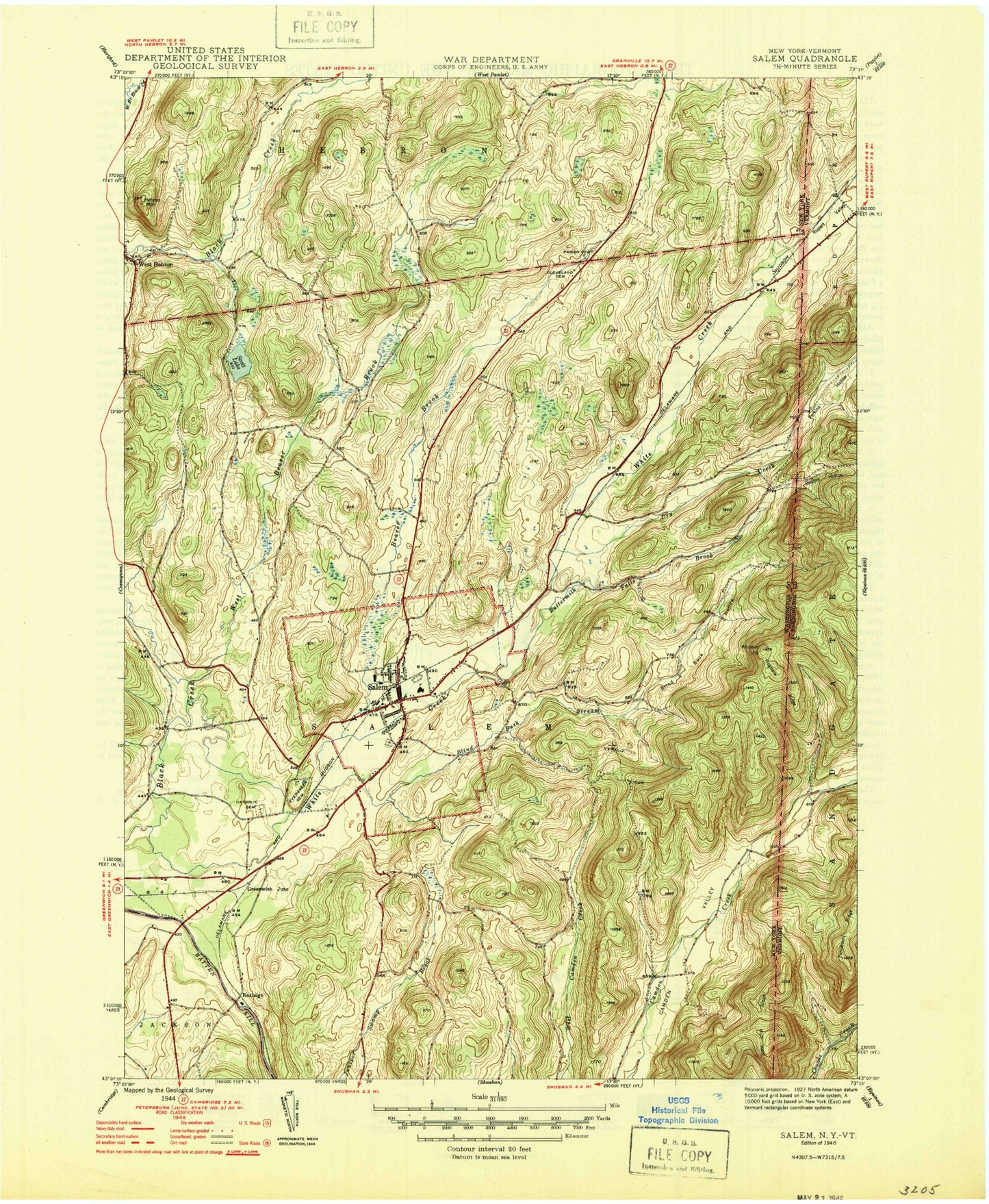
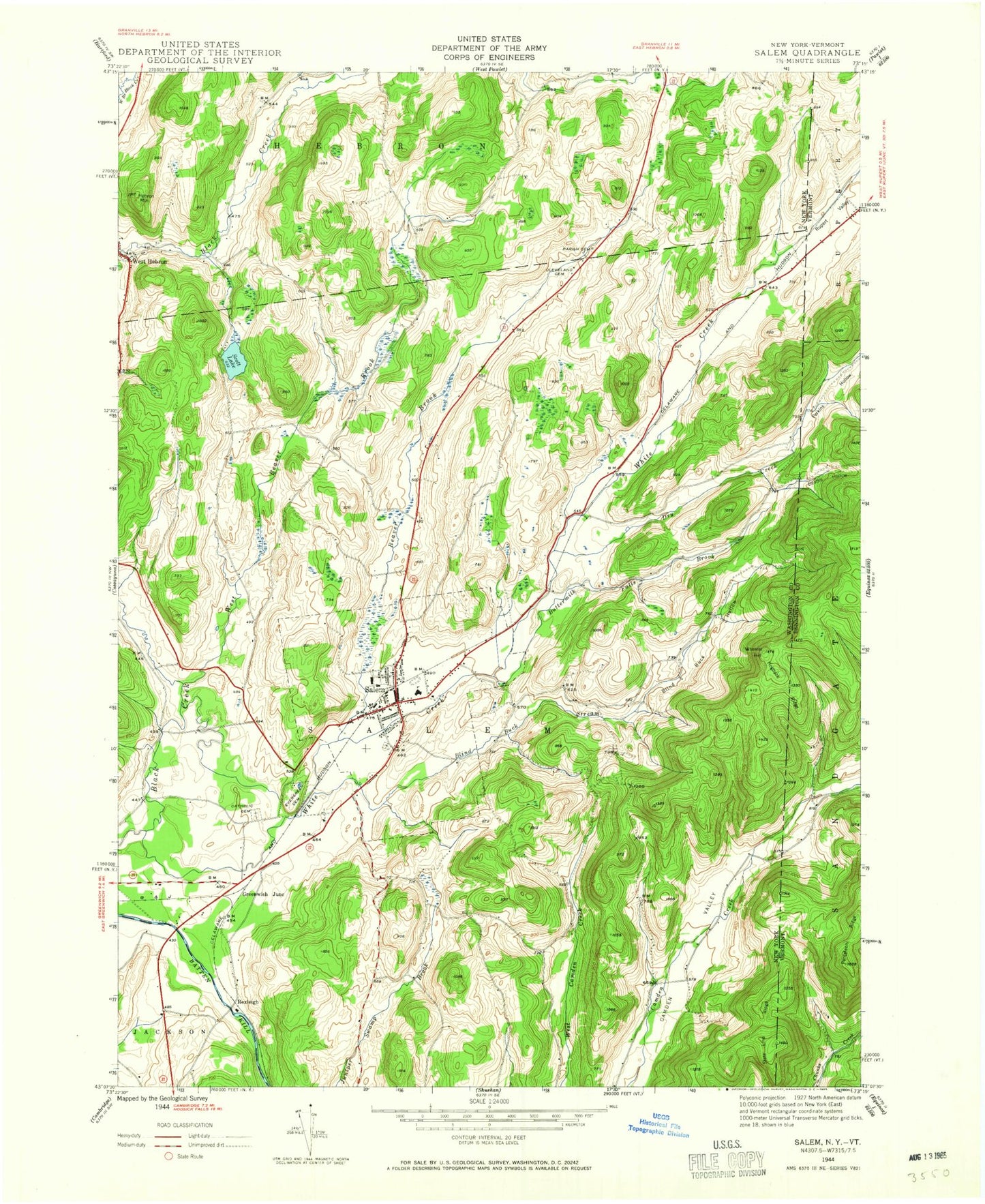
Historical USGS topographic quad map of Salem in the states of New York, Vermont. Typical map scale is 1:24,000, but may vary for certain years, if available. Print size: 24" x 27"
This quadrangle is in the following counties: Bennington, Washington.
The map contains contour lines, roads, rivers, towns, and lakes. Printed on high-quality waterproof paper with UV fade-resistant inks, and shipped rolled.
Contains the following named places: Beattie Hollow, Beaver Brook, Blind Buck Hollow, Blind Buck Stream, Buttermilk Falls Brook, Holy Cross Cemetery, Cleveland Cemetery, Dry Creek, Evergreen Cemetery, Hebron Mountain, Hogback Ridge, Parish Cemetery, Salem, Scott Lake, West Beaver Brook, Wheeler Hill, White Creek, Greenwich Junction, Rexleigh, Town of Salem, Perkins Hollow, Rupert Valley, Village of Salem (historical), Rexleigh Bridge, Salem Central School, Washington County Jail, Battenkill Railroad Station, Holy Cross Catholic Church, Salem Methodist Church, First Presbyterian Church, West Hebron Presbyterian Church, Salem Historic District, Revolutionary War Cemetery, Chambers Valley Farms, Bancroft Public Library, Salem Rescue Squad, Salem Census Designated Place, Salem Post Office, State Line Ridge, Baldwin Brook, Terry Brook, Panteleoni Ridge, Beattie Hollow, Beaver Brook, Blind Buck Hollow, Blind Buck Stream, Buttermilk Falls Brook, Holy Cross Cemetery, Cleveland Cemetery, Dry Creek, Evergreen Cemetery, Hebron Mountain, Hogback Ridge, Parish Cemetery, Salem, Scott Lake, West Beaver Brook, Wheeler Hill, White Creek, Greenwich Junction, Rexleigh, Town of Salem, Perkins Hollow, Rupert Valley, Village of Salem (historical), Rexleigh Bridge, Salem Central School, Washington County Jail, Battenkill Railroad Station, Holy Cross Catholic Church, Salem Methodist Church, First Presbyterian Church, West Hebron Presbyterian Church, Salem Historic District, Revolutionary War Cemetery, Chambers Valley Farms, Bancroft Public Library, Salem Rescue Squad, Salem Census Designated Place, Salem Post Office, State Line Ridge, Baldwin Brook, Terry Brook, Panteleoni Ridge