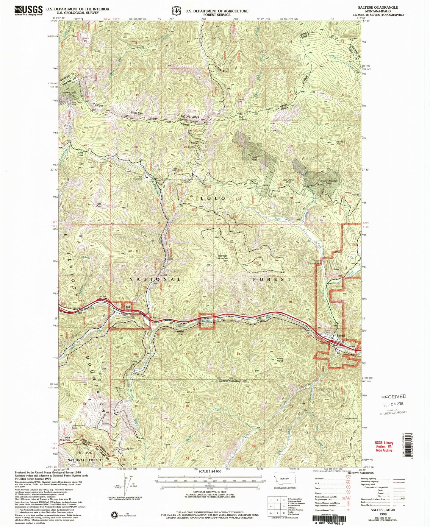
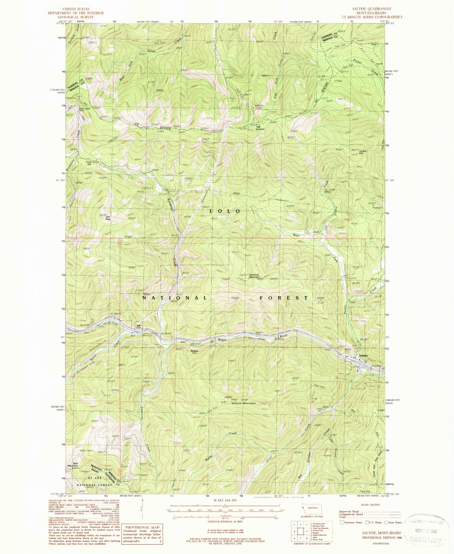
MyTopo
Classic USGS Saltese Montana 7.5'x7.5' Topo Map
Couldn't load pickup availability
Historical USGS topographic quad map of Saltese in the states of Montana, Idaho. Typical map scale is 1:24,000, but may vary for certain years, if available. Print size: 24" x 27"
This quadrangle is in the following counties: Mineral, Sanders, Shoshone.
The map contains contour lines, roads, rivers, towns, and lakes. Printed on high-quality waterproof paper with UV fade-resistant inks, and shipped rolled.
Contains the following named places: Big Sunday Creek, Bryan Mine, Bryson, Burke Creek, Dominion Creek, Ford Hill, Hemlock Mine, Hemlock Mountain, Last Chance Mines, Meadow Mountain Mines, Packer Creek, Rainy Creek, Randolph Creek, Saltese Mountain, Silver Cable Mine, Silver Creek, Taft, Taft Peak, Taft Summit, Tarbox Hill, West Fork Packer Creek, Mephisto Creek, East Fork Pass, Last Chance Creek, Little Sunday Creek, Silver Cable Mine, Hemlock Mine, Boston Colby Mine, Inland Mine, Synidicate Prospect Mine, Last Chance Mine, Bryan Mine, Meadow Mountain Mine, Saltese, Petes Point, Taft (historical), Taft Post Office (historical), Taft School (historical), Saltese (historical), Saltese School (historical), Polleys Spur (historical), Saltese Post Office (historical), Saltese Cemetery, Saltese Census Designated Place, Bald Mountain