MyTopo
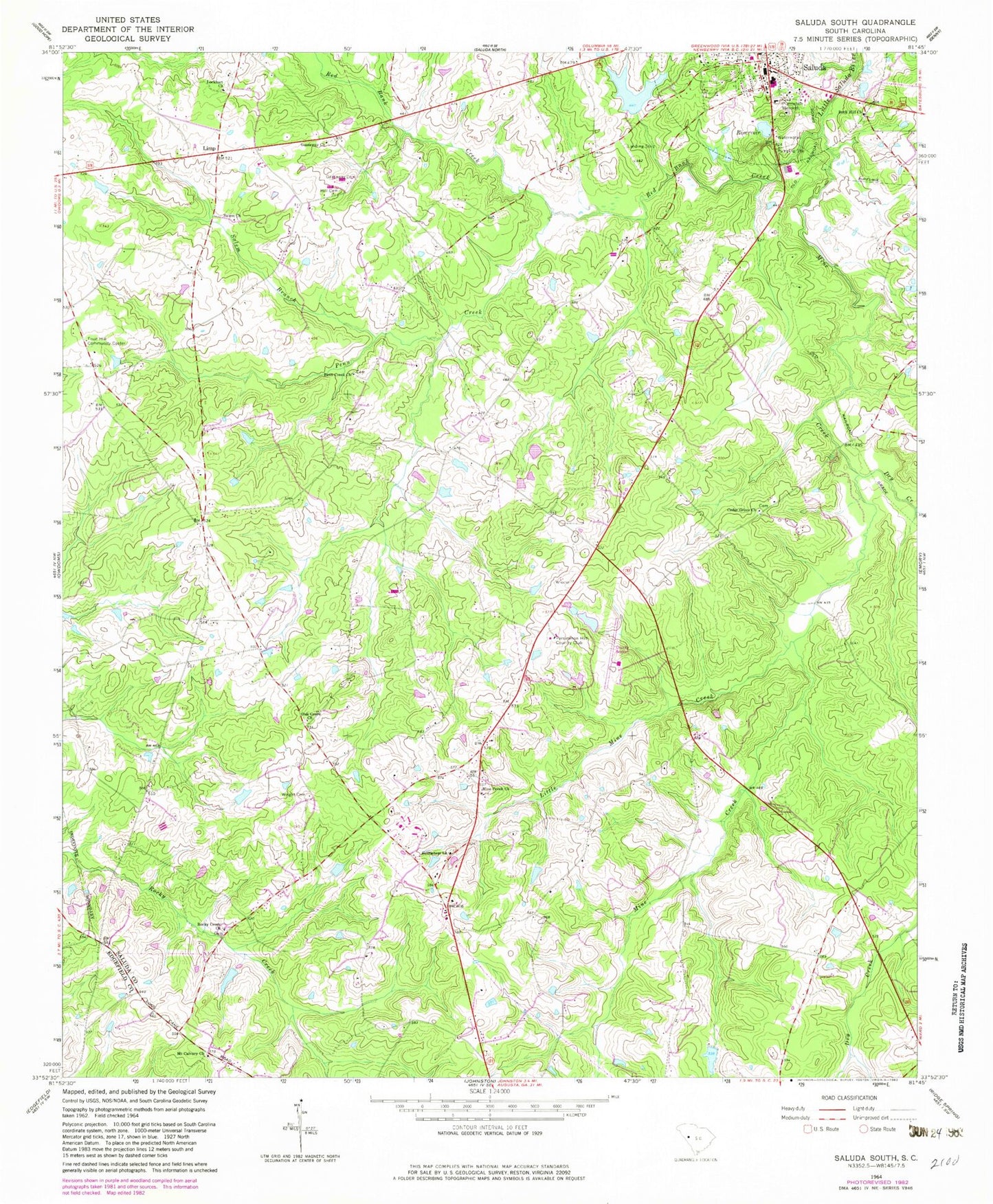
Classic USGS Saluda South South Carolina 7.5'x7.5' Topo Map
Couldn't load pickup availability
Historical USGS topographic quad map of Saluda South in the state of South Carolina. Map scale may vary for some years, but is generally around 1:24,000. Print size is approximately 24" x 27"
This quadrangle is in the following counties: Edgefield, Saluda.
The map contains contour lines, roads, rivers, towns, and lakes. Printed on high-quality waterproof paper with UV fade-resistant inks, and shipped rolled.
Contains the following named places: Bethlehem Church, Bethlehem School, Cedar Grove Church, Dry Creek, Etheredge Plantation Airport, Fruit Hill, Fruit Hill Community Center, Fruit Hill School, Gassaway Cemetery, Gassaway Church, Hill Cemetery, Limp, Little Mine Creek, Lockhart Church, Lockhart School, Mathais Crossroads, Mine Creek, Mine Creek Church, Mine Creek School, Mount Calvary Church, Mount Calvary School, New Saluda Reservoir, Oak Grove Church, Oak Grove School, Old Saluda Reservoir, Old Saluda Reservoir Dam D-0031, Penn Creek, Penn Creek Church, Penn Creek School, Persimmon Hill Country Club, Plum Branch School, Red Bank Creek, Rock Hill Church, Rocky Creek Church, Routons Pond, Routons Pond Dam D-1201, Salem Branch, Salem Church, Saluda County Airport, Saluda Division, South Carolina Noname 41001 D-1196 Dam, South Carolina Noname 41011 D-1202 Dam, Suddath School, Sumter School, Wright Cemetery, Yances Pond, Yances Pond Dam D-1596