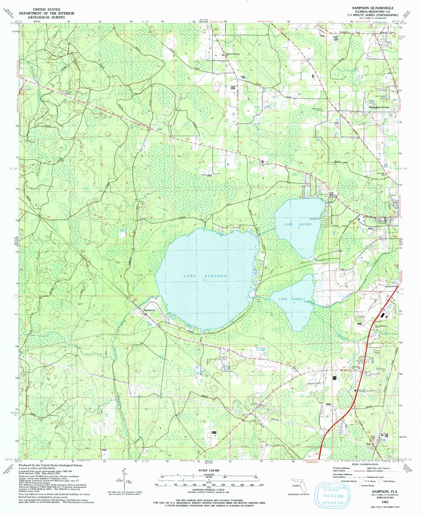
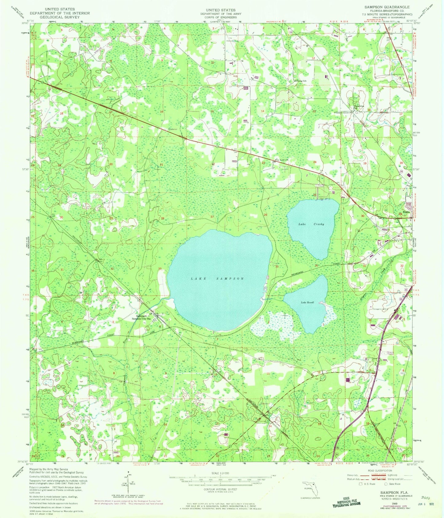
MyTopo
Classic USGS Sampson Florida 7.5'x7.5' Topo Map
Couldn't load pickup availability
Historical USGS topographic quad map of Sampson in the state of Florida. Map scale may vary for some years, but is generally around 1:24,000. Print size is approximately 24" x 27"
This quadrangle is in the following counties: Bradford.
The map contains contour lines, roads, rivers, towns, and lakes. Printed on high-quality waterproof paper with UV fade-resistant inks, and shipped rolled.
Contains the following named places: Alligator Creek, Bayless Hiway Church, Bradford County, Bradford-Union Fire Control Headquarters, Brown Cemetery, Crosby Lake Cemetery, Lake Crosby, Lake Rowell, Lake Sampson, Olin's Mobile Home Park, Pine Level Church, Pleasant Grove, Pleasant Grove Church, Prescott Cemetery, Prevatt Cemetery, Prevatt Creek, Rising School, Sampson, Sampson City Baptist Church, Sampson City Volunteer Fire Department, Seventh Day Adventist Church, Starke Division, Water Oak School, ZIP Code: 32091