MyTopo
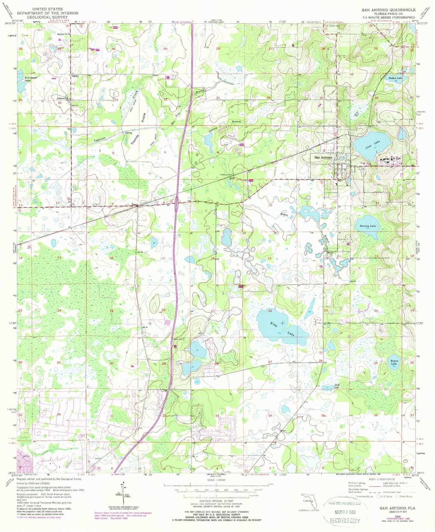
Classic USGS San Antonio Florida 7.5'x7.5' Topo Map
Couldn't load pickup availability
Historical USGS topographic quad map of San Antonio in the state of Florida. Map scale may vary for some years, but is generally around 1:24,000. Print size is approximately 24" x 27"
This quadrangle is in the following counties: Pasco.
The map contains contour lines, roads, rivers, towns, and lakes. Printed on high-quality waterproof paper with UV fade-resistant inks, and shipped rolled.
Contains the following named places: Academy at the Farm, Alliance Church, Amelia Church, Bayou Branch, Bayou Lake, Bee Tree Branch, Bird Island Lakes, Central Pasco Division, City of San Antonio, Clear Lake, Darby, Dick Lake, Emmaus Cemetery, Gator Lake Heliport, Holton Cemetery, Hudson Lake, Karney Lake, King Lake, Pasco, Pasco County Fire Rescue Station 27, Quail Hollow Elementary School, Saint Joseph Cemetery, Saint Leo, Saint Leo College, Saint Leo Post Office, Saint Leo Tower, San Antonio, San Antonio Elementary School, San Antonio Post Office, Stanley Branch, Thomas Prairie, Town of Saint Leo, Wesley Chapel Elementary School, Wesley Chapel High Adult Education School, Wesley Chapel High School, ZIP Codes: 33544, 33545, 33576