MyTopo
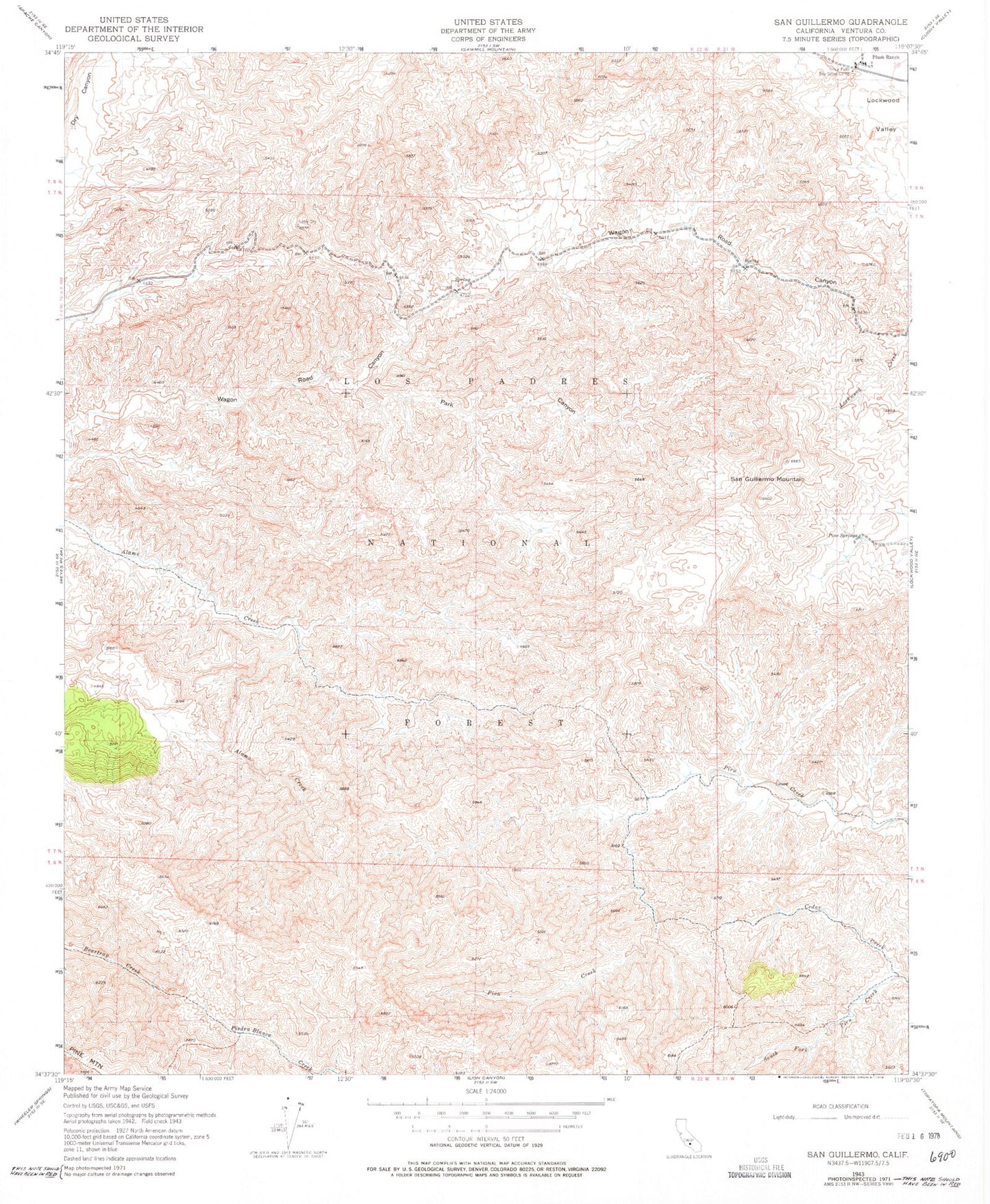
Classic USGS San Guillermo Mountain California 7.5'x7.5' Topo Map
Couldn't load pickup availability
Historical USGS topographic quad map of San Guillermo Mountain in the state of California. Typical map scale is 1:24,000, but may vary for certain years, if available. Print size: 24" x 27"
This quadrangle is in the following counties: Ventura.
The map contains contour lines, roads, rivers, towns, and lakes. Printed on high-quality waterproof paper with UV fade-resistant inks, and shipped rolled.
Contains the following named places: Park Canyon, Plush Ranch, Pine Spring, San Guillermo Mountain, Camp Three Falls, Piedra Blanca National Recreation Trail, Haddock Campsite, Pine Spring Campground, Cedar Lake Trail, Pine Springs Recreation Site, Cedar Campground, Fish Bowls Campground, Haddock Campground, Los Padres Division, Park Canyon, Plush Ranch, Pine Spring, San Guillermo Mountain, Camp Three Falls, Piedra Blanca National Recreation Trail, Haddock Campsite, Pine Spring Campground, Cedar Lake Trail, Pine Springs Recreation Site, Cedar Campground, Fish Bowls Campground, Haddock Campground, Los Padres Division, Park Canyon, Plush Ranch, Pine Spring, San Guillermo Mountain, Camp Three Falls, Piedra Blanca National Recreation Trail, Haddock Campsite, Pine Spring Campground, Cedar Lake Trail, Pine Springs Recreation Site, Cedar Campground, Fish Bowls Campground, Haddock Campground, Los Padres Division