MyTopo
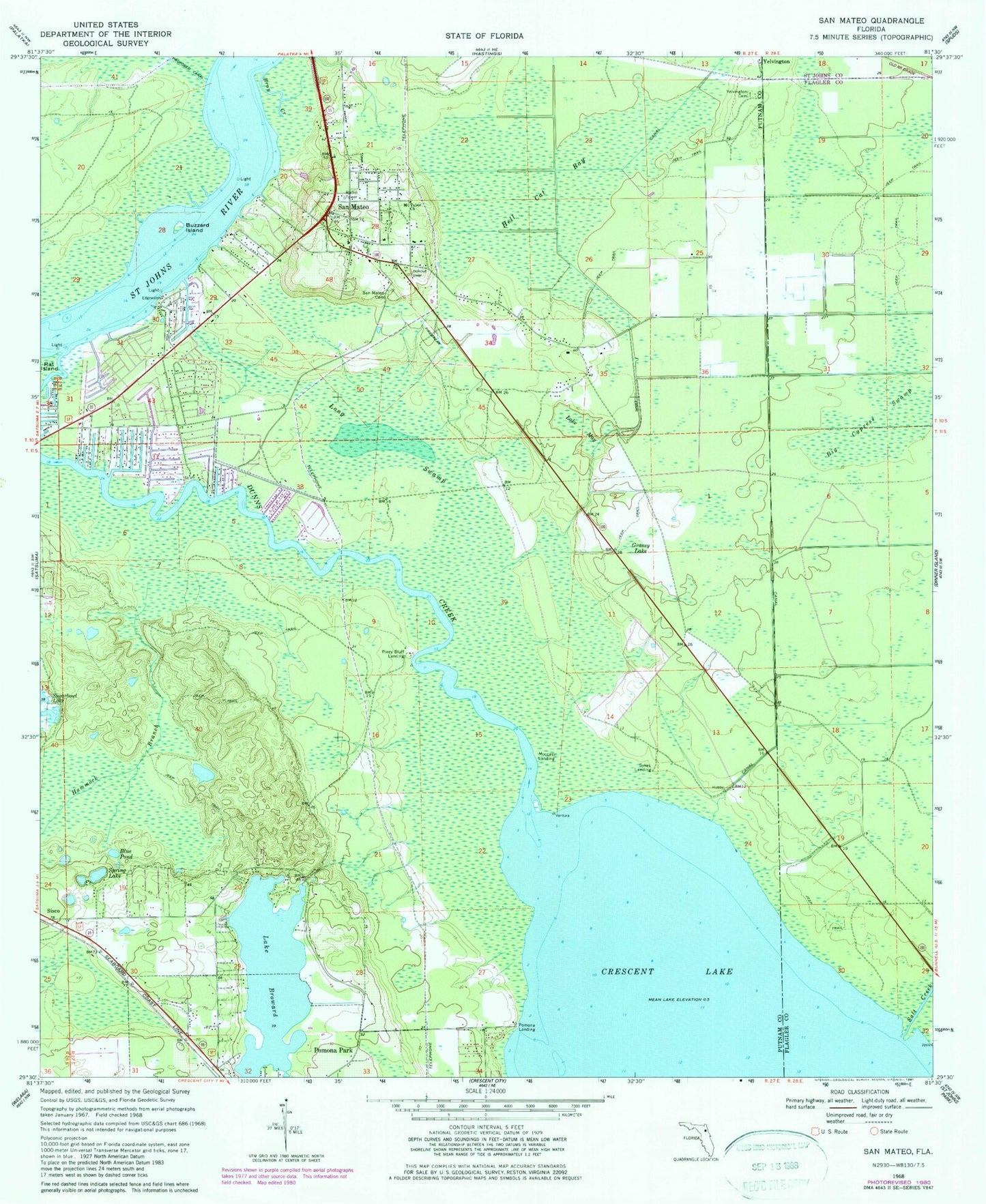
Classic USGS San Mateo Florida 7.5'x7.5' Topo Map
Couldn't load pickup availability
Historical USGS topographic quad map of San Mateo in the state of Florida. Map scale may vary for some years, but is generally around 1:24,000. Print size is approximately 24" x 27"
This quadrangle is in the following counties: Flagler, Putnam, St. Johns.
The map contains contour lines, roads, rivers, towns, and lakes. Printed on high-quality waterproof paper with UV fade-resistant inks, and shipped rolled.
Contains the following named places: Acosta Grant, Blue Pond, BNCFL Airport, Bray Creek, Buzzard Island, Church of God, Clarke and Atkinson Grant, Dunns Creek Baptist Church, Farm Service Agency Interest of Florida, G W Perpall Grant, Grassy Lake, Hammock Branch, Hell Cat Bay, Job Wiggins Grant, John Broward Grant, Lake Broward, Lake May, Long Swamp, Moccasin Landing, Mount Tabor Church, Piney Bluff Landing, Pomona Landing, Pomona Park, Salt Creek, San Mateo, San Mateo Cemetery, San Mateo Fire Department Station 19, San Mateo Post Office, San Mateo Tower, Shell Hill Point, Spring Lake, Sutherlands Still, Sykes Cove, Sykes Landing, Town of Pomona Park, Willow Cove, Willow Point, Yelvington Cemetery, ZIP Codes: 32181, 32187