MyTopo
Classic USGS San Miguel Island East California 7.5'x7.5' Topo Map
Regular price
$16.95
Regular price
Sale price
$16.95
Unit price
per
Couldn't load pickup availability
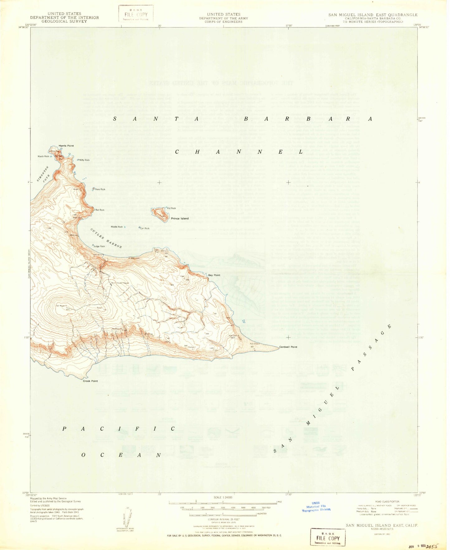
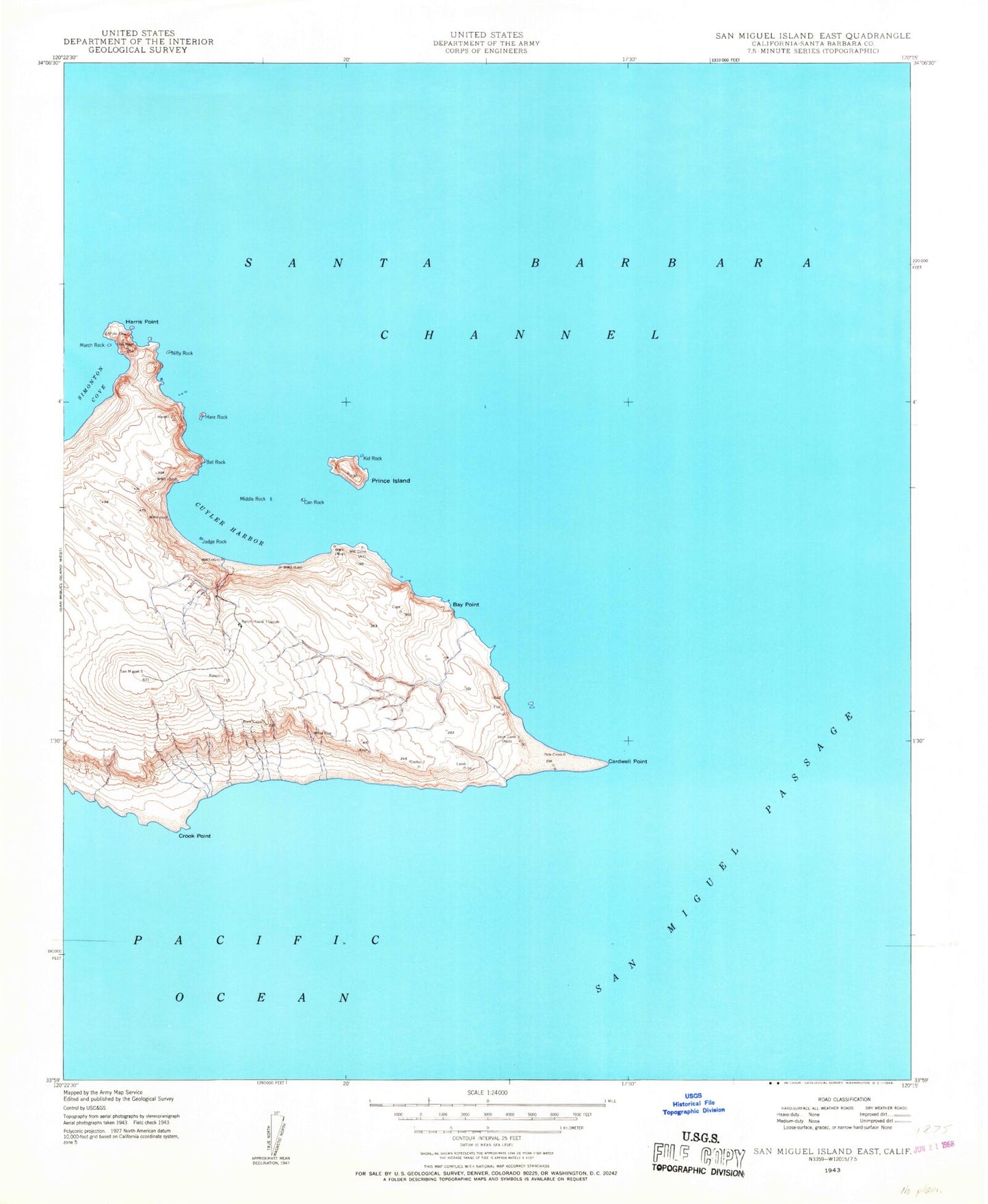
Historical USGS topographic quad map of San Miguel Island East in the state of California. Map scale may vary for some years, but is generally around 1:24,000. Print size is approximately 24" x 27"
This quadrangle is in the following counties: Santa Barbara.
The map contains contour lines, roads, rivers, towns, and lakes. Printed on high-quality waterproof paper with UV fade-resistant inks, and shipped rolled.
Contains the following named places: Bat Rock, Bay Point, Can Rock, Cardwell Point, Clover Rock, Crook Point, Cuyler Harbor, Gull Rock, Hare Rock, Harris Point, Judge Rock, Kid Rock, March Rock, Middle Rock, Nifty Rock, Prince Island, Ranch House Flagpole, San Miguel Passage