MyTopo
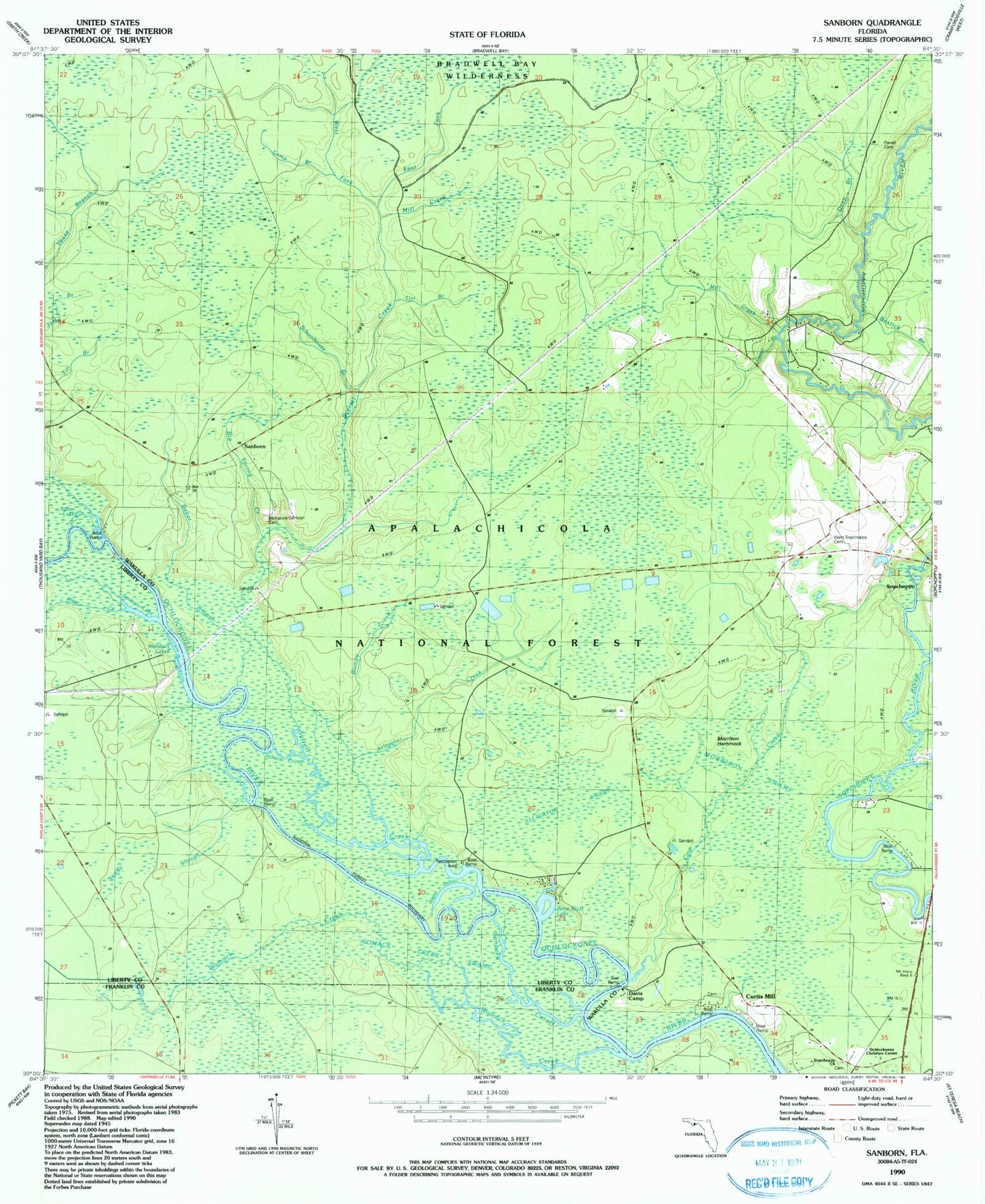
Classic USGS Sanborn Florida 7.5'x7.5' Topo Map
Couldn't load pickup availability
Historical USGS topographic quad map of Sanborn in the state of Florida. Map scale may vary for some years, but is generally around 1:24,000. Print size is approximately 24" x 27"
This quadrangle is in the following counties: Franklin, Liberty, Wakulla.
The map contains contour lines, roads, rivers, towns, and lakes. Printed on high-quality waterproof paper with UV fade-resistant inks, and shipped rolled.
Contains the following named places: Alligator Creek, Alligator Swamp, Baker Branch, Big Spring Creek, Bone Bluff Lake, Bostick Branch, Bumpy Creek, Camp Branch, Cow Creek, Curtis Mill, Davis Camp, Deep Branch, Duval Branch, East Fork Syfrett Creek, Haw Creek, Joel Branch, Marshall Lakes, Mill Creek, Morrison Hammock, Morrison Hammock Scenic Area, Mount Beeser Church, Sanborn, Sanborn Cutoff, Sanborn Lake, Sanborn Lookout Tower, Sanborn McKenzie Cemetery, Sanborn School, Schoolhouse Branch, Silver Lake, Sufrett Cutoff, Syfrett Creek, Titi Branch, West Fork Syfrett Creek, West Sopchoppy Cemetery, Womack Creek, Womack Creek Swamp, Wood Lake, Wood Lake Campground, ZIP Code: 32358