MyTopo
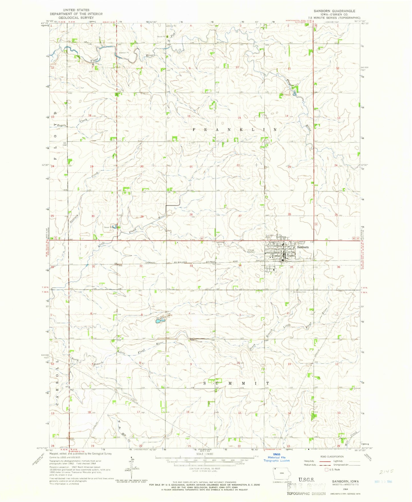
Classic USGS Sanborn Iowa 7.5'x7.5' Topo Map
Couldn't load pickup availability
Historical USGS topographic quad map of Sanborn in the state of Iowa. Map scale may vary for some years, but is generally around 1:24,000. Print size is approximately 24" x 27"
This quadrangle is in the following counties: O'Brien.
The map contains contour lines, roads, rivers, towns, and lakes. Printed on high-quality waterproof paper with UV fade-resistant inks, and shipped rolled.
Contains the following named places: Allison Acres, B and B Farms, Christian Reformed Church, City of Sanborn, Cornerstone United Reformed Church, Diamond H Farms, Douma Park, First Reformed Church, Getting Farms, Hartley - Melvin - Sanborn Middle School, Hartog Elevator Incorporated Elevator, Hofman Farm, North Fork Floyd River, Peelen Farms, Prairie View Retirement Home, Roseland Cemetery, Saint Andrews United Methodist Church, Saint Cecilia Catholic Church, Saint Cecilia Cemetery, Saint Johns Lutheran Church, Sanborn, Sanborn Ambulance Service, Sanborn Chiropractic Clinic, Sanborn Christian School, Sanborn Golf and Country Club, Sanborn Medical Clinic, Sanborn Post Office, Sanborn Presbyterian Church, Sanborn Public Library, Sanborn Sow Farm, Siouxland Farmers Co-op Elevator, Solsma Farms, Township of Franklin, Township of Summit, Vollink Farms, ZIP Code: 51248