MyTopo
Classic USGS Sand Lake SW Michigan 7.5'x7.5' Topo Map
Couldn't load pickup availability
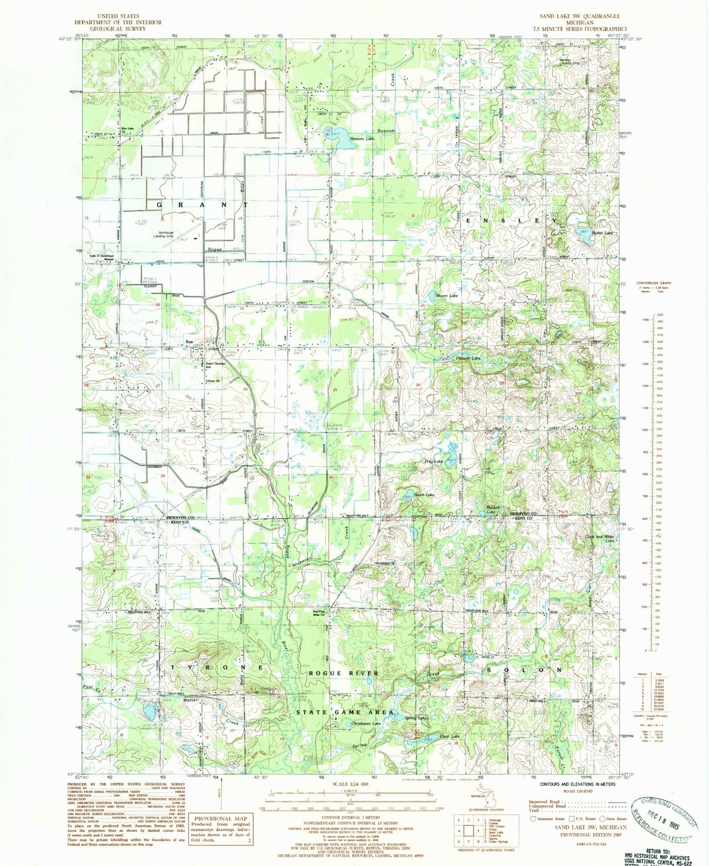
Historical USGS topographic quad map of Sand Lake SW in the state of Michigan. Map scale may vary for some years, but is generally around 1:24,000. Print size is approximately 24" x 27"
This quadrangle is in the following counties: Kent, Newaygo.
The map contains contour lines, roads, rivers, towns, and lakes. Printed on high-quality waterproof paper with UV fade-resistant inks, and shipped rolled.
Contains the following named places: Baldwin Lake, Bellamy Landing Strip, Bolthouse Landing Strip, Butler Lake, Chrishaven Lake, Clear Lake, Costen Drain, Flowing Well School, Frey Lake, Frey School, Geers Drain, Grant Church, Grant School, Harwell Lake, Hickory Creek, Hilbrand Drain, Lady of Guadalupe Mission, Longcore School, Moore Lake, Perrins Post Office, Plaiser Drain, Plumville Post Office, Ransom Creek, Ransom Lake, Red Pine Bible Church, Rice Lake Church, South Lake, Spring Lake, Spring Valley School, Sun, Sun Post Office, Township of Grant, Veenboer Drain, Walter Creek