MyTopo
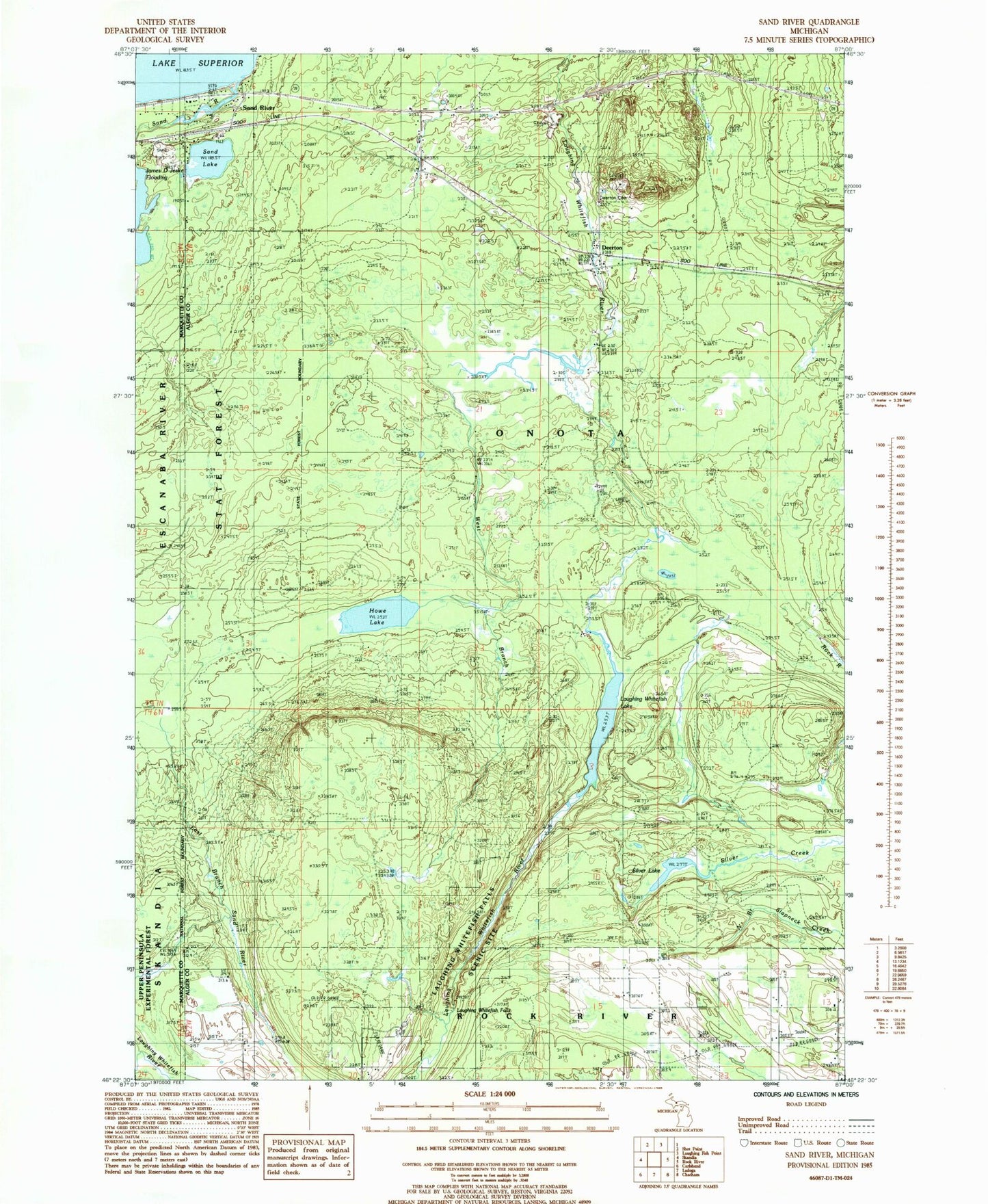
Classic USGS Sand River Michigan 7.5'x7.5' Topo Map
Couldn't load pickup availability
Historical USGS topographic quad map of Sand River in the state of Michigan. Map scale may vary for some years, but is generally around 1:24,000. Print size is approximately 24" x 27"
This quadrangle is in the following counties: Alger, Marquette.
The map contains contour lines, roads, rivers, towns, and lakes. Printed on high-quality waterproof paper with UV fade-resistant inks, and shipped rolled.
Contains the following named places: Au Train-Onota Public Schools, Deerton, Deerton Cemetery, Deerton Post Office, Deerton Station, Howe Lake, James D Jeske Flooding, Laughing Whitefish Falls, Laughing Whitefish Falls Scenic Site, Laughing Whitefish Lake, Onota Township Volunteer Fire Department, Sand Lake, Sand River, Sand River Post Office, Sand River Station, Silver Lake, Tyoga Post Office, Tyoga Station, West Branch Laughing Whitefish River, ZIP Code: 49822