MyTopo
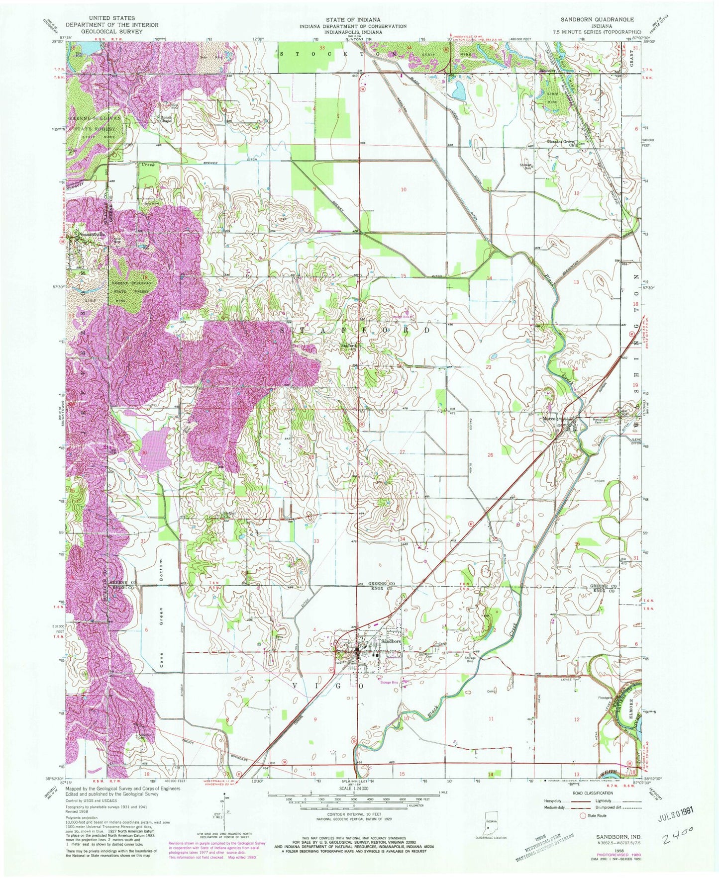
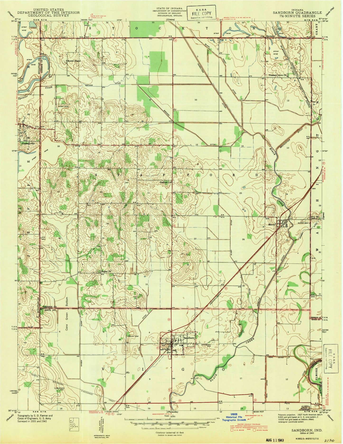
Classic USGS Sandborn Indiana 7.5'x7.5' Topo Map
Couldn't load pickup availability
Historical USGS topographic quad map of Sandborn in the state of Indiana. Map scale may vary for some years, but is generally around 1:24,000. Print size is approximately 24" x 27"
This quadrangle is in the following counties: Daviess, Greene, Knox, Sullivan.
The map contains contour lines, roads, rivers, towns, and lakes. Printed on high-quality waterproof paper with UV fade-resistant inks, and shipped rolled.
Contains the following named places: Armuth Ditch, Begeman Cemetery, Bethel Church, Black Creek Ditch, Brewer Ditch, Burris Chapel, Calico Slash Ditch, Cane Green Bottom, Delay Cemetery, Goose Pond, Greene-Sullivan State Forest, Hamilton Ditch, Hill Ditch, Marco, Marco Cemetery, McGinnis Levee, Neal Levee, Pleasant Grove Church, Sandborn, Sandborn Cemetery, Sandborn Post Office, Sandborn Volunteer Fire Department, Singer Ditch, Singer Ditch Dam, Spencer Creek, Stafford Church, Town of Sandborn, Township of Stafford, ZIP Code: 47578