MyTopo
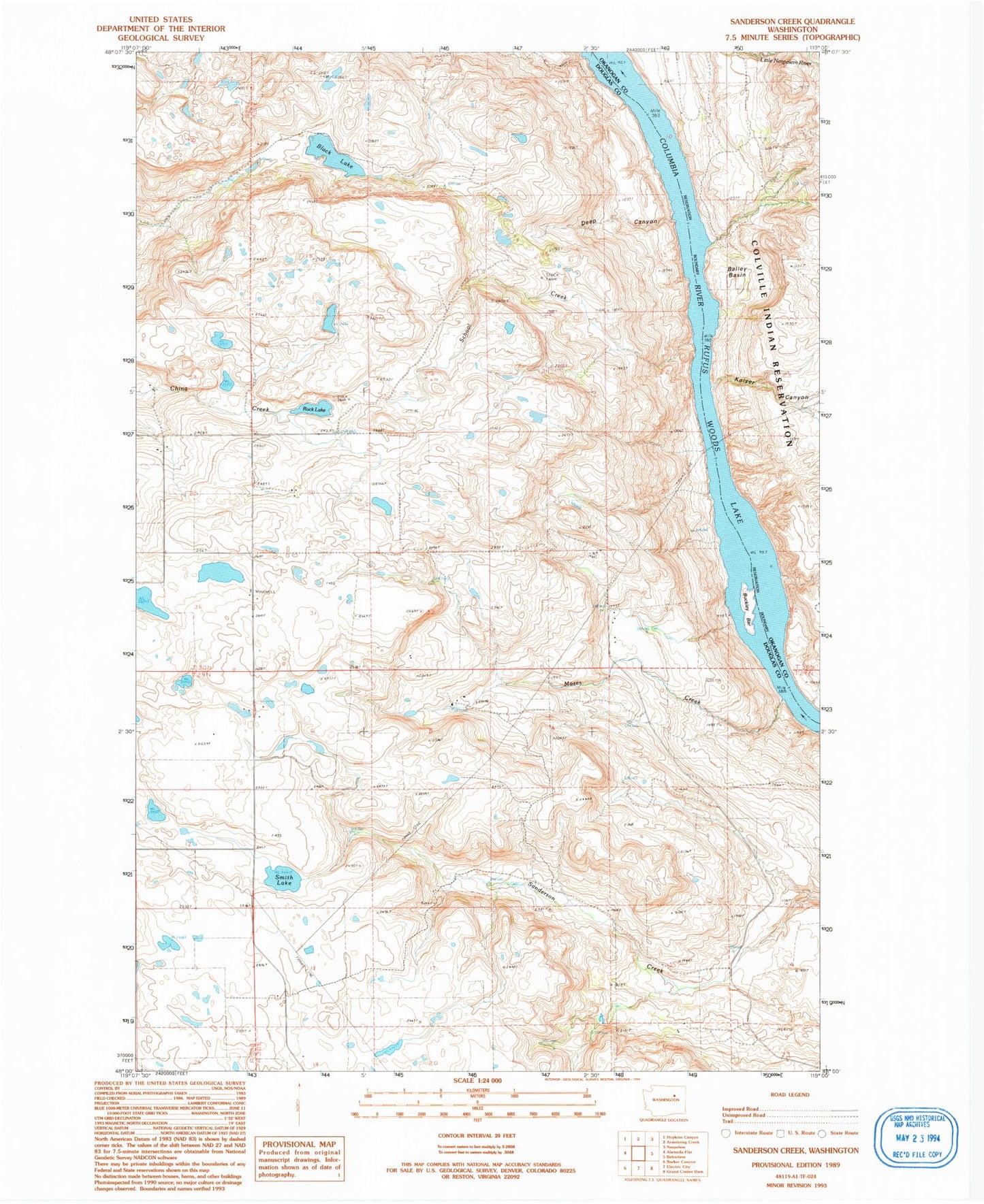
Classic USGS Sanderson Creek Washington 7.5'x7.5' Topo Map
Regular price
$16.95
Regular price
Sale price
$16.95
Unit price
per
Couldn't load pickup availability
Historical USGS topographic quad map of Sanderson Creek in the state of Washington. Map scale may vary for some years, but is generally around 1:24,000. Print size is approximately 24" x 27"
This quadrangle is in the following counties: Douglas, Okanogan.
The map contains contour lines, roads, rivers, towns, and lakes. Printed on high-quality waterproof paper with UV fade-resistant inks, and shipped rolled.
Contains the following named places: Bailey Basin, Barry School, Black Lake, Buckley Bar, Deep Canyon, Equilibrium Rapids, Kaiser Canyon, Monaghan Rapids, Moses Creek, Nespelem Rapids, Rex, Rex Grange Hall, Rock Lake, Rock Lake School, School Creek, Smith Lake, ZIP Code: 99133