MyTopo
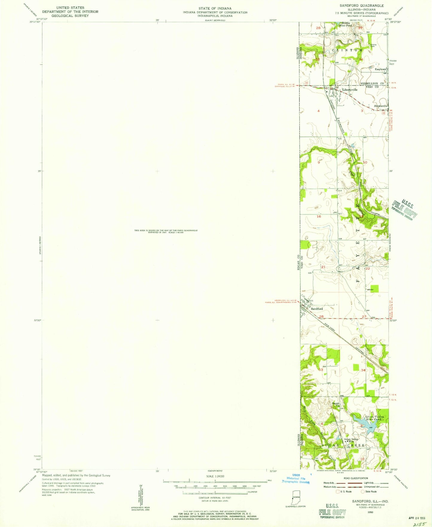
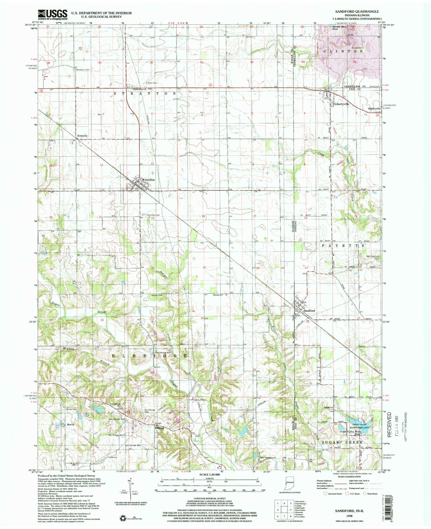
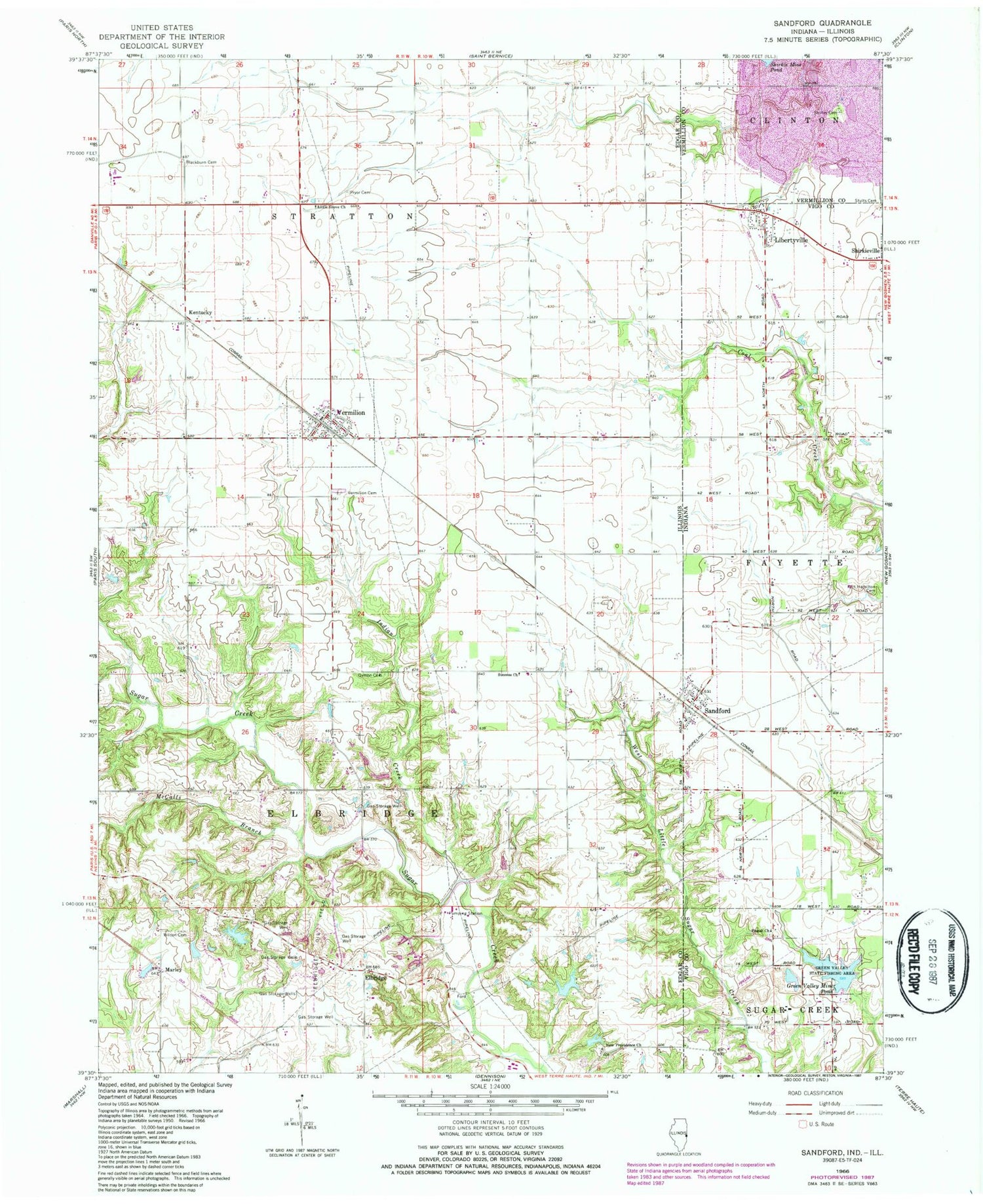
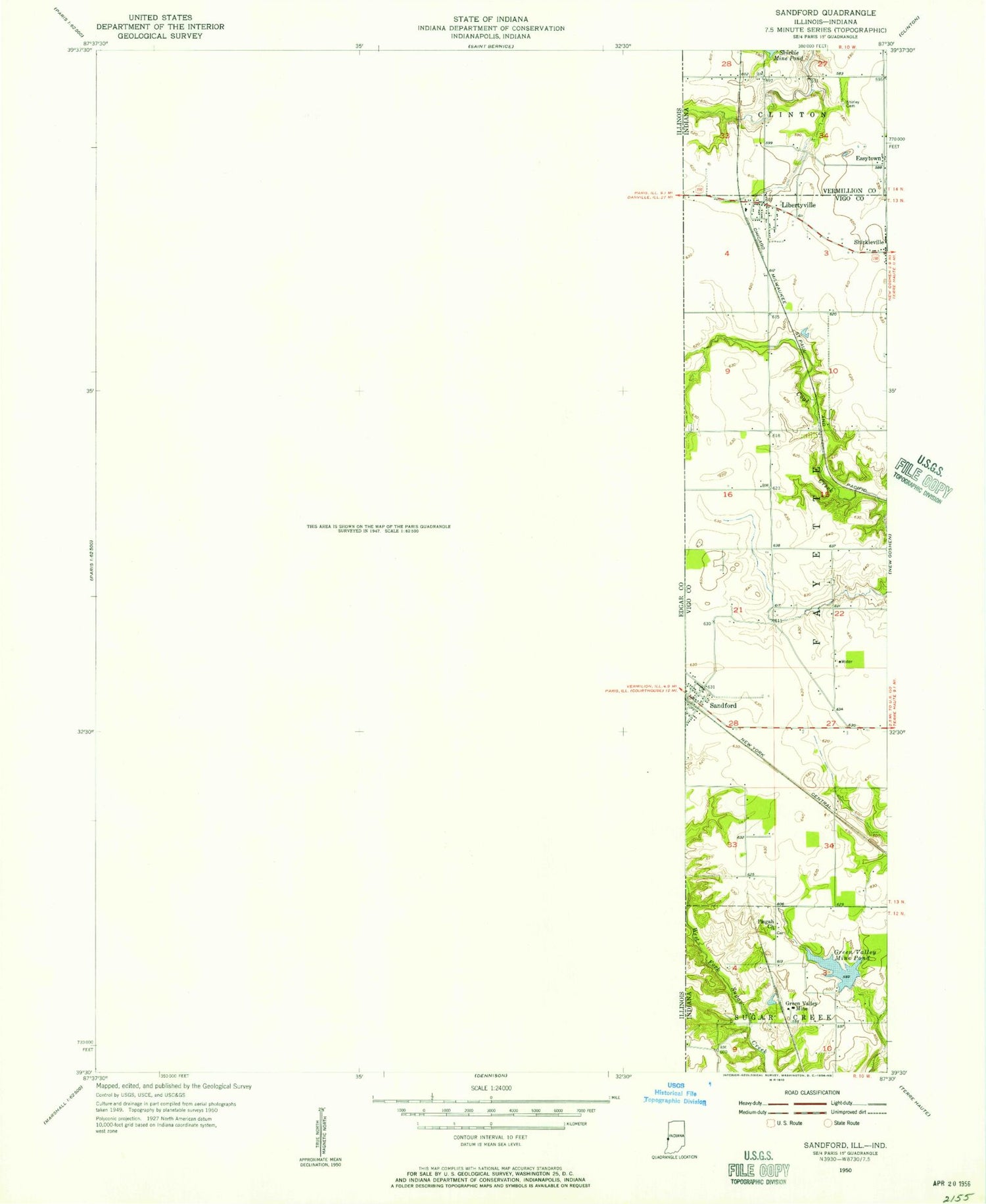
Classic USGS Sandford Indiana 7.5'x7.5' Topo Map
Couldn't load pickup availability
Historical USGS topographic quad map of Sandford in the states of Indiana, Illinois. Map scale may vary for some years, but is generally around 1:24,000. Print size is approximately 24" x 27"
This quadrangle is in the following counties: Edgar, Vermillion, Vigo.
The map contains contour lines, roads, rivers, towns, and lakes. Printed on high-quality waterproof paper with UV fade-resistant inks, and shipped rolled.
Contains the following named places: Blackburn Cemetery, Easytown, Elbridge, Elbridge Oil Field, Farm Pond, Farm Pond Dam, Fayette Township Volunteer Fire Department of Sandford, Fort Hamilton Cemetery, Gin Creek, Grand Central School, Grand Success School, Green Valley Mine Pond, Green Valley Mine Pond Dam, Green Valley Public Fishing Area, Guymon Cemetery, Indian Creek, Kentucky, Kentucky School, Lake Wannetta, Lake Wannetta Dam, Libertyville, Little Grove Cemetery, Little Grove Church, Marley, McCalls Branch, New Providence Cemetery, New Providence Church, New Providence School, Old Baptist Cemetery, Pisgah Church, Pryor Cemetery, Rose Hill Church, Sandford, School Number 7, Shirkie Mine Pond, Shirley Cemetery, Stults Cemetery, Success Church, Success School, Superior School, Tighe, Township of Elbridge, Township of Stratton, Vermilion, Vermilion Cemetery, Vermilion Fire Department, Vermilion Post Office, Village of Vermilion, West Sandford, Wilson Cemetery, ZIP Code: 61955