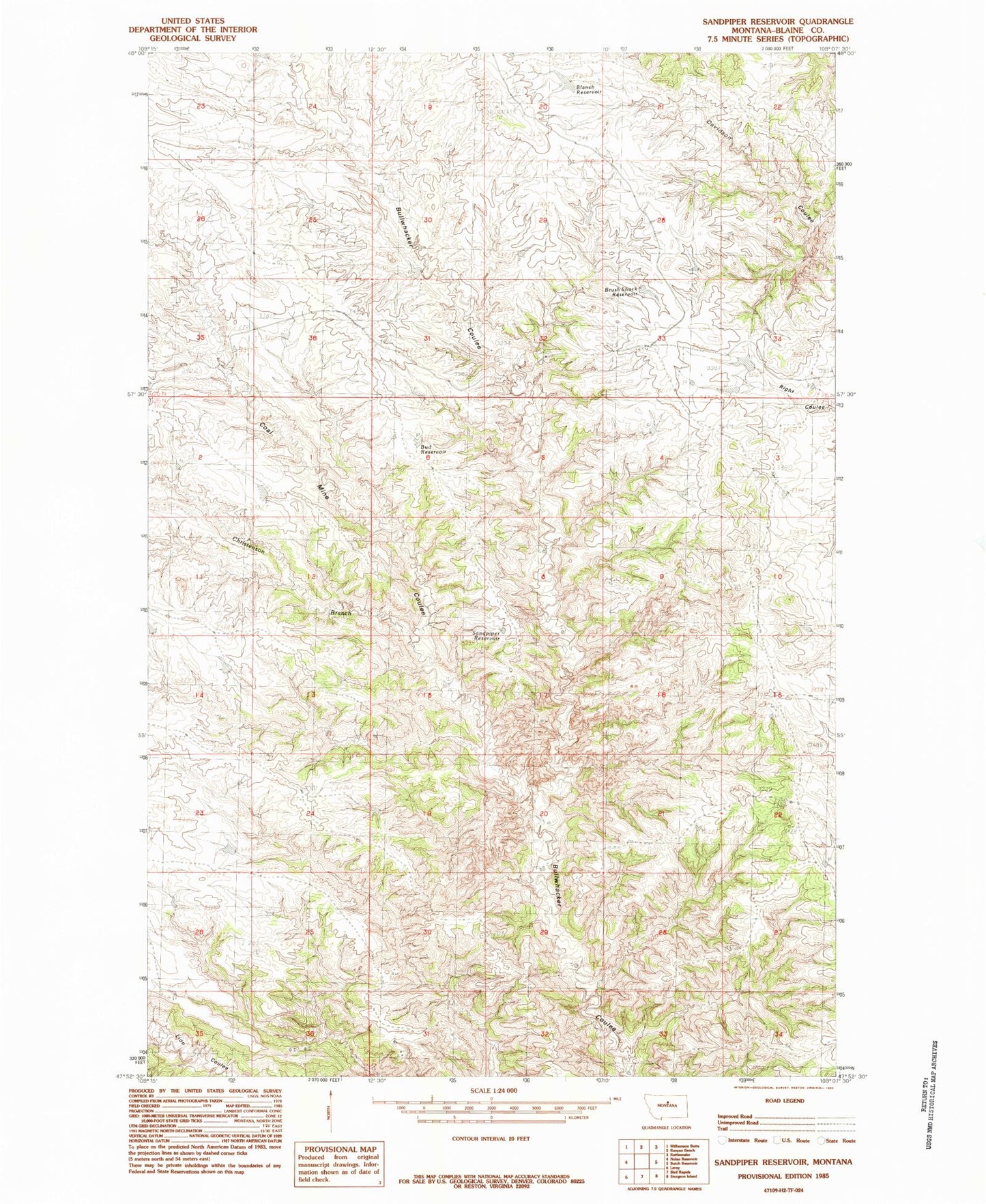
MyTopo
Classic USGS Sandpiper Reservoir Montana 7.5'x7.5' Topo Map
Regular price
$16.95
Regular price
Sale price
$16.95
Unit price
per
Couldn't load pickup availability
Historical USGS topographic quad map of Sandpiper Reservoir in the state of Montana. Map scale may vary for some years, but is generally around 1:24,000. Print size is approximately 24" x 27"
This quadrangle is in the following counties: Blaine.
The map contains contour lines, roads, rivers, towns, and lakes. Printed on high-quality waterproof paper with UV fade-resistant inks, and shipped rolled.
Contains the following named places: 25N20E33BCBC01 Well, Blanch Reservoir, Brush Shack Reservoir, Bud Reservoir, Christenson Branch, Coal Mine Coulee, Cow Island Trail, Sandpiper Reservoir