MyTopo
Classic USGS Sandy Hook Indiana 7.5'x7.5' Topo Map
Couldn't load pickup availability
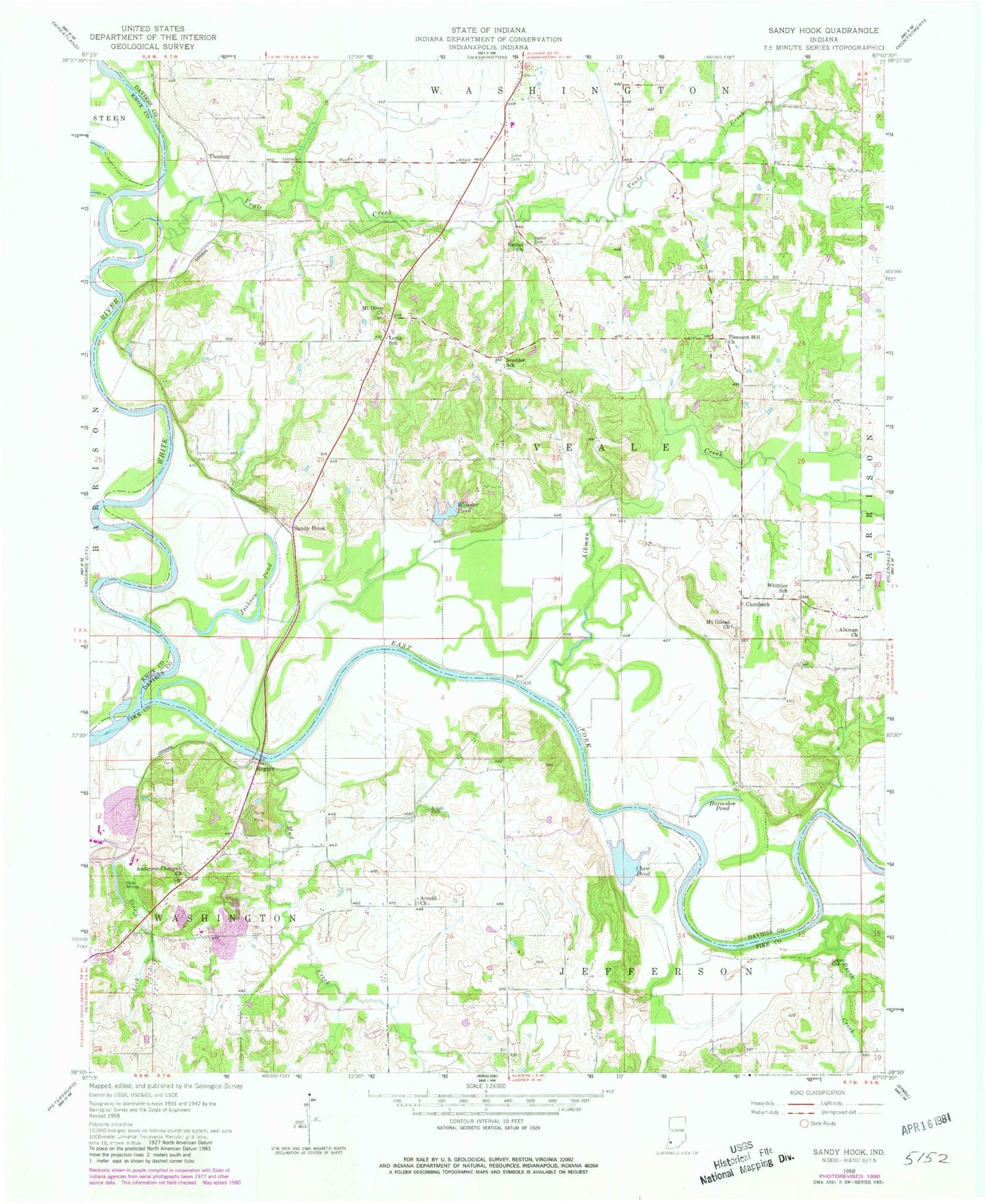
Historical USGS topographic quad map of Sandy Hook in the state of Indiana. Map scale may vary for some years, but is generally around 1:24,000. Print size is approximately 24" x 27"
This quadrangle is in the following counties: Daviess, Knox, Pike.
The map contains contour lines, roads, rivers, towns, and lakes. Printed on high-quality waterproof paper with UV fade-resistant inks, and shipped rolled.
Contains the following named places: Aikman Church, Aikman Creek, Anderson-Chappell Church, Arnold Cemetery, Arnold Church, Beech Creek, Bethel Cemetery, Bethel Church, Chew Pond, Cumback, East Fork White River, Highbank Town, Horseshoe Pond, Jackson Pond, Letts School, Logan Cemetery, Mount Gilead Church, Mount Olive Church, Mud Creek, Pleasant Hill Church, Pond Creek, Rogers, Sandy Hook, Scudder School, Thomas, Township of Veale, Veale Creek, Veale Township Volunteer Fire Department, Whittier School, Wonder Pond, Wonder Pond Dam