MyTopo
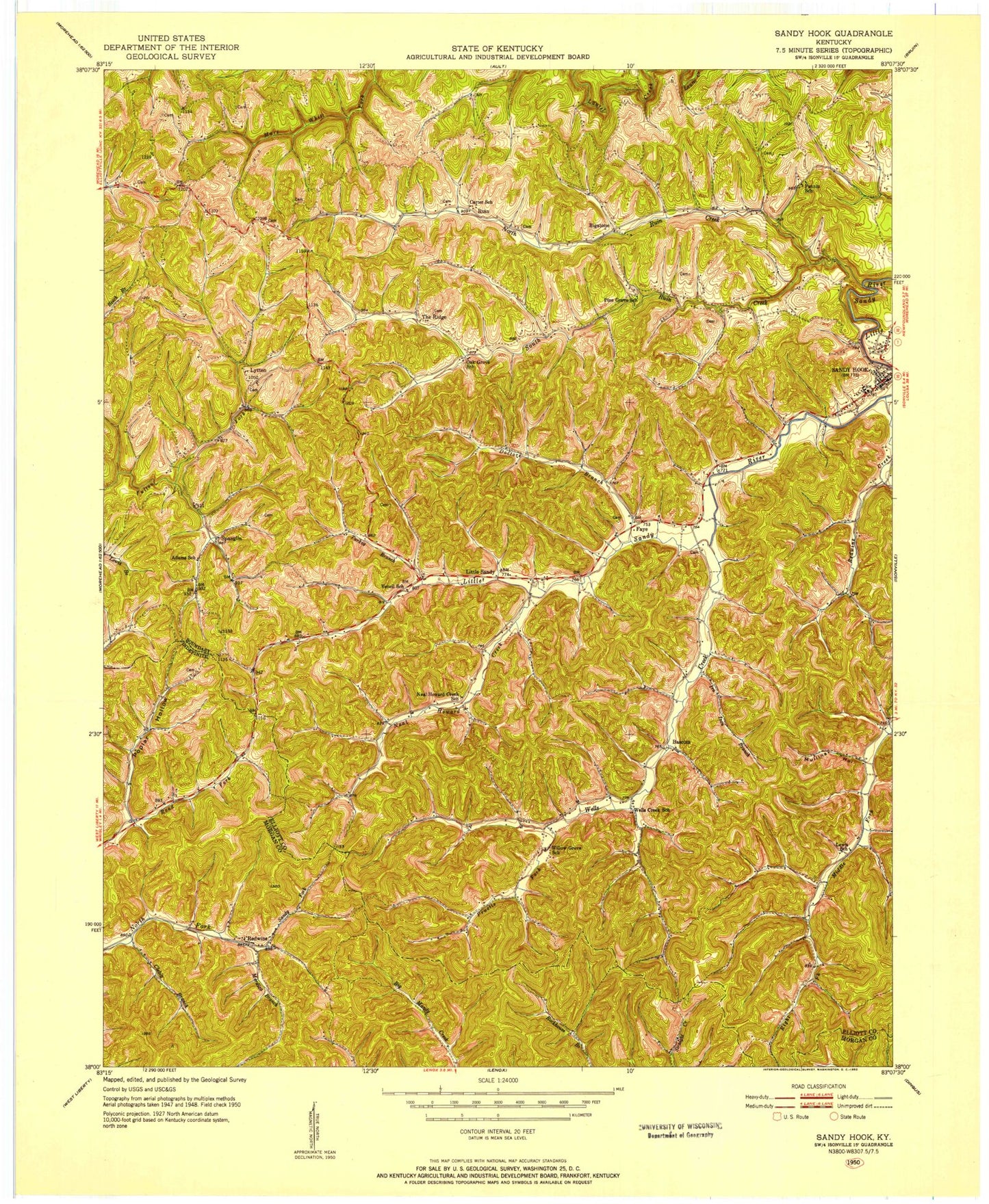
Classic USGS Sandy Hook Kentucky 7.5'x7.5' Topo Map
Couldn't load pickup availability
Historical USGS topographic quad map of Sandy Hook in the state of Kentucky. Map scale may vary for some years, but is generally around 1:24,000. Print size is approximately 24" x 27"
This quadrangle is in the following counties: Elliott, Morgan.
The map contains contour lines, roads, rivers, towns, and lakes. Printed on high-quality waterproof paper with UV fade-resistant inks, and shipped rolled.
Contains the following named places: Adams School, Adkins Cemetery, Bascom, Bascom Post Office, Bell City, Bigstone, Bigstone Post Office, Bob Horton Hill, Carter Cemetery, Carter School, Clebitt Branch, Click Cemetery, Devil Fork, Doctors Branch, Doctors Knob, Doctors Knob Tower, Elisha Fannin Hill, Elliott County Sheriff's Office, Fannin Church, Fannin Hill, Fannin School, Faye, Faye Post Office, Guss Post Office, Hopkins Cave Branch, Howards Creek, Ira Ison Branch, Left Fork Howards Creek, Lewis School, Little Sandy, Little Sandy Post Office, Loveland Post Office, Lytten, Lytten Cemetery, Lytten Post Office, Lytten School, Milton Ladd Carter Cemetery, Mordica Branch, Mullins Hollow, Neal Howard Creek, North Ruin Creek, Pine Grove School, Polk Howard Cemetery, Poplar Hollow, Pruetts Fork, Redwine, Redwine Post Office, Ruin, Ruin Post Office, Sandy Fork, Sandy Hook, Sandy Hook Post Office, South Ruin Creek, Spanglin, Spanglin Post Office, The Jeff Knob, The Ridge, The Ridge Post Office, The Tabernacle, Turkey Branch, Vencil School, Watsons Store, Wells Creek, Wells Creek School, Whitt Cemetery, Willow Grove School