MyTopo
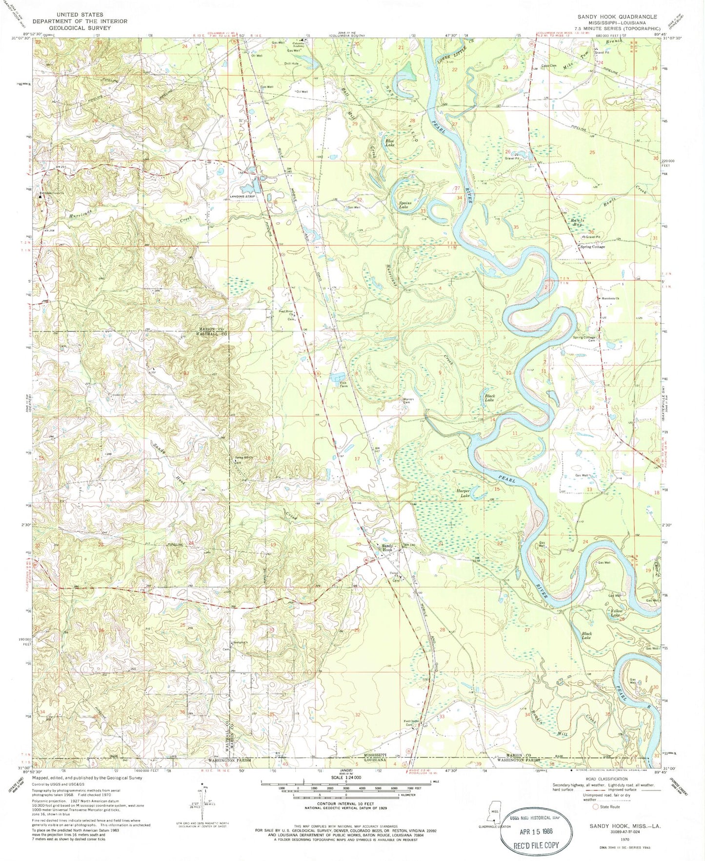
Classic USGS Sandy Hook Mississippi 7.5'x7.5' Topo Map
Couldn't load pickup availability
Historical USGS topographic quad map of Sandy Hook in the states of Mississippi, Louisiana. Map scale may vary for some years, but is generally around 1:24,000. Print size is approximately 24" x 27"
This quadrangle is in the following counties: Marion, Walthall, Washington.
The map contains contour lines, roads, rivers, towns, and lakes. Printed on high-quality waterproof paper with UV fade-resistant inks, and shipped rolled.
Contains the following named places: Allen Bay, Ball Mill Creek, Black Lake, Blue Lake, Capp Cemetery, Columbia Academy, Ford Chapel, Ford Chapel Cemetery, Fords Fort, Fords School, Fordsville, Fortenberry Lake Dam, Harper Lake, Hurricane Creek, Hurricane Creek Cemetery, Hurricane Creek Church, Hurricane Creek School, Lower Little Creek, Macedonia Church, Mike Tom Branch, Old Spring Cottage Church, Pearl River Cemetery, Pearl River Church, Rankin Mill Creek, Rawls Bay, Rawls Creek, Saint Paul, Sandy Hook, Sandy Hook Baptist Church, Sandy Hook Cemetery, Sandy Hook Creek, Sandy Hook Post Office, Sandy Hook School, Sauer, Saxon, Southwest Marion Volunteer Fire Department Station 3, Southwest Marion Volunteer Fire Department Station 4, Spains Lake, Spring Cottage, Spring Cottage Cemetery, Spring Hill Church, Sunlight Church, Sweetwater Creek, T E Stogner Cemetery, Tolar Ponds Dam, Twin, United Church, Warren Cemetery, West Sauer, Willy Pittman Pond Dam, Yellow Lake, ZIP Code: 39478