MyTopo
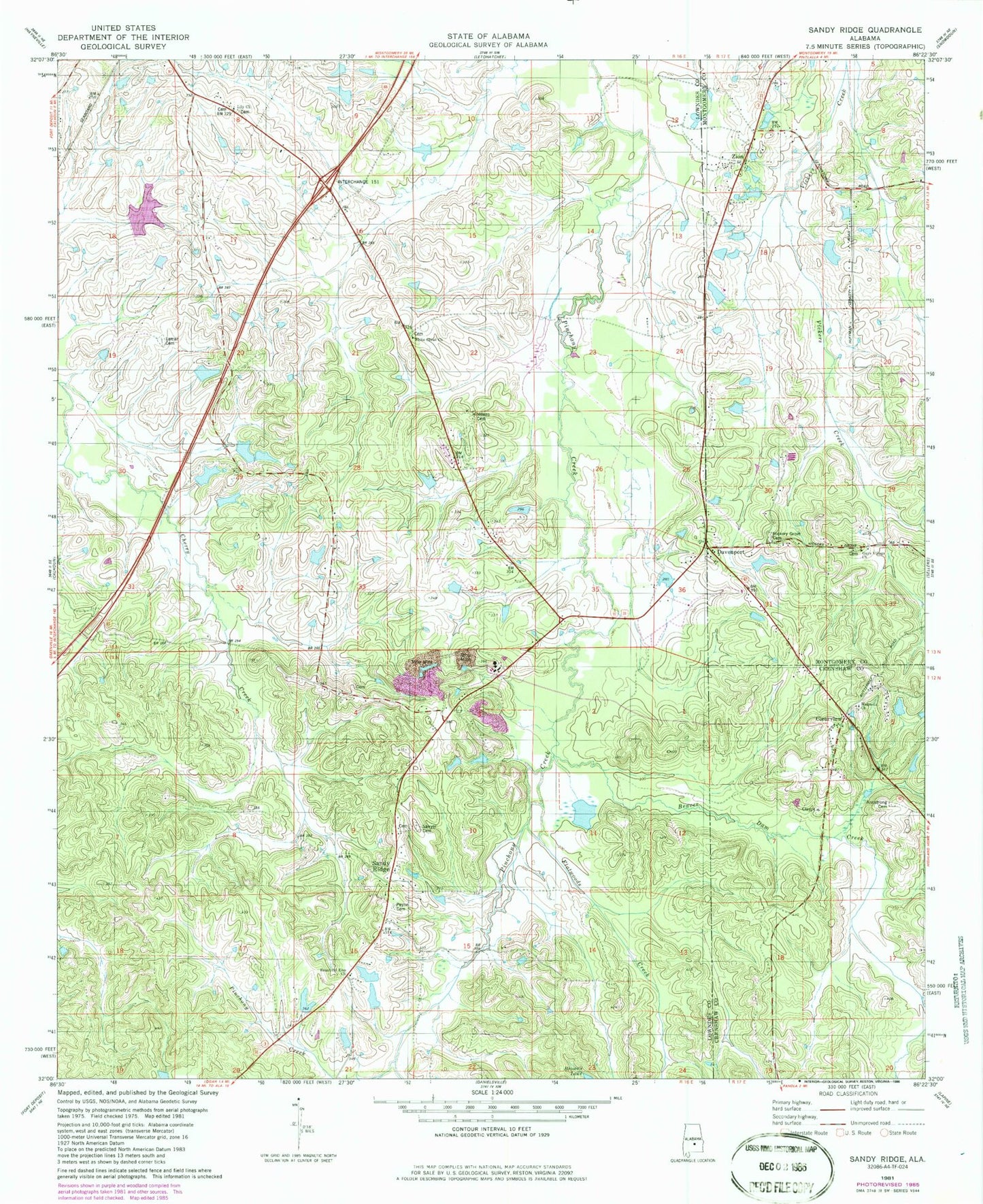
Classic USGS Sandy Ridge Alabama 7.5'x7.5' Topo Map
Couldn't load pickup availability
Historical USGS topographic quad map of Sandy Ridge in the state of Alabama. Map scale may vary for some years, but is generally around 1:24,000. Print size is approximately 24" x 27"
This quadrangle is in the following counties: Crenshaw, Lowndes, Montgomery.
The map contains contour lines, roads, rivers, towns, and lakes. Printed on high-quality waterproof paper with UV fade-resistant inks, and shipped rolled.
Contains the following named places: Armstrong Cemetery, Beautiful Zion African Methodist Episcopal Zion Church, Beaver Dam Creek, Big Zion Church, Big Zion School, Browns Dam, Calvary Church, Cedar Lake, Clearview, Davenport, E B and S L Payne Lake, E B and S L Payne Lake Dam, Flatwoods Creek, Gaston Lake, Gaston Lake Two, Gus Gaston Dam One, Gus Gaston Dam Two, Guys Pond, Guys Village Church, Guys Village School, Hazley School, Hickory Grove Cemetery, Lamar Cemetery, Lily Missionary Baptist Church, Lily School, Maddox Dam, Maddox Lake, Magnolia Cemetery, Magnolia Church, McQueens Pond, Means Lake, Mount Nebo Church, Payne Cemetery, Paynes Dam, Pierces Hill, Pintlala Volunteer Fire Department Station 2, Robinsons Pond, Sandy Ridge, Sandy Ridge Church, Sandy Ridge School, Sandy Ridge Volunteer Fire Department, Sawyer Cemetery, W D Farrior Junior Lake, W D Farrior Junior Lake Dam, W E Pritchett Lake Dam Number One, W E Pritchett Lake Dam Number Two, W E Pritchett Lake Number One, W E Pritchett Lake Number Two, White Cloud Church, Zion