MyTopo
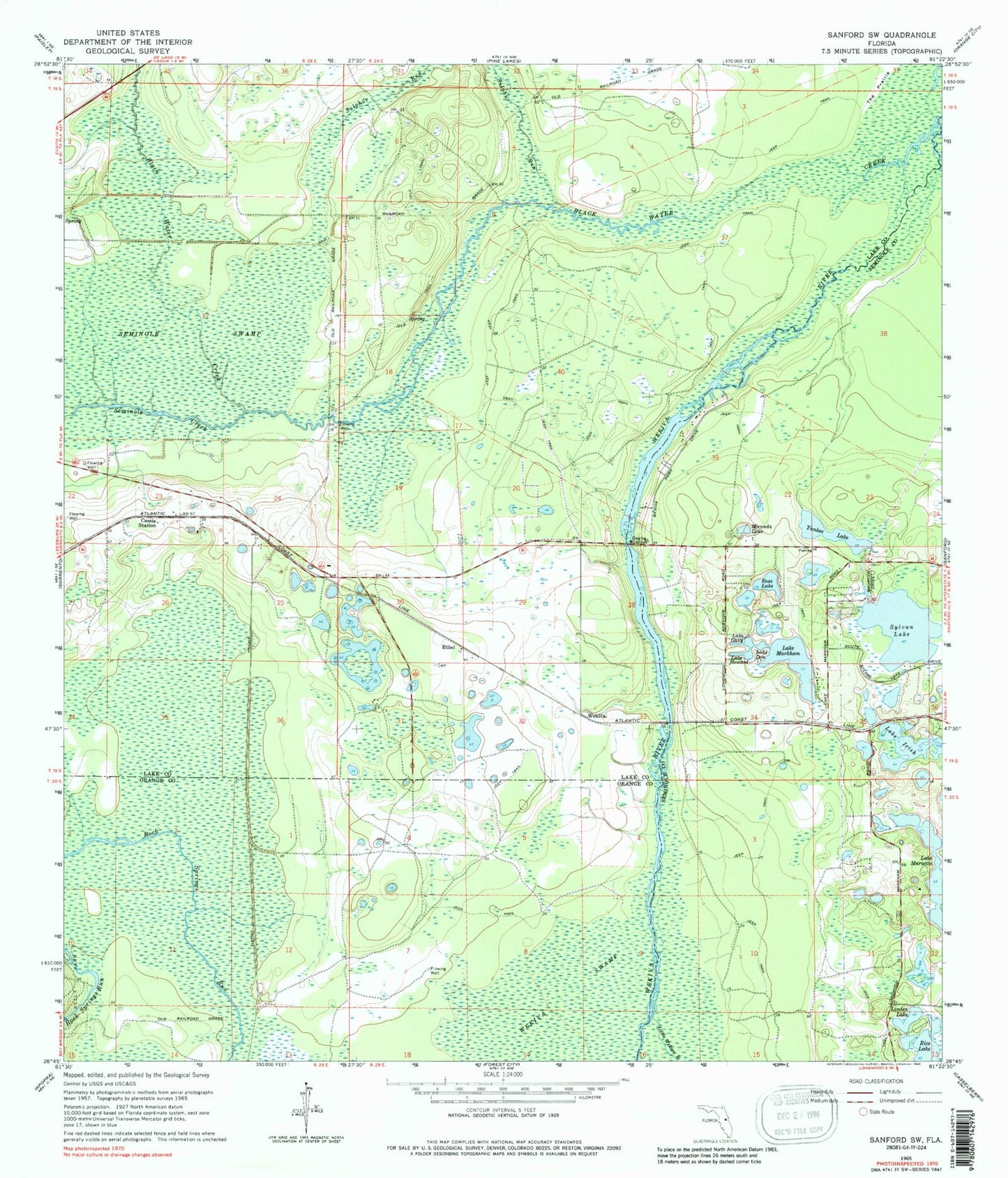
Classic USGS Sanford SW Florida 7.5'x7.5' Topo Map
Couldn't load pickup availability
Historical USGS topographic quad map of Sanford SW in the state of Florida. Typical map scale is 1:24,000, but may vary for certain years, if available. Print size: 24" x 27"
This quadrangle is in the following counties: Lake, Orange, Seminole.
The map contains contour lines, roads, rivers, towns, and lakes. Printed on high-quality waterproof paper with UV fade-resistant inks, and shipped rolled.
Contains the following named places: Black Water Creek, Cassia Station, Lake Don, Lake Gary, Lake Howard, Lake Irish, Linden Lake, Little Wekiva River, Lake Marietta, Lake Markham, Miranda Lake, Rice Lake, Ross Lake, Seminole Creek, Seminole Swamp, Sylvan Lake, Yankee Lake, The Prairie, Ethel, Wekiva, Peter Miranda Grant, Markham, Theresa Rodriquez Grant, Walling, Black Water Creek, Sulphur Run, Alaqua Lakes, Legacy Club at Alaqua Lakes, Magnolia Plantation Golf Club, Seminole County Fire Department Station 36, Gleneagles Country Club, Lehigh Golf and Resort, Seminole County Superintendents Office, Heathrow Elementary School, Wekiva Wild and Scenic River