
MyTopo
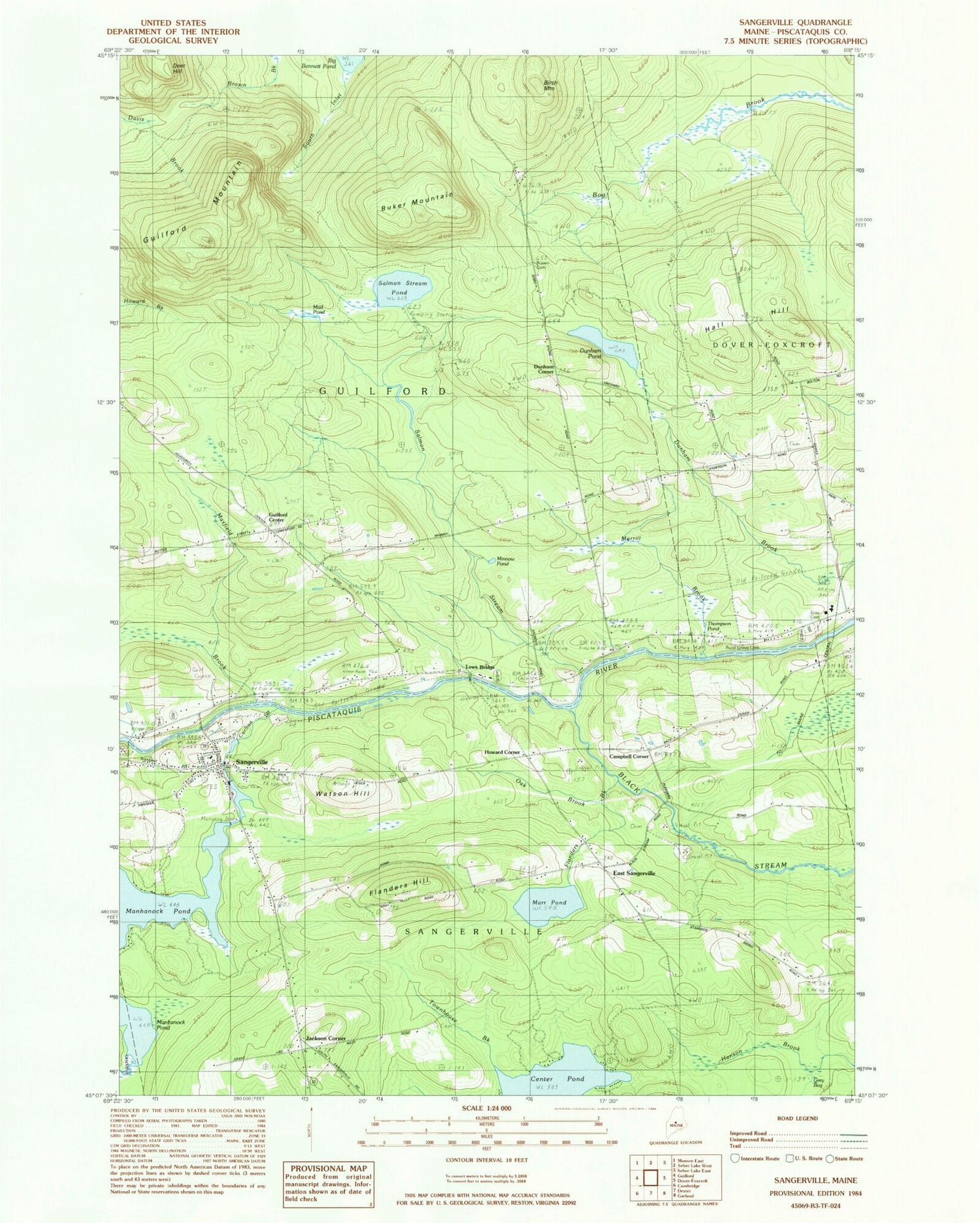
Classic USGS Sangerville Maine 7.5'x7.5' Topo Map
Couldn't load pickup availability
Historical USGS topographic quad map of Sangerville in the state of Maine. Typical map scale is 1:24,000, but may vary for certain years, if available. Print size: 24" x 27"
This quadrangle is in the following counties: Piscataquis.
The map contains contour lines, roads, rivers, towns, and lakes. Printed on high-quality waterproof paper with UV fade-resistant inks, and shipped rolled.
Contains the following named places: Birch Mountain, Black Stream, Brown Brook, Brown School, Buker Mountain, Campbell Corner School, Carlton Stream, Dunham Pond, Flanders Brook, Flanders Hill, Guilford Mountain, Jackson Corner School, Lows Bridge, Marr Pond, Maxfield Brook, Merrill Brook, Minnow Pond, Oak Brook, Salmon Stream, Salmon Stream Pond, Sangerville, Schoolhouse Brook, South Inlet, Sucker Brook, Thompson Pond, Townhouse Brook, Watson Hill, Dunham Corner, East Sangerville, Guilford Center, Howard Corner, Town of Guilford, Town of Sangerville, Carlton Stream Dam, Carlton Stream Reservoir, Manhanock Pond Dam, Manhanock Pond Dam, Abbie Fowler School, Dover-Foxcroft Plaza Shopping Center, First Unitarian Universalist Church of Sangerville, Gray Cemetery, Guilford Center Cemetery, Guilford Center Baptist Church, Lows Bridge, Old Blacksmith Shop Museum, Piscataquis Country Club, Rural Grove Cemetery, Village Cemetery, Sangerville Volunteer Fire Department, Town House Cemetery, Brawn Cemetery, Knowlton Mills Cemetery, Sangerville Public Library, Sangerville Post Office


