MyTopo
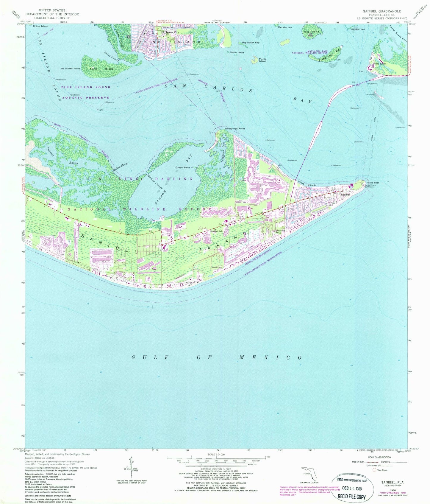
Classic USGS Sanibel Florida 7.5'x7.5' Topo Map
Couldn't load pickup availability
Historical USGS topographic quad map of Sanibel in the state of Florida. Map scale may vary for some years, but is generally around 1:24,000. Print size is approximately 24" x 27"
This quadrangle is in the following counties: Lee.
The map contains contour lines, roads, rivers, towns, and lakes. Printed on high-quality waterproof paper with UV fade-resistant inks, and shipped rolled.
Contains the following named places: Baileys Center, Big Island, Big Sister Key, Bigelow Shopping Center, City of Sanibel, Dixie Beach, First Baptist Church Sanibel, Fisherman Key, Green Point, Gulfside Park Historic Cemetery, Henley Canal, J N "Ding" Darling Wilderness, J N Ding Darling National Wildlife Refuge, James Cipriani Heliport, Knapps Point, Ladyfinger Lake, Lee County Emergency Medical Services, Long Cutoff, McIntyre Creek, Periwinkle Place Shopping Center, Phillips Canal, Picnic Island, Plaza Central, Point Ybel, Punta Rassa, Punta Rassa Cove, Saint James City, Saint James City Mobile Home Park, Saint James Point, San Carlos Bay, Sanibel, Sanibel Bayou, Sanibel Bayous, Sanibel Community Church, Sanibel Congregational United Church of Christ, Sanibel Fire Department Station 171, Sanibel Island, Sanibel Island Causeway, Sanibel Island Lighthouse, Sanibel Police Department, Sanibel Post Office, Sanibel School, Shallow Cutoff, Shallow Mouth, Shangri La Mobile Home Park, Short Cutoff, Sister Keys, Tahitian Garden Shopping Center, Tarpon Bay, Tropic Isles Baptist Church, Woodrings Point, Ybel, York Island, ZIP Code: 33957