MyTopo
Classic USGS Sanish NW North Dakota 7.5'x7.5' Topo Map
Regular price
$16.95
Regular price
Sale price
$16.95
Unit price
per
Couldn't load pickup availability
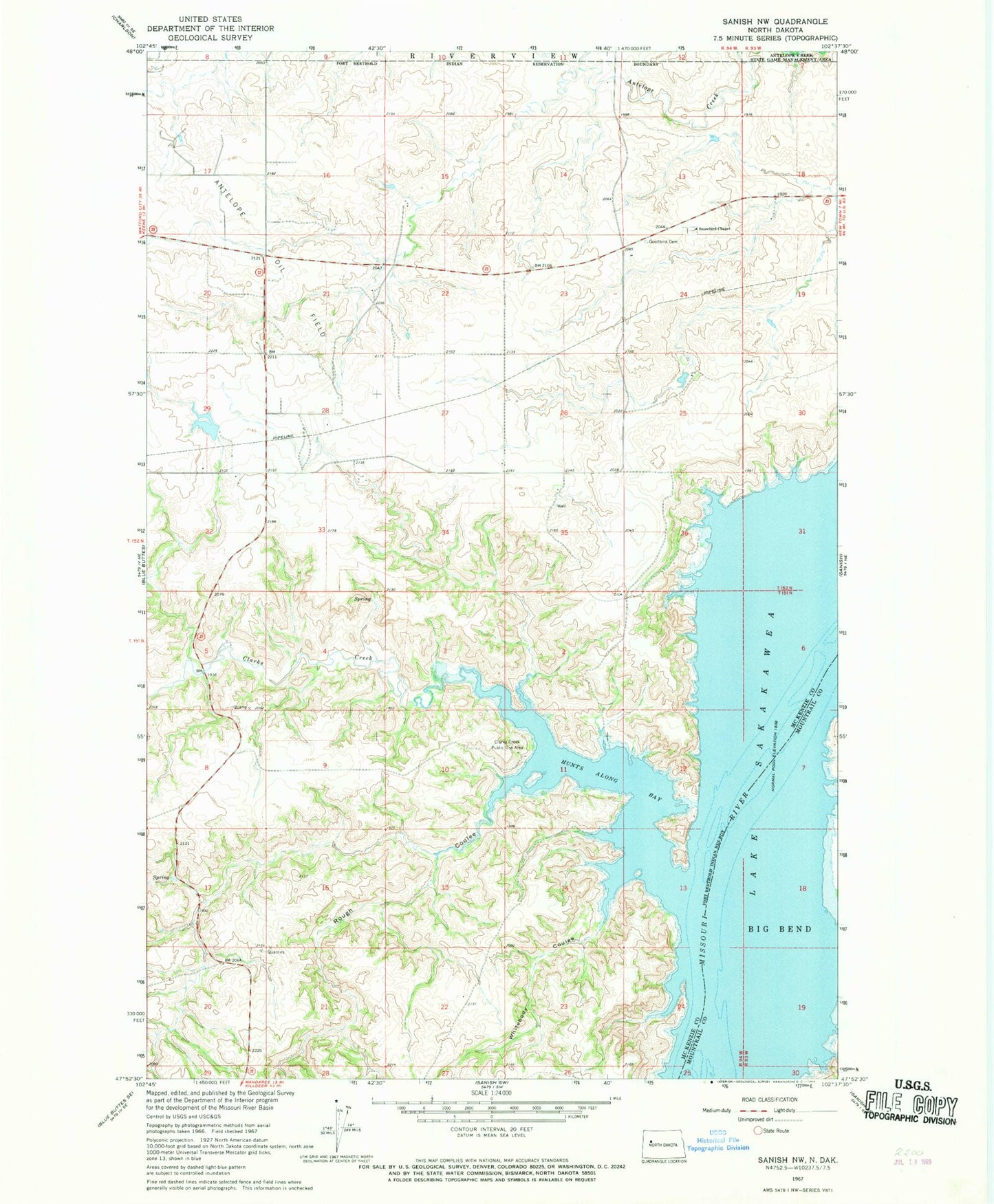
Historical USGS topographic quad map of Sanish NW in the state of North Dakota. Map scale may vary for some years, but is generally around 1:24,000. Print size is approximately 24" x 27"
This quadrangle is in the following counties: McKenzie, Mountrail.
The map contains contour lines, roads, rivers, towns, and lakes. Printed on high-quality waterproof paper with UV fade-resistant inks, and shipped rolled.
Contains the following named places: Antelope Creek State Game Management Area, Clarks Creek, Clarks Creek Public Use Area, Four Bears Segment, Goodbird Cemetery, Great Bend, Hunts Along Bay, Matthews Cemetery, Rough Coulee, Snowbird Cemetery, Snowbird Chapel, Whitebody Coulee