MyTopo
Classic USGS Santa Catalina South California 7.5'x7.5' Topo Map
Couldn't load pickup availability
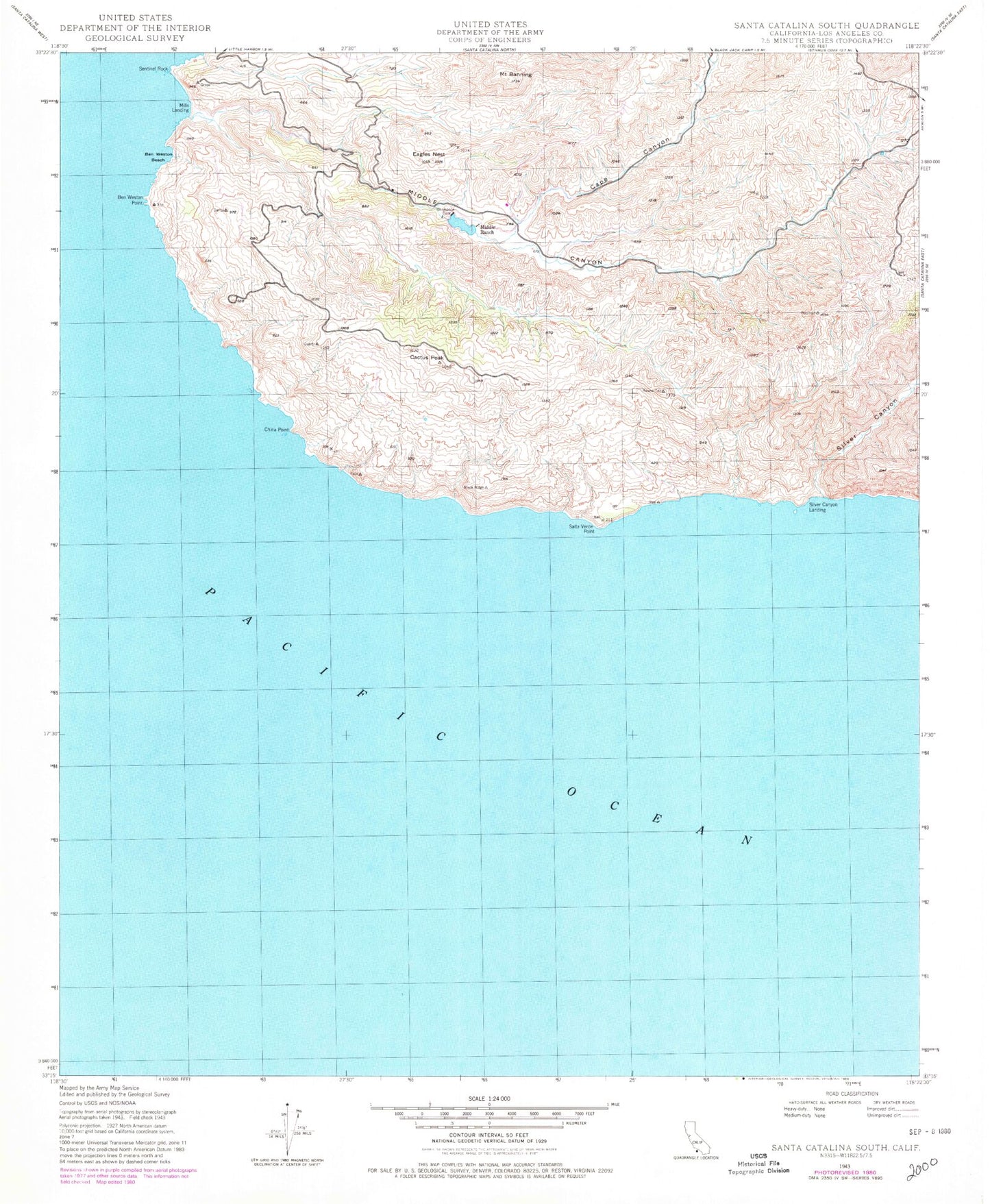
Historical USGS topographic quad map of Santa Catalina South in the state of California. Typical map scale is 1:24,000, but may vary for certain years, if available. Print size: 24" x 27"
This quadrangle is in the following counties: Los Angeles.
The map contains contour lines, roads, rivers, towns, and lakes. Printed on high-quality waterproof paper with UV fade-resistant inks, and shipped rolled.
Contains the following named places: Mount Banning, Ben Weston Beach, Ben Weston Point, Cactus Peak, Cape Canyon, China Point, Eagles Nest, Grand Canyon, Middle Canyon, Middle Ranch, Salta Verde Point, Sentinel Rock, Silver Canyon, Thompson Dam, Mills Landing, Silver Canyon Landing, McGee Lake, Mount Banning, Ben Weston Beach, Ben Weston Point, Cactus Peak, Cape Canyon, China Point, Eagles Nest, Grand Canyon, Middle Canyon, Middle Ranch, Salta Verde Point, Sentinel Rock, Silver Canyon, Thompson Dam, Mills Landing, Silver Canyon Landing, McGee Lake