MyTopo
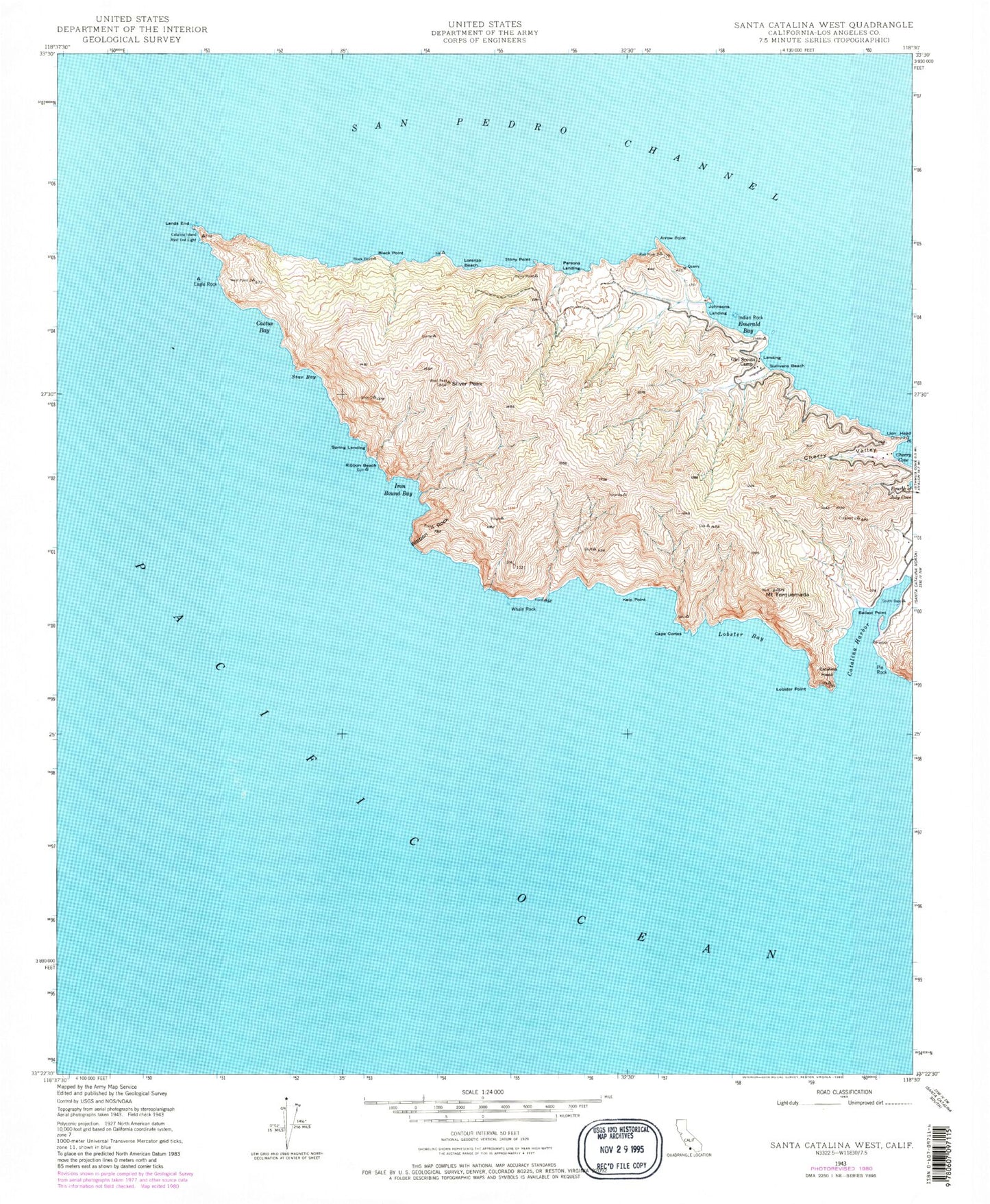
Classic USGS Santa Catalina West California 7.5'x7.5' Topo Map
Couldn't load pickup availability
Historical USGS topographic quad map of Santa Catalina West in the state of California. Typical map scale is 1:24,000, but may vary for certain years, if available. Print size: 24" x 27"
This quadrangle is in the following counties: Los Angeles.
The map contains contour lines, roads, rivers, towns, and lakes. Printed on high-quality waterproof paper with UV fade-resistant inks, and shipped rolled.
Contains the following named places: Arrow Point, Ballast Point, Black Point, Cactus Bay, Catalina Harbor, Catalina Island West End Light, Cherry Cove, Cherry Valley, Eagle Rock, Emerald Bay, Indian Rock, Iron Bound Bay, Johnsons Landing, Kelp Point, Lobster Bay, Lobster Point, Lorenzo Beach, Parsons Landing, Pin Rock, Ribbon Beach, Ribbon Rock, Silver Peak, Spring Landing, Star Bay, Stony Point, Sullivans Beach, Mount Torquemada, Whale Rock, West End, Eagle Reef, Howland Landing, Cape Cortes, Lion Head, Two Harbors Amphibious Terminal Seaplane Base, Catalina Head, Los Angeles County Fire Department Station 155