MyTopo
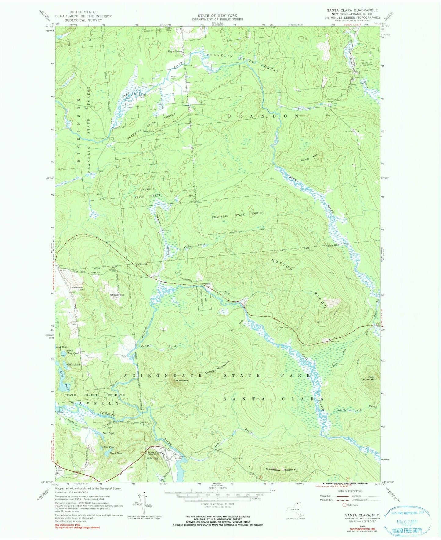
Classic USGS Santa Clara New York 7.5'x7.5' Topo Map
Couldn't load pickup availability
Historical USGS topographic quad map of Santa Clara in the state of New York. Typical map scale is 1:24,000, but may vary for certain years, if available. Print size: 24" x 27"
This quadrangle is in the following counties: Franklin.
The map contains contour lines, roads, rivers, towns, and lakes. Printed on high-quality waterproof paper with UV fade-resistant inks, and shipped rolled.
Contains the following named places: Alder Brook, Black Pond, Cady Brook, Cheney Hill, Cherry Hill, Clear Pond, Conger Brook, Conger Mountain, Deer Pond, Goodnow Mountain, Grass Pond, Little Clear Pond, Little Hurd Hill, Long Pond, Mile Brook, Mulholland Hill, Mutton Ridge, Pleasant Brook, Santa Clara, Stacy Mountain, The Pinnacle, Trim Hill, East Branch Saint Regis River, Franklin State Forest, Little Cold Brook, Reynoldston, Trombley Landing, Town of Brandon, School Number 5 (historical)