MyTopo
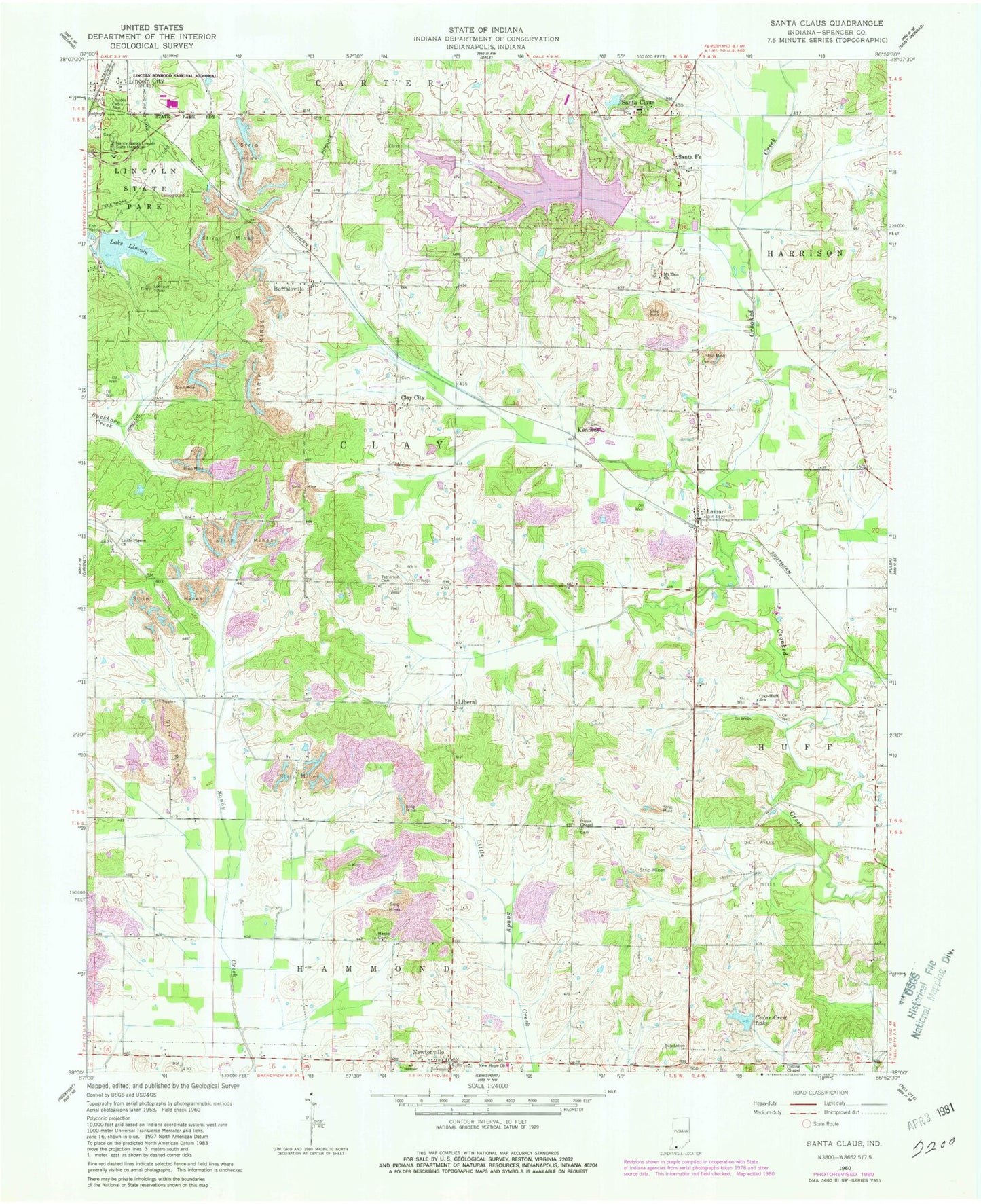
Classic USGS Santa Claus Indiana 7.5'x7.5' Topo Map
Couldn't load pickup availability
Historical USGS topographic quad map of Santa Claus in the state of Indiana. Map scale may vary for some years, but is generally around 1:24,000. Print size is approximately 24" x 27"
This quadrangle is in the following counties: Spencer.
The map contains contour lines, roads, rivers, towns, and lakes. Printed on high-quality waterproof paper with UV fade-resistant inks, and shipped rolled.
Contains the following named places: Buffaloville, Buffaloville Cemetery, Cedar Crest Lake, Christmas Lake, Christmas Lake Dam, Clay City, Clay-Huff Elementary School, Collins Chapel, Foertsch Airport, Kennedy, Lake Holly, Lake Holly Dam, Lake Lincoln, Lamar, Lamar Post Office, Liberal, Lincoln Boyhood National Memorial, Lincoln Cabin Site, Lincoln City, Lincoln State Park, Little Pigeon Church, Meeks Cemetery, Mount Zion Church, Nancy Hanks Lincoln State Memorial, New Hope Church, Newtonville, Noel Lake, Noel Lake Dam, Santa Claus, Santa Claus Post Office, Santa Claus Volunteer Fire Department, Santa Fe, Tableman Cemetery, Town of Santa Claus, Township of Clay, Union Chapel, ZIP Codes: 47550, 47552, 47579