MyTopo
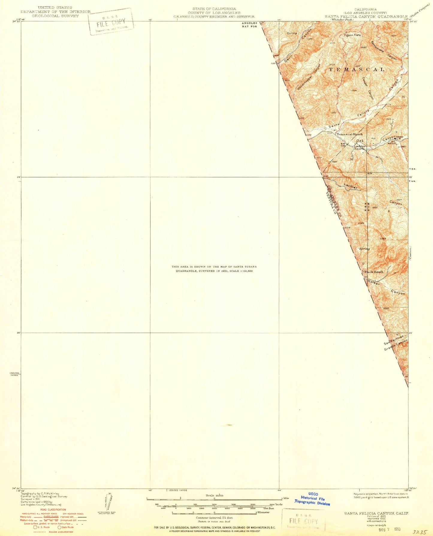
Classic USGS Santa Felicia Canyon California 7.5'x7.5' Topo Map
Couldn't load pickup availability
Historical USGS topographic quad map of Santa Felicia Canyon in the state of California. Map scale may vary for some years, but is generally around 1:24,000. Print size is approximately 24" x 27"
This quadrangle is in the following counties: Los Angeles, Ventura.
The map contains contour lines, roads, rivers, towns, and lakes. Printed on high-quality waterproof paper with UV fade-resistant inks, and shipped rolled.
Contains the following named places: Arundell Peak, Arundell Spring, Baldy, Black Ranch, Blanchard Canyon, Camulos, Chino Flat, Debris Dam, Devil Canyon, Dominguez Campground, Dominguez Canyon, Dominguez Ranch, Hathaway Ranch, Holser Canyon, Holser Oil Field, Juan Fernandez Spring, Karlyn Ranch, Lake Piru, Lechler Canyon, Lechler Ranch, Lime Canyon, Maple Canyon, Modelo Canyon, Nuevo Canyon, Oak Canyon, Oil Ridge, Piru, Piru Branch Ventura County Library, Piru Canyon, Piru Elementary School, Piru Post Office, Piru United Methodist Church, Ramona Canyon, Ramona Oil Field, Rancho Del Rey, Reasoner Canyon, San Salvador Catholic Church, Santa Felicia Canyon, Santa Felicia Dam, Tapo Canyon, Temascal, Temecal Division Ranch, Temescal Forest Service Station, Temescal Guard Station, Temescal School, Ventura County Fire Station 28, Warring Canyon, Warring Park, ZIP Code: 93040