MyTopo
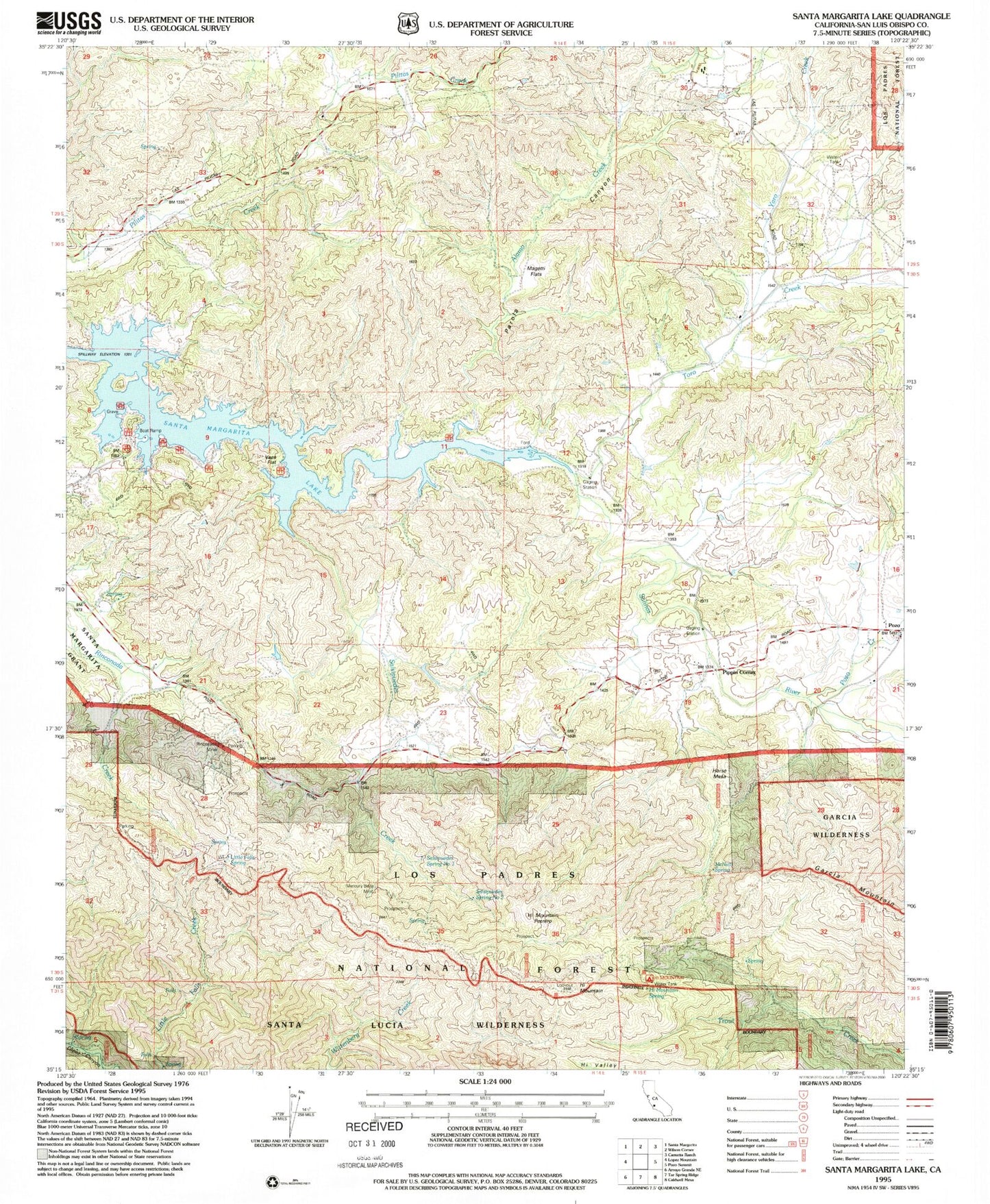
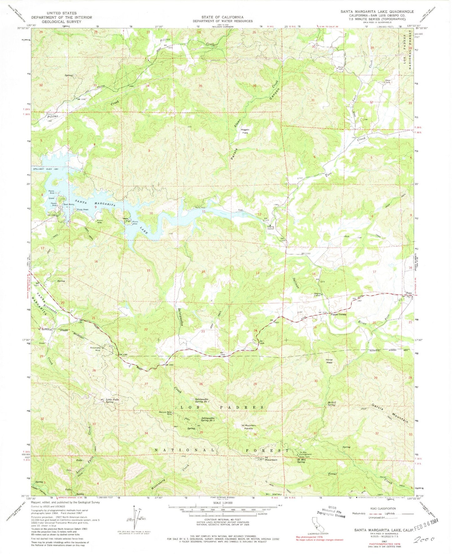
Classic USGS Santa Margarita Lake California 7.5'x7.5' Topo Map
Couldn't load pickup availability
Historical USGS topographic quad map of Santa Margarita Lake in the state of California. Typical map scale is 1:24,000, but may vary for certain years, if available. Print size: 24" x 27"
This quadrangle is in the following counties: San Luis Obispo.
The map contains contour lines, roads, rivers, towns, and lakes. Printed on high-quality waterproof paper with UV fade-resistant inks, and shipped rolled.
Contains the following named places: Alamo Creek, Hi Mountain, Hi Mountain Campground, Hi Mountain Spring, Horse Mesa, Little Falls Spring, Magetti Flats, McNeil Spring, Mercury Belle Mine, Parola Canyon, Pozo, Rinconada Mine, Salsipuedes Creek, Vaca Flat, Yaro Creek, Pippin Corner, Salsipuedes Spring Number One, Salsipuedes Spring Number Two, Toro Creek, Santa Margarita Lake, Pozo Creek, Hi Mountain Potrero, El Dorado School (historical), New District School (historical)