MyTopo
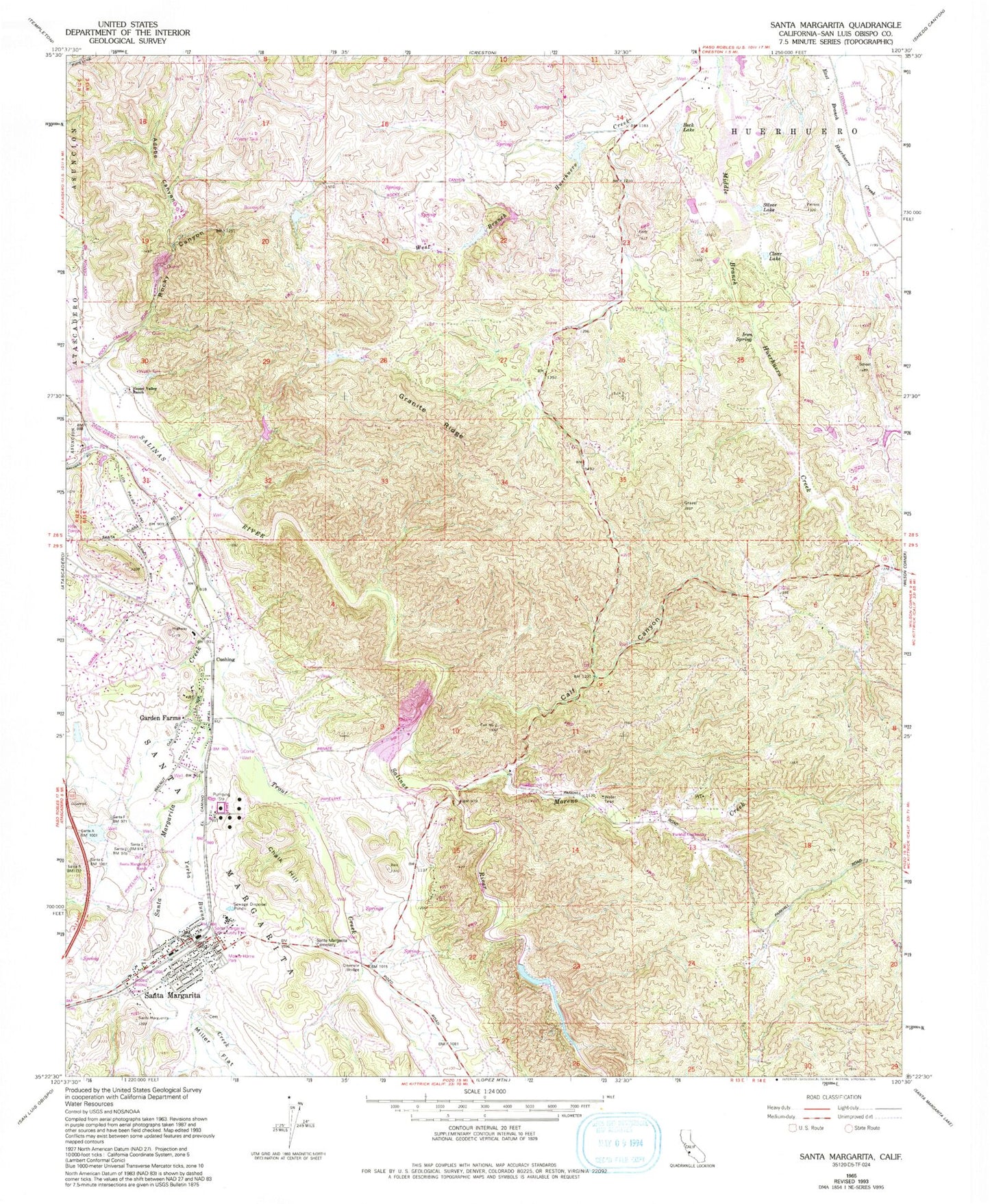
Classic USGS Santa Margarita California 7.5'x7.5' Topo Map
Couldn't load pickup availability
Historical USGS topographic quad map of Santa Margarita in the state of California. Map scale may vary for some years, but is generally around 1:24,000. Print size is approximately 24" x 27"
This quadrangle is in the following counties: San Luis Obispo.
The map contains contour lines, roads, rivers, towns, and lakes. Printed on high-quality waterproof paper with UV fade-resistant inks, and shipped rolled.
Contains the following named places: Adobe Canyon, Asistencia de Santa Margarita, Beck Lake, Calf Canyon, California Department of Forestry and Fire Protection Station 40 Parkhill, Chalk Hill, Clear Lake, Cushing, Eaglet, Garden Farms, Garden Farms Bible Chapel, Garden Farms Census Designated Place, Granite Ridge, Happy Valley Ranch, Hart Ranch Airport, Holy Angels Catholic Church, Iron Spring, Kaiser - Santa Margarita Quarry, Moreno Creek, Onemile Bridge, Parkhill School, Rocky Canyon, Santa Margarita, Santa Margarita Branch San Luis Obispo City-County Library, Santa Margarita Cemetery, Santa Margarita Census Designated Place, Santa Margarita Community Church, Santa Margarita Community Park, Santa Margarita Creek, Santa Margarita Elementary School, Santa Margarita Fire Control Station, Santa Margarita Post Office, Santa Margarita Ranch, Santa Margarita Volunteer Fire Department, Silver Lake, Trout Creek, Yerba Buena Creek