MyTopo
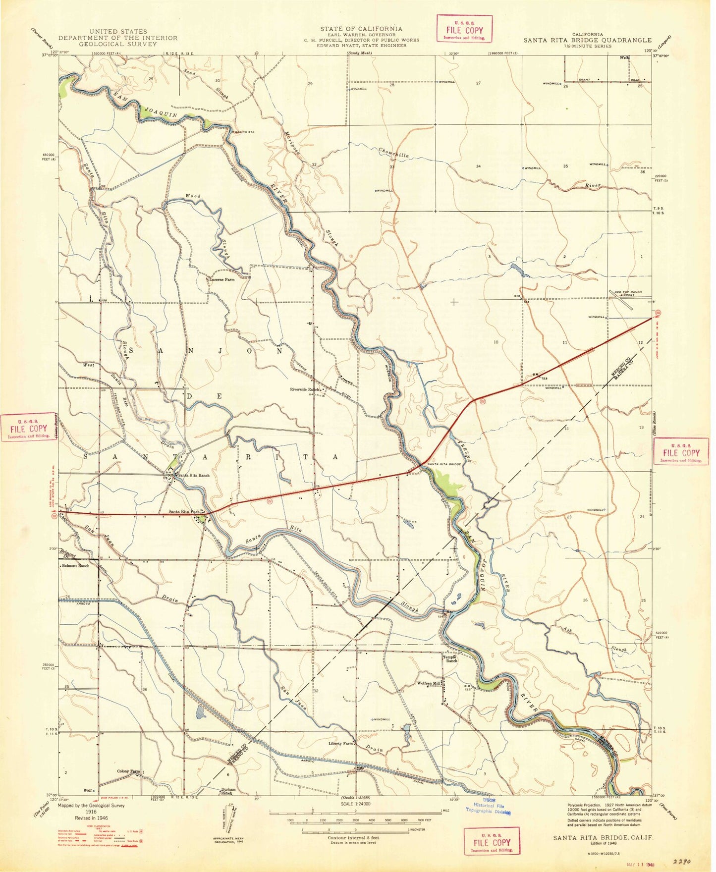
Classic USGS Santa Rita Bridge California 7.5'x7.5' Topo Map
Couldn't load pickup availability
Historical USGS topographic quad map of Santa Rita Bridge in the state of California. Map scale may vary for some years, but is generally around 1:24,000. Print size is approximately 24" x 27"
This quadrangle is in the following counties: Fresno, Madera, Merced.
The map contains contour lines, roads, rivers, towns, and lakes. Printed on high-quality waterproof paper with UV fade-resistant inks, and shipped rolled.
Contains the following named places: Ash Slough, Azevedo Landing Strip, Belmont Ranch, Chowchilla River, Colony Farm, Cowden Ditch, Dairy Field Ditch, Dairy Field Ditch Number One, Dairy Field Drain Number Two, Diversion Canal, Durham Ranch, Eastside Bypass, Escano Branch Number One Ditch, Escano Ditch, Field Drain, Fresno River, Helm Ditch, Island Field Drain, Liberty Farm, Lucerne Ditch, Lucerne Ranch, Orchard Ditch, Riverside Canal, Riverside Ranch, Salt Slough, San Juan Drain, San Juan Drain Number Four, San Juan Drain Number Three, Santa Rita Bridge, Santa Rita Ditch, Santa Rita Drain, Santa Rita Park, Santa Rita Ranch, Santa Rita Slough, Schmidt Ditch, Temple Gun Club, Temple Ranch, Temple Santa Rita Canal, Willis Ranch Airport, Willow Tree Ditch, Wood Slough, Wood Slough Drain