MyTopo
Classic USGS Santa Rita Peak California 7.5'x7.5' Topo Map
Couldn't load pickup availability
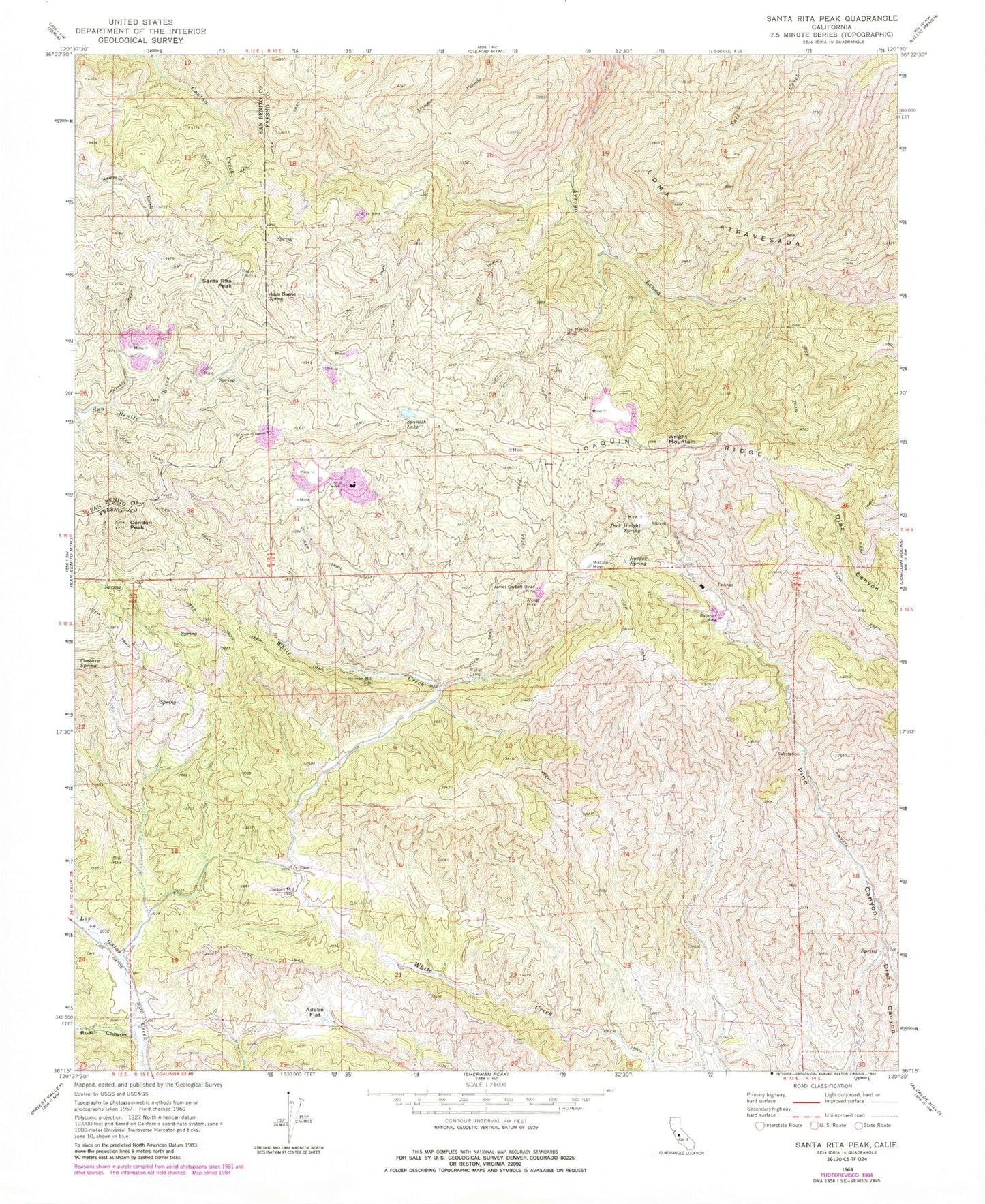
Historical USGS topographic quad map of Santa Rita Peak in the state of California. Typical map scale is 1:24,000, but may vary for certain years, if available. Print size: 24" x 27"
This quadrangle is in the following counties: Fresno, San Benito.
The map contains contour lines, roads, rivers, towns, and lakes. Printed on high-quality waterproof paper with UV fade-resistant inks, and shipped rolled.
Contains the following named places: Adobe Flat, Agua Buena Spring, Archer Camp, Archer Mine, Del Mexico Mine, Dick Wright Spring, Gem Mine, Holman Mill, James Corbett Byles Mine, Joaquin Mill, Joaquin Ridge, Mistake Mine, Railroad Mine, Rita Mine, Roach Canyon, Rucker Spring, Spanish Lake, Three Sisters, Twentyfive Spring, Wright Mountain, Santa Rita Peak, Condon Peak, Loma Atravesada, KCAC Mine, Atlas Asbestos Mine