MyTopo
Classic USGS Santa Rosa Lake New Mexico 7.5'x7.5' Topo Map
Couldn't load pickup availability
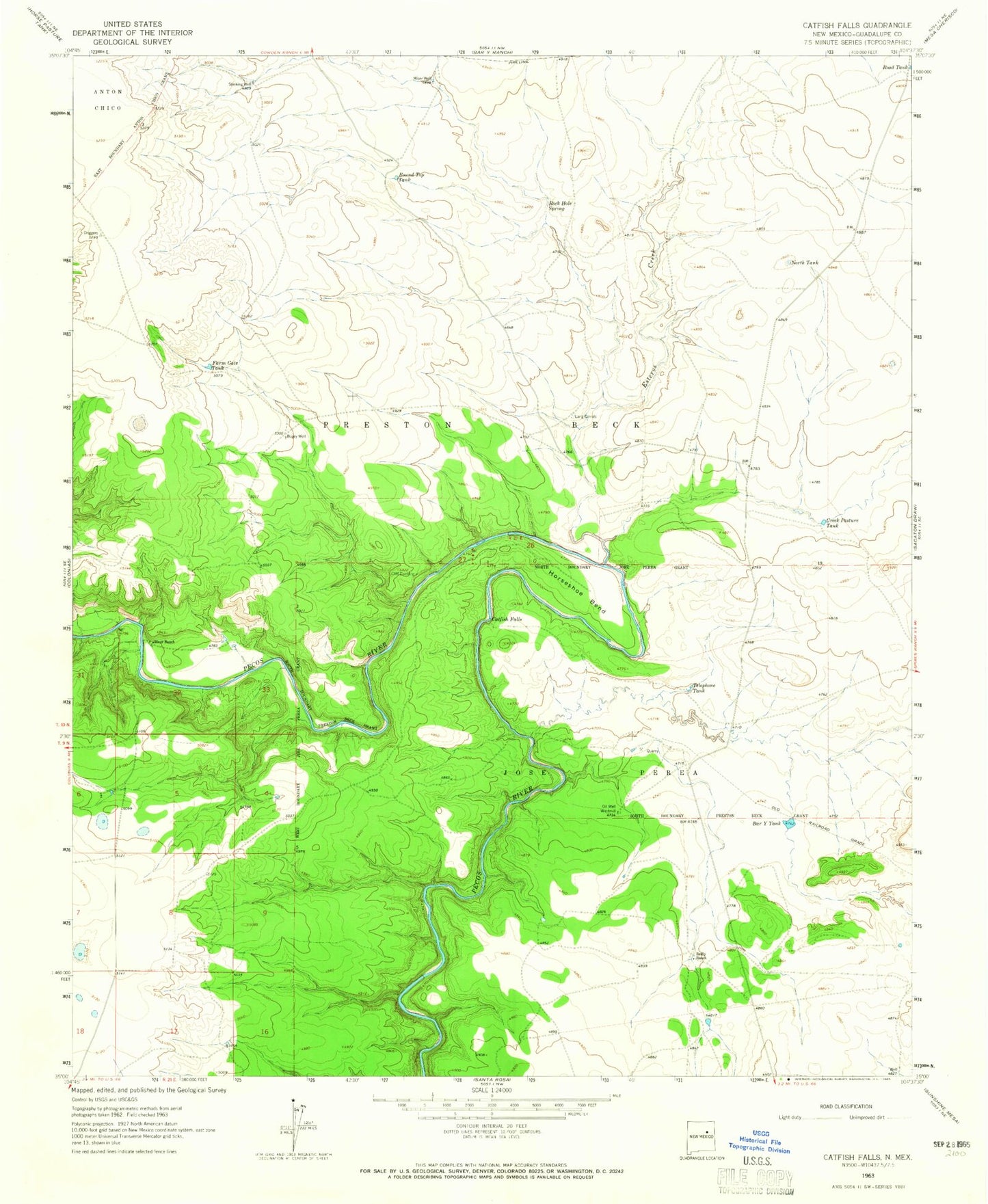
Historical USGS topographic quad map of Santa Rosa Lake in the state of New Mexico. Map scale may vary for some years, but is generally around 1:24,000. Print size is approximately 24" x 27"
This quadrangle is in the following counties: Guadalupe.
The map contains contour lines, roads, rivers, towns, and lakes. Printed on high-quality waterproof paper with UV fade-resistant inks, and shipped rolled.
Contains the following named places: Bar Y Tank, Bogey Well, Box Canyon, Catfish Falls, Creek Pasture Tank, Esteros Creek, Farm Gate Tank, Horseshoe Bend, Jose Perea, Miser Well, North Tank, Oil Well Windmill, Reilly Ranch, River Ranch, Rock Hole Spring, Round Top Tank, Santa Rosa Dam, Santa Rosa Lake, Santa Rosa Lake State Park, Shaw and Craig Walker, Stinking Well, Telephone Tank