MyTopo
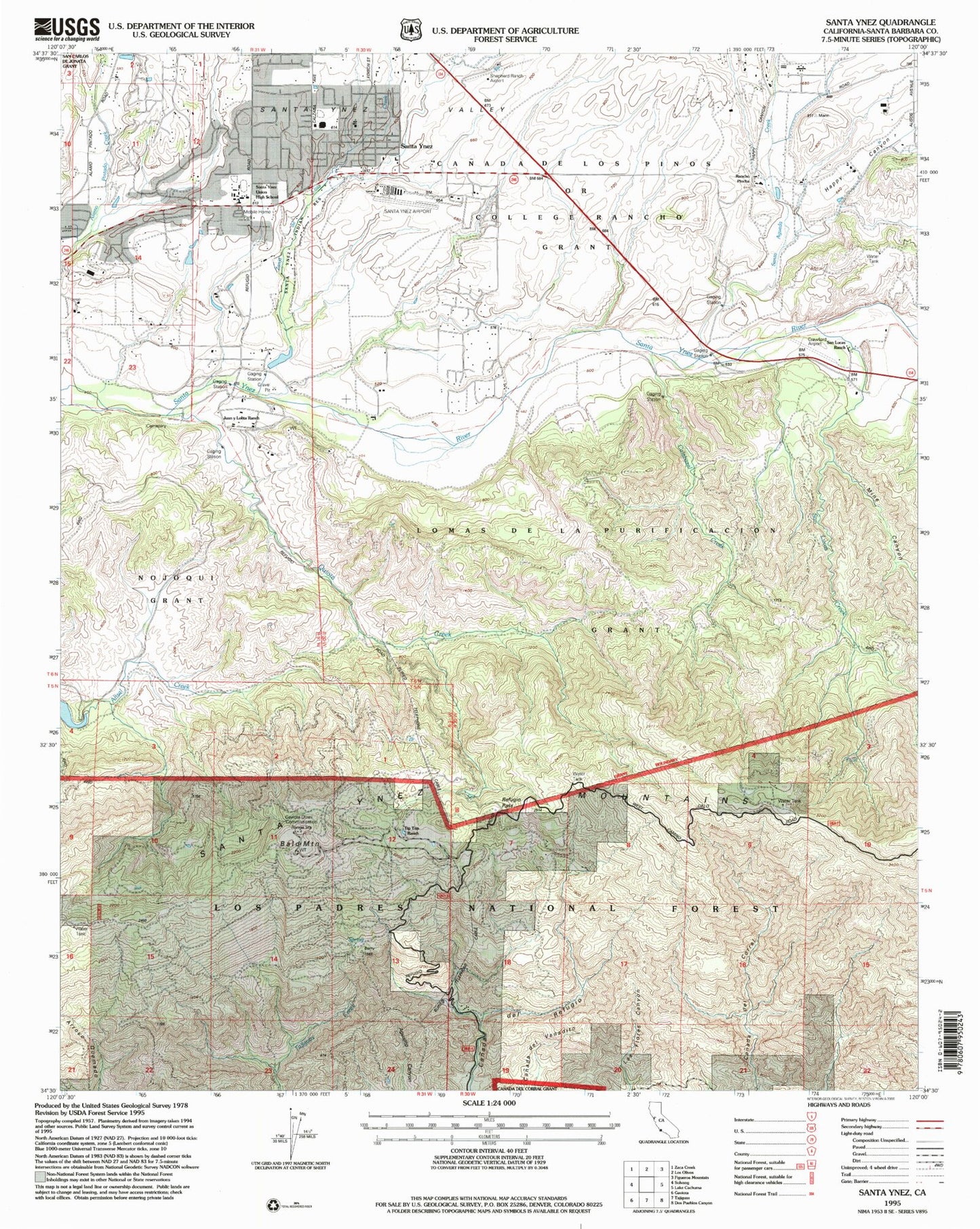
Classic USGS Santa Ynez California 7.5'x7.5' Topo Map
Couldn't load pickup availability
Historical USGS topographic quad map of Santa Ynez in the state of California. Map scale may vary for some years, but is generally around 1:24,000. Print size is approximately 24" x 27"
This quadrangle is in the following counties: Santa Barbara.
The map contains contour lines, roads, rivers, towns, and lakes. Printed on high-quality waterproof paper with UV fade-resistant inks, and shipped rolled.
Contains the following named places: Apple Lane Farm, Bald Mountain, Buttonwood Farm Winery and Vineyard, Calabazal Creek, College Elementary School, Crawford Airport, Double A J Ranch, El Capitan Lodge, Ellen Gleason Library, Farm and Country Shopping Center, Gainey Equine Farm, Gaviota Omni Radio Range Station, Happy Canyon, High Point Ranch, Hunsicker Ranch, Juan y Lolita Ranch, Kalyra Wineries, Lomas De La Purificacion, Mesa Verde Ranch, Mine Canyon, Old Bridge Farm, Providence Farm, Quiota Creek, Rancho Piocha, Refugio Guard Station, Refugio High School, Refugio Pass, San Lucas Creek, San Lucas Ranch, Santa Agueda Creek, Santa Barbara County, Santa Barbara County Fire Department Station 32, Santa Ynez, Santa Ynez Airport, Santa Ynez Census Designated Place, Santa Ynez County Park, Santa Ynez Elementary School, Santa Ynez Post Office, Santa Ynez Reservation, Santa Ynez Valley, Santa Ynez Valley Charter School, Santa Ynez Valley Christian Academy, Santa Ynez Valley Union High School, Santa Ynez Valley Winery, Shepherd Ranch Airport, Sunstone Vineyards and Winery, The Gainey Vineyard, Tip Top Ranch, Travlers Farms, Windhorse Farm, Zanja de Cota Creek