MyTopo
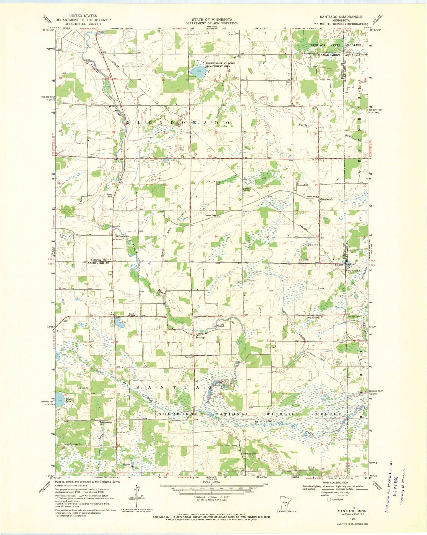
Classic USGS Santiago Minnesota 7.5'x7.5' Topo Map
Couldn't load pickup availability
Historical USGS topographic quad map of Santiago in the state of Minnesota. Map scale may vary for some years, but is generally around 1:24,000. Print size is approximately 24" x 27"
This quadrangle is in the following counties: Benton, Mille Lacs, Sherburne.
The map contains contour lines, roads, rivers, towns, and lakes. Printed on high-quality waterproof paper with UV fade-resistant inks, and shipped rolled.
Contains the following named places: Benlacs State Wildlife Management Area, Bibles State Wildlife Management Area, Country Church, County Ditch Number Five, County Ditch Number Nineteen, County Ditch Number Thirteen, County Ditch Number Twentytwo, Fox Pond, Fox Pond Dam, Glendorado, Glendorado Church, Glendorado Lutheran Church Cemetery, Glendorado Post Office, Good Shepherd Lutheran Church, Oak Hill Cemetery, Our Savior Church, Our Savior Lutheran Church Cemetery, Our Savior School, Pool Number 1, Saint Francis Cemetery, Santiago, Santiago Cemetery, Santiago Post Office, School Number 114, School Number 1898, School Number 86, School Number 88, Sherburne National Wildlife Refuge Dam, South Santiago Cemetery, South Santiago Church, Township of Glendorado, Township of Santiago