MyTopo
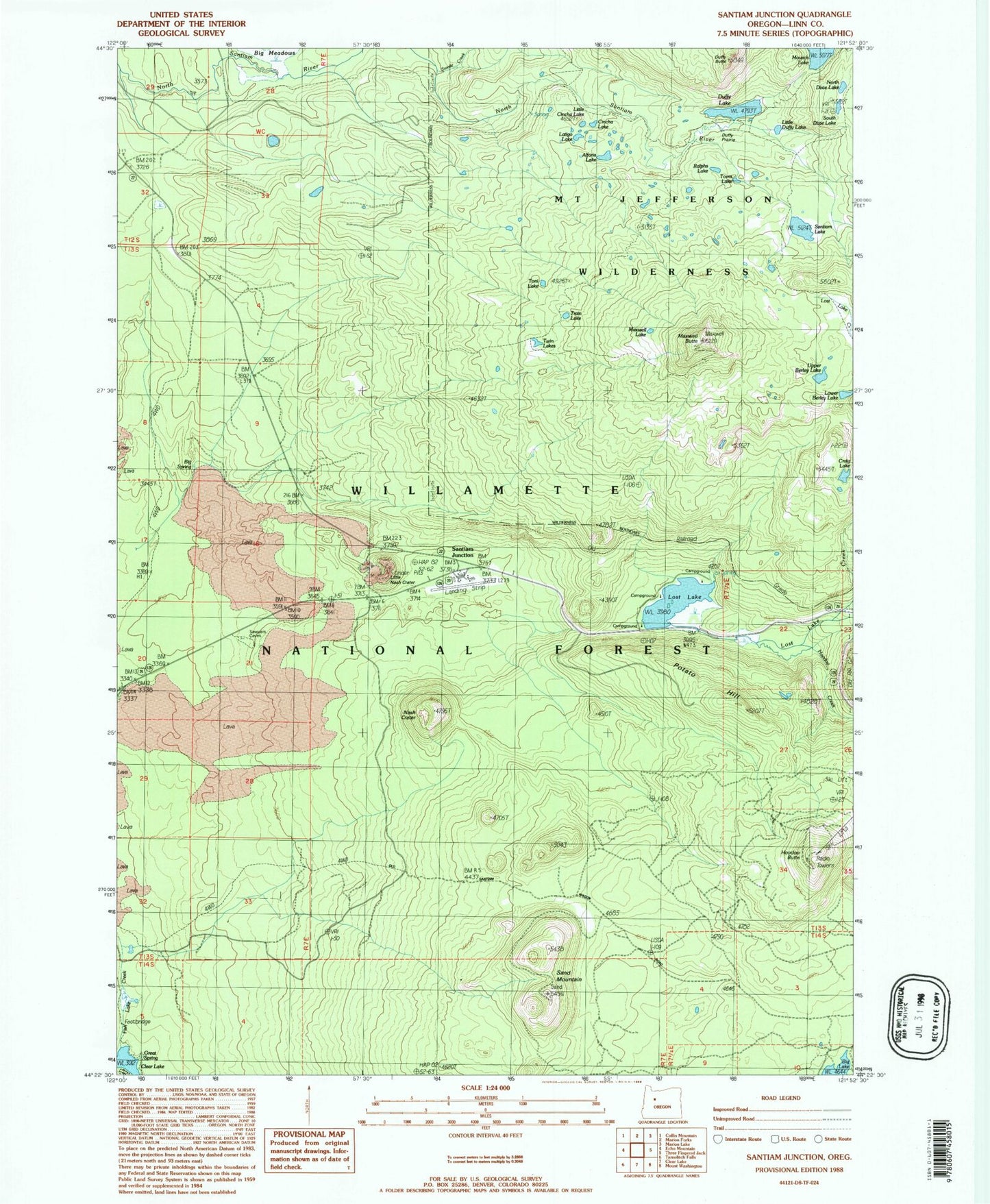
Classic USGS Santiam Junction Oregon 7.5'x7.5' Topo Map
Couldn't load pickup availability
Historical USGS topographic quad map of Santiam Junction in the state of Oregon. Typical map scale is 1:24,000, but may vary for certain years, if available. Print size: 24" x 27"
This quadrangle is in the following counties: Linn.
The map contains contour lines, roads, rivers, towns, and lakes. Printed on high-quality waterproof paper with UV fade-resistant inks, and shipped rolled.
Contains the following named places: Alforja Lake, Big Spring, Cincha Lake, Craig Lake, Duffy Butte, Duffy Lake, Duffy Lake Trail, Duffy Prairie, Great Spring, Hoodoo Butte, Latigo Lake, Lava Trail, Little Cincha Lake, Little Duffy Lake, Little Nash Crater, Lost Lake, Maxwell Butte, Maxwell Lake, Maxwell Trail, Nash Crater, North Dixie Lake, Ralphs Lake, Sand Mountain, Santiam Junction, Santiam Lake, South Dixie Lake, Swede Creek, Toms Lake, Toni Lake, Train Lake, Twin Lakes, Upper Berley Lake, Santiam Junction State Airport, Potato Hill, Hoodoo Creek, Lost Lake Creek, Lower Berley Lake, Big Meadows Horse Camp, Lost Lake Campground (historical), Big Lake West Recreation Site, Lost Lake Campground Unimproved Boat Launch