MyTopo
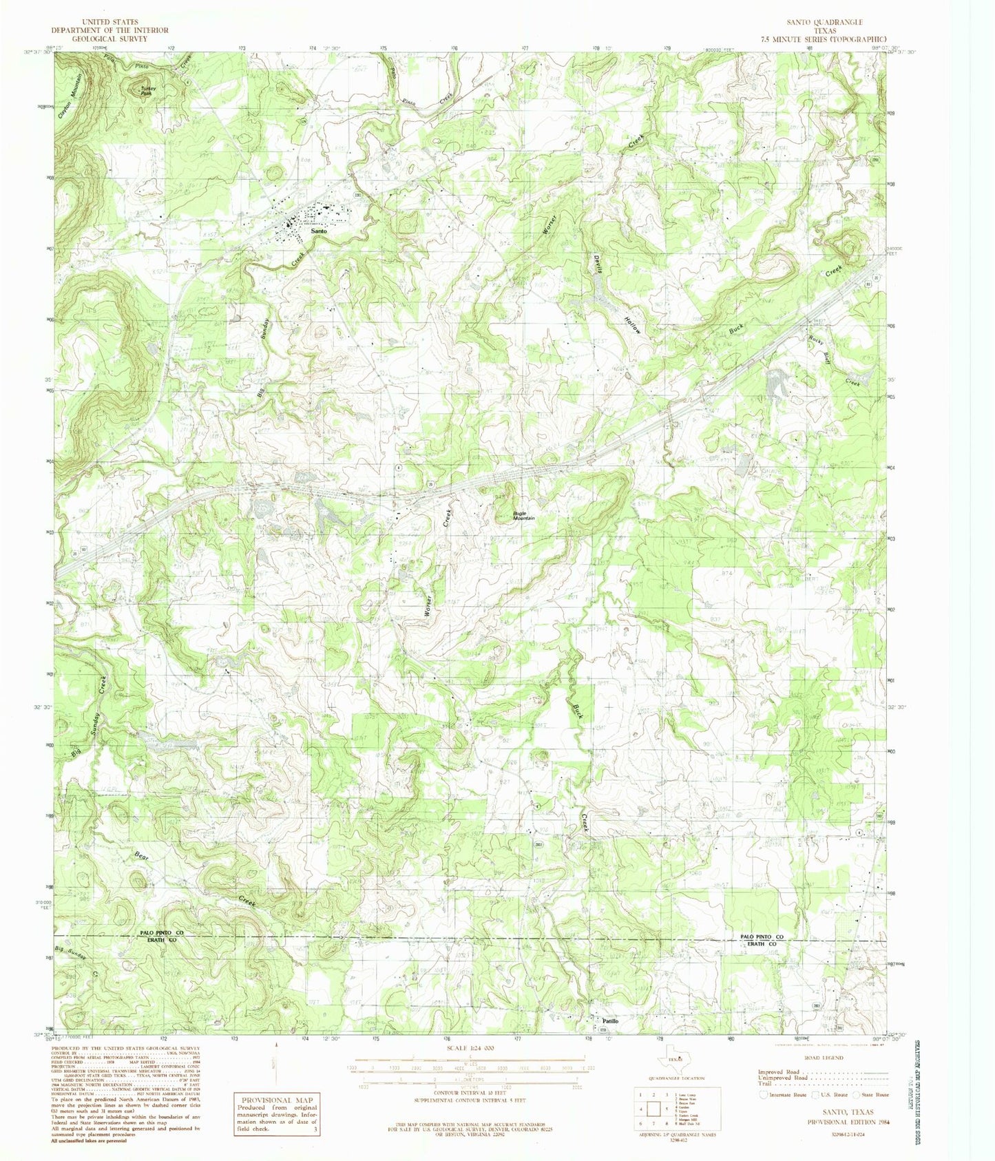
Classic USGS Santo Texas 7.5'x7.5' Topo Map
Couldn't load pickup availability
Historical USGS topographic quad map of Santo in the state of Texas. Map scale may vary for some years, but is generally around 1:24,000. Print size is approximately 24" x 27"
This quadrangle is in the following counties: Erath, Palo Pinto.
The map contains contour lines, roads, rivers, towns, and lakes. Printed on high-quality waterproof paper with UV fade-resistant inks, and shipped rolled.
Contains the following named places: Bear Creek, Big Sunday Creek, Bosley Cemetery, Brannon Cemetery, Bugle Mountain, Cantrell Creek, Devils Hollow, E J Porter Lake, E J Porter Lake Dam, Lawrence Porter Lake Number 1, Lawrence Porter Lake Number 1 Dam, Lawrence Porter Lake Number 2, Lawrence Porter Lake Number 2 Dam, Lawrence Porter Lake Number 3, Lawrence Porter Lake Number 3 Dam, Le Wallen Lake Number 1, Le Wallen Lake Number 1 Dam, Le Wallen Lake Number 2, Le Wallen Lake Number 2 Dam, Palo Pinto County Constable's Office Precinct 1, Patillo, Richards Lake Number 2, Richards Lake Number 2 Dam, Richards Lake Number 3, Richards Lake Number 3 Dam, Richards Lake Number 4, Richards Lake Number 4 Dam, Rocky Bluff Creek, Santo, Santo Census Designated Place, Santo East Cemetery, Santo Post Office, Santo Volunteer Fire - EMS Department, Turkey Peak, ZIP Code: 76472