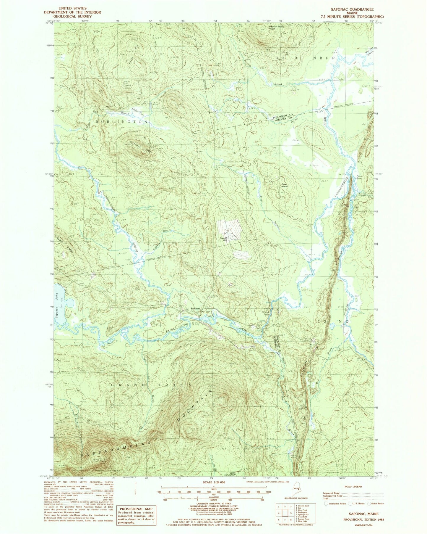
MyTopo
Classic USGS Saponac Maine 7.5'x7.5' Topo Map
Couldn't load pickup availability
Historical USGS topographic quad map of Saponac in the state of Maine. Typical map scale is 1:24,000, but may vary for certain years, if available. Print size: 24" x 27"
This quadrangle is in the following counties: Hancock, Penobscot.
The map contains contour lines, roads, rivers, towns, and lakes. Printed on high-quality waterproof paper with UV fade-resistant inks, and shipped rolled.
Contains the following named places: Bog Brook, Bowers Brook, Bryant Hill, Grand Falls, Grass Island, Hathaway Ridge, Madagascal Stream, Negro Hill, Nicatous Stream, Oaks Bog, Passadumkeag Mountain, Pistol Green, Pistol Stream, Rocky Brook, Saponac, The Horseback, Trout Brook, Turner Cemetery, Upper Lord Brook, Upper Sand Brook, Wheeler Brook, Wyman Brook, Wyman Brook Ridge, WHCF-FM (Bangor), Grand Falls Township