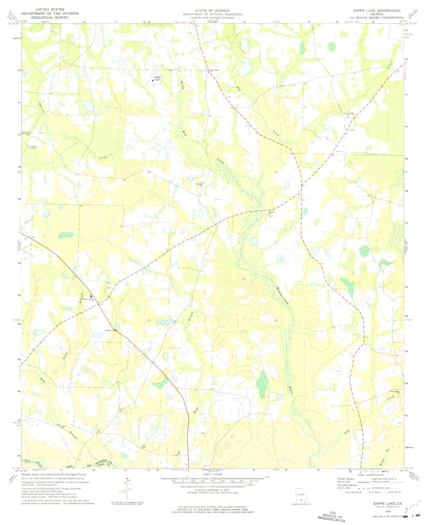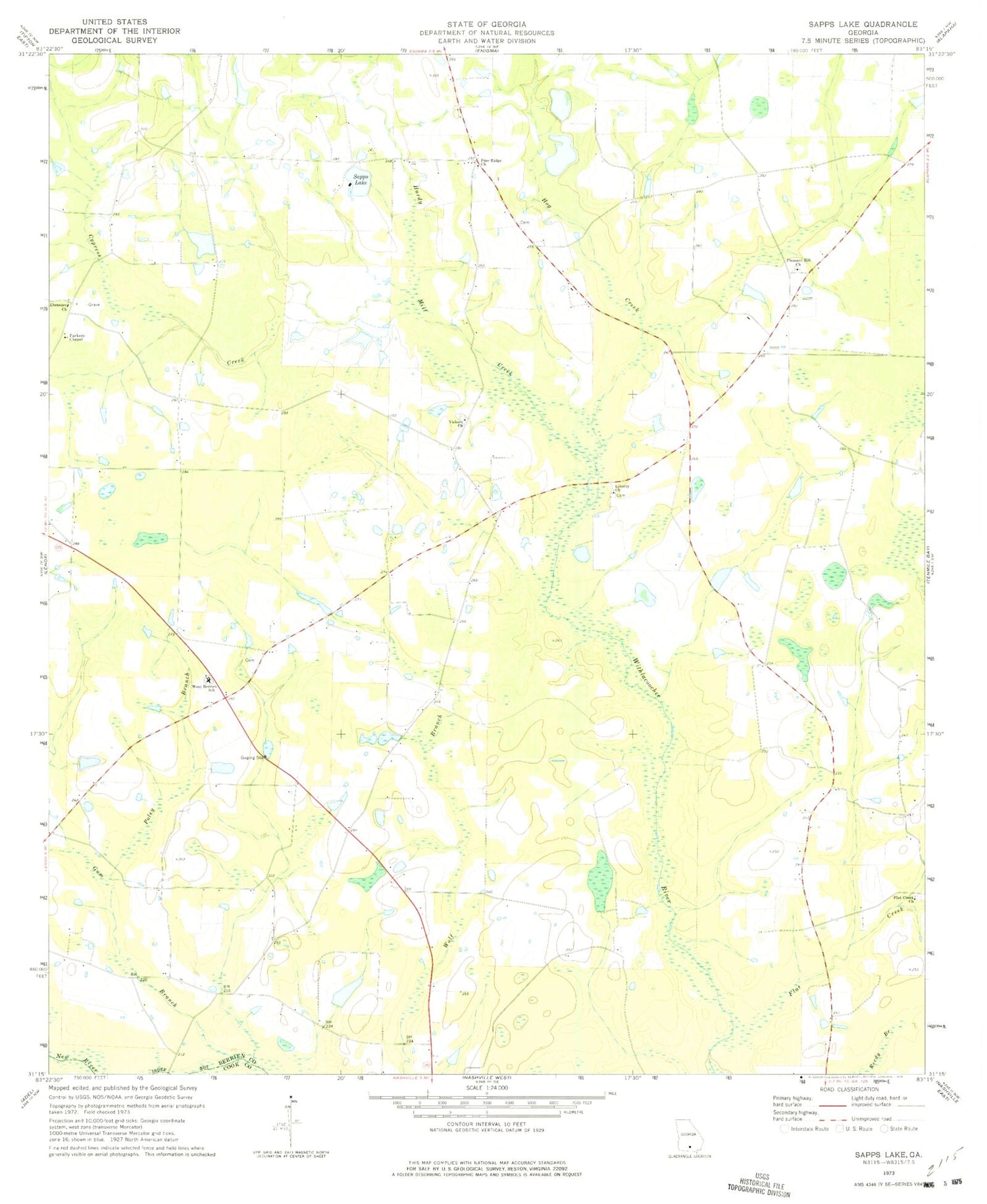
MyTopo
Classic USGS Sapps Lake Georgia 7.5'x7.5' Topo Map
Couldn't load pickup availability
Historical USGS topographic quad map of Sapps Lake in the state of Georgia. Map scale may vary for some years, but is generally around 1:24,000. Print size is approximately 24" x 27"
This quadrangle is in the following counties: Berrien, Cook.
The map contains contour lines, roads, rivers, towns, and lakes. Printed on high-quality waterproof paper with UV fade-resistant inks, and shipped rolled.
Contains the following named places: Cypress Creek, Ebenezer Church, Emmaus Primitive Baptist Church, Enigma Division, Flat Creek, Flat Creek Cemetery, Flat Creek Church, Gainey Bridge, Gaskins Lake, Gaskins Lake Dam, Gum Branch, Hardy Mill Creek, Hog Creek, Liberty Church, Lindsey Lake, Lindsey Lake Dam, McMillian Lake, McMillian Lake Dam, Parkers Chapel, Pine Ridge Church, Pleasant Hill Church, Poley Branch, Sapps Lake, Sapps Lake Dam, Vickers Cemetery, Vickers Church, Vickers School, West Berrien School, West Berrien Volunteer Fire Department