MyTopo
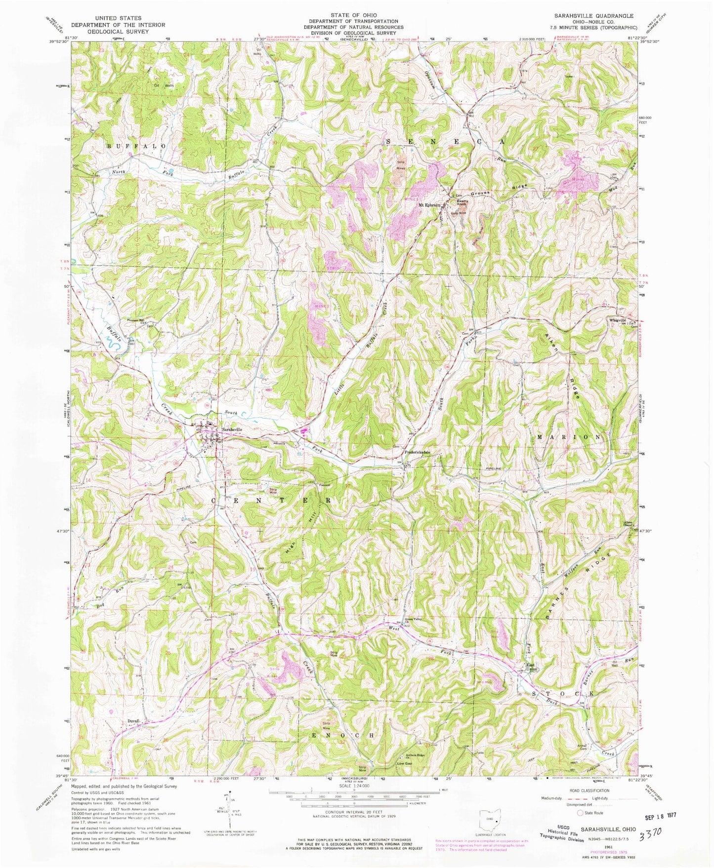
Classic USGS Sarahsville Ohio 7.5'x7.5' Topo Map
Couldn't load pickup availability
Historical USGS topographic quad map of Sarahsville in the state of Ohio. Map scale may vary for some years, but is generally around 1:24,000. Print size is approximately 24" x 27"
This quadrangle is in the following counties: Noble.
The map contains contour lines, roads, rivers, towns, and lakes. Printed on high-quality waterproof paper with UV fade-resistant inks, and shipped rolled.
Contains the following named places: Aiken Ridge, Aiken School, Allens Chapel, Allens Chapel Cemetery, Archer Cemetery, Archer School, Archers Ridge Cemetery, Archers Ridge Church, Baggs School, Barnes Run, Beatty Knob, Center, Duvall, East Union, East Union Cemetery, Fredericksdale, Fredericksdale Post Office, Green Valley Church, Groves Ridge, High Hill, Lemon School, Little Buffalo Creek, Low Gap, McGarry School, Mount Ephraim, Mount Ephraim Post Office, Mount Ephraim Station, Mount Ephriam Methodist Church, Noble County, Old Mount Ephriam Cemetery, Pleasant Hill Cemetery, Pleasant Hill Church, Reeds School, Riches Church, Riches School, Sarahsville, Sarahsville Post Office, Shenandoah Elementary School, Shenandoah High School, South Fork Buffalo Creek, Stones School, Township of Center, Township of Seneca, Upper Opossum School, Village of Sarahsville, Vorhies, West Fork East Fork Duck Creek, Whigville Cemetery, Wolfpen Run, ZIP Code: 43779