MyTopo
Classic USGS Sardinia South Carolina 7.5'x7.5' Topo Map
Couldn't load pickup availability
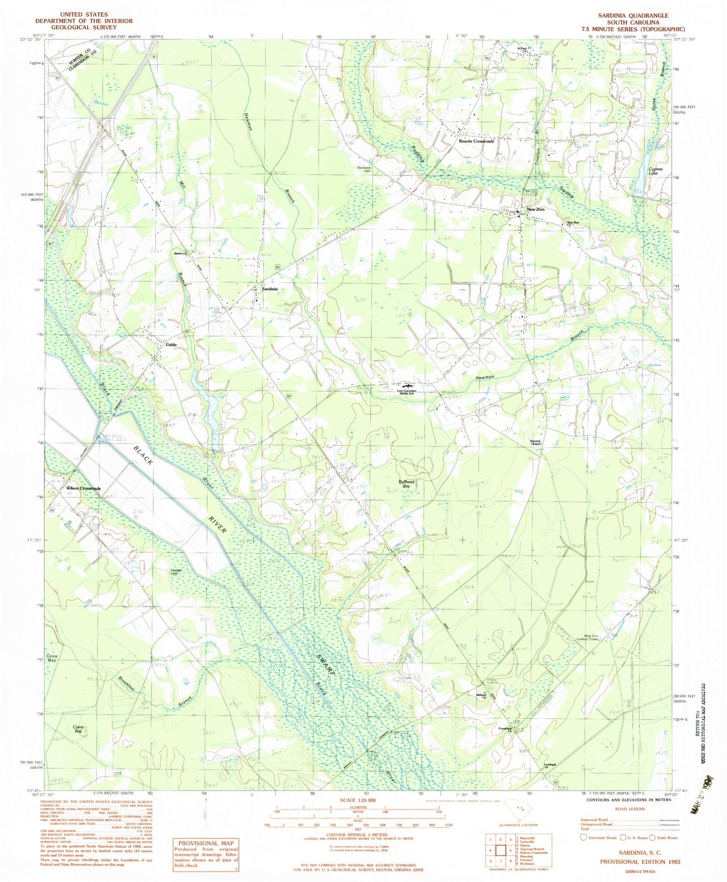
Historical USGS topographic quad map of Sardinia in the state of South Carolina. Map scale may vary for some years, but is generally around 1:24,000. Print size is approximately 24" x 27"
This quadrangle is in the following counties: Clarendon, Sumter.
The map contains contour lines, roads, rivers, towns, and lakes. Printed on high-quality waterproof paper with UV fade-resistant inks, and shipped rolled.
Contains the following named places: Baker Mill Pond, Beards Crossroads, Boozer Upper Pond, Boozer Upper Pond Dam D-2668, Breakfast Branch, Bullhead Bay, Clarendon Fire Department Station 13, Clarendon Fire Department Station 9, Cutno Bay, Cypress Lake, East Clarendon Elementary School, East Clarendon Middle School, Ebenezer Cemetery, Ebenezer Church, Ebenezer School, Edens Small Pond, Edens Small Pond Dam D-2615, Friendship Church, Friendship School, Gable, Gable Post Office, Gable School, Gamble Chapel, Gilliard Crossing, Hodges Cemetery, Horse Branch, Howard Chapel, Howard Chapel School, Loadabar Church, Loadabar School, Loadagal Church, Malina School, Mcfadden Pond Dam D-3483, Mcfaddens Pond, Melina Church, Midway Church, Midway Crossing, Mill Branch, New Zion, New Zion Church, New Zion Lookout Tower, New Zion Station, Rainbow Lake, Saint Paul Church, Salem School, Sardinia, Sardinia Division, Sardinia Post Office, Sardinia Presbyterian Church, South Carolina Noname 09001 D-2614 Dam, South Carolina Noname 14001 D-3487 Dam, South Carolina Noname 14005 D-3484 Dam, Trustless Branch, Wilson Crossroads, ZIP Code: 29111