MyTopo
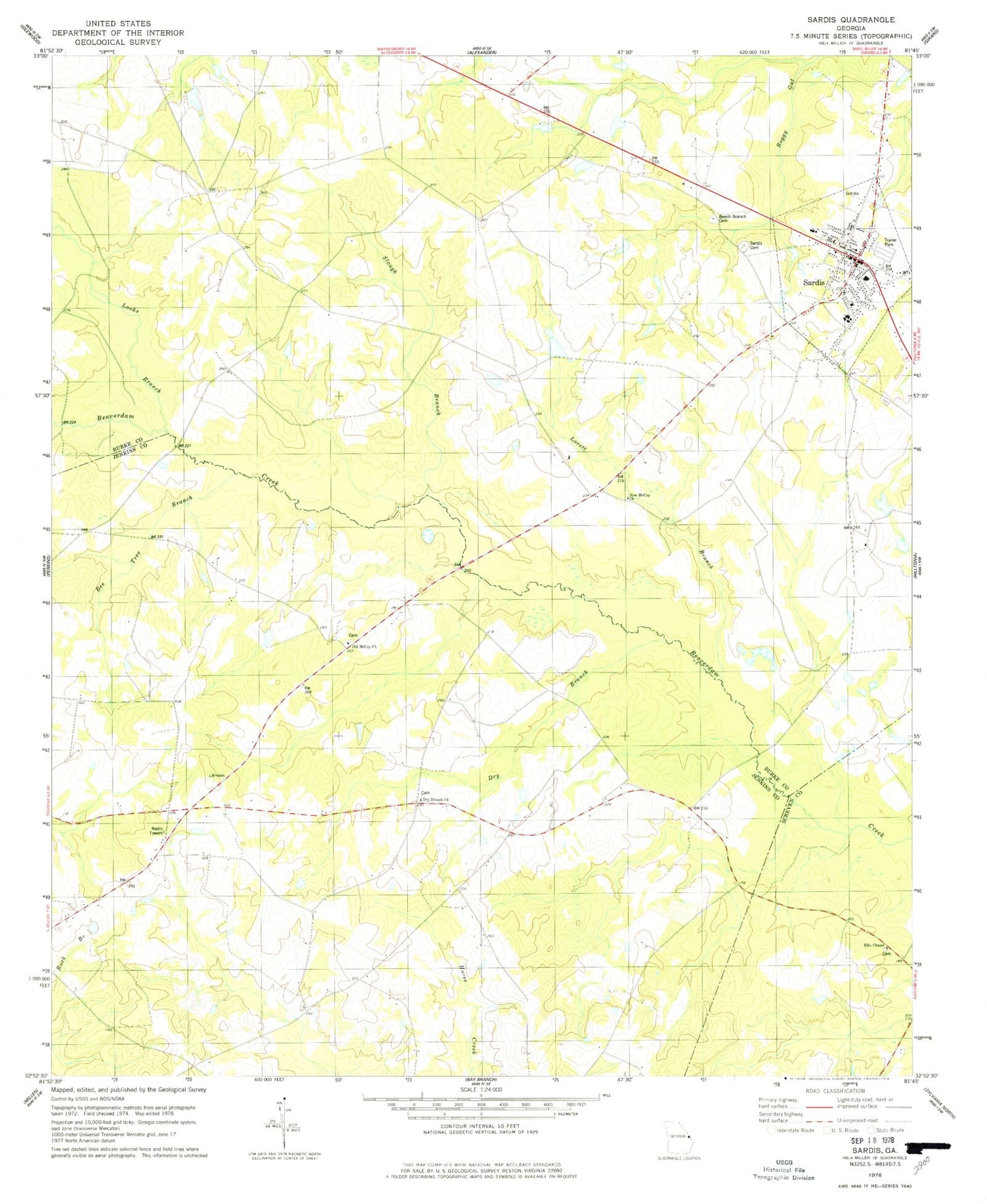
Classic USGS Sardis Georgia 7.5'x7.5' Topo Map
Couldn't load pickup availability
Historical USGS topographic quad map of Sardis in the state of Georgia. Map scale may vary for some years, but is generally around 1:24,000. Print size is approximately 24" x 27"
This quadrangle is in the following counties: Burke, Jenkins, Screven.
The map contains contour lines, roads, rivers, towns, and lakes. Printed on high-quality waterproof paper with UV fade-resistant inks, and shipped rolled.
Contains the following named places: Bee Tree Branch, Beech Branch Baptist Church, Beech Branch Cemetery, Beech Branch School, Bill Davis, Burke County Emergency Management Agency Engine Company 12, City of Sardis, Cousins Elementary School, Dry Branch, Dry Branch Church, Dry Branch School, East Burke Church, Ellis Chapel United Methodist Church Cemetery, Looks Branch, Lovett Branch, New McCoy Church, Old McCoy Church, Old Sardis, Pleasant Grove School, Sardis, Sardis Branch Library, Sardis Cemetery, Sardis Division, Sardis Police Department, Sardis Post Office, Sardis Town Hall, Slough Branch, ZIP Codes: 30456, 30822