MyTopo
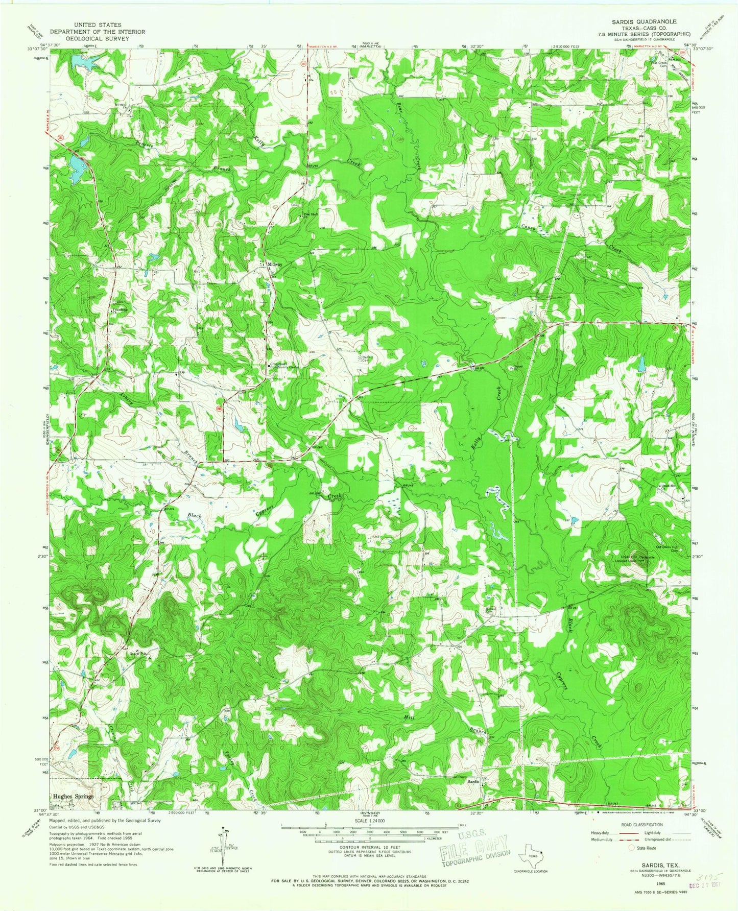
Classic USGS Sardis Texas 7.5'x7.5' Topo Map
Couldn't load pickup availability
Historical USGS topographic quad map of Sardis in the state of Texas. Map scale may vary for some years, but is generally around 1:24,000. Print size is approximately 24" x 27"
This quadrangle is in the following counties: Cass.
The map contains contour lines, roads, rivers, towns, and lakes. Printed on high-quality waterproof paper with UV fade-resistant inks, and shipped rolled.
Contains the following named places: Arbery Branch, Bear Creek, Caney Creek, Coker Lake, Coker Lake Dam, Crossroads - Cornett Volunteer Fire Department, Crossroads Community Center, Dennis Cemetery, Flat Creek Cemetery, Friendship Church, Kelly Creek, Midway, Mill Branch, Mount Olive Church, Old Union Hill Cemetery, Pine Bluff Church, Prairie Branch, Rankin Cemetery, Sardis, Union Hill Church, Union Hill Lookout Tower, ZIP Code: 75656