MyTopo
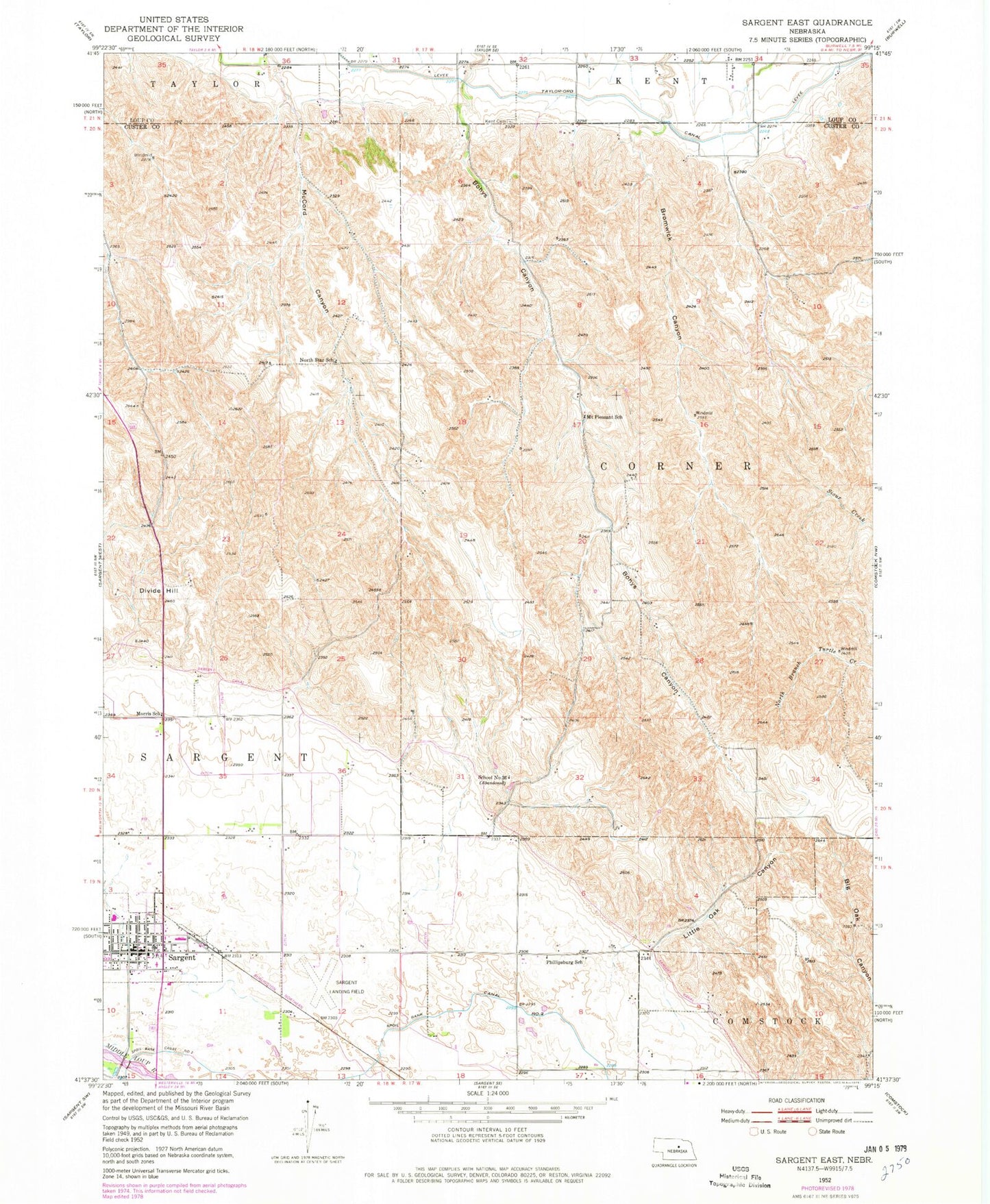
Classic USGS Sargent East Nebraska 7.5'x7.5' Topo Map
Couldn't load pickup availability
Historical USGS topographic quad map of Sargent East in the state of Nebraska. Map scale may vary for some years, but is generally around 1:24,000. Print size is approximately 24" x 27"
This quadrangle is in the following counties: Custer, Loup.
The map contains contour lines, roads, rivers, towns, and lakes. Printed on high-quality waterproof paper with UV fade-resistant inks, and shipped rolled.
Contains the following named places: Assumption of Blessed Virgin Mary Church, Bohys Canyon, Bromwick Canyon, Church of Christ, City of Sargent, Divide Hill, Evangelical Free Church, Farmers Cooperative Elevator, Kent Cemetery, Little Oak Canyon, Morris School, Mount Pleasant School, North Star School, Peace Lutheran Church, Phillipsburg Post Office, Phillipsburg School, Sargent, Sargent Ambulance Service, Sargent Family Practice, Sargent Feed and Grain Company Elevator, Sargent Golden Acres RV Park, Sargent Library, Sargent Municipal Airport, Sargent Nursing Home, Sargent Park, Sargent Post Office, Sargent Public Schools, Sargent Rural Health Clinic, Sargent Volunteer Fire Department, School Number 36, Township of Corner, Township of Sargent, United Methodist Church