MyTopo
Classic USGS Saska Peak Washington 7.5'x7.5' Topo Map
Couldn't load pickup availability
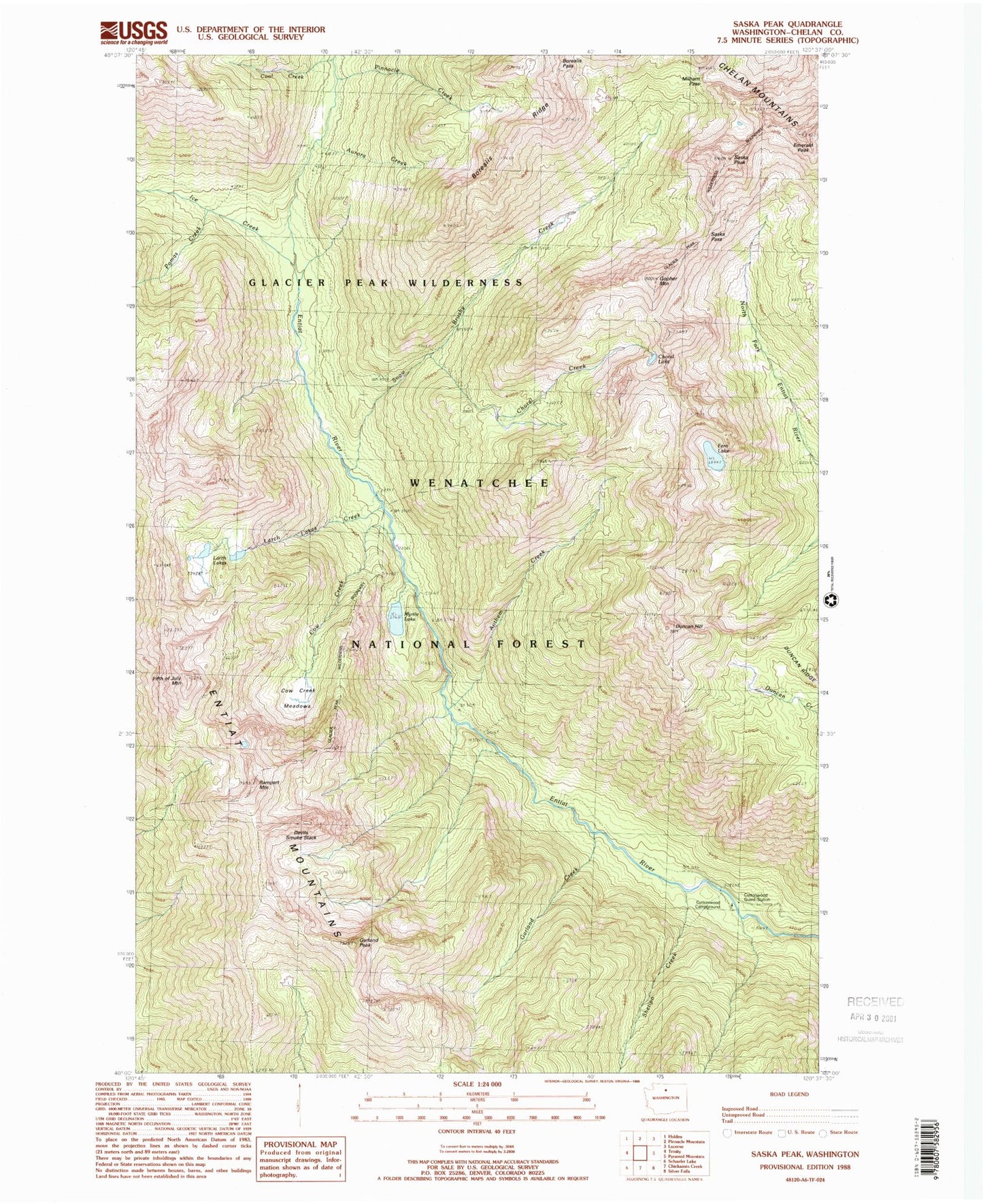
Historical USGS topographic quad map of Saska Peak in the state of Washington. Typical map scale is 1:24,000, but may vary for certain years, if available. Print size: 24" x 27"
This quadrangle is in the following counties: Chelan.
The map contains contour lines, roads, rivers, towns, and lakes. Printed on high-quality waterproof paper with UV fade-resistant inks, and shipped rolled.
Contains the following named places: Anthem Creek, Aurora Creek, Bearcat Ridge, Borealis Ridge, Choral Creek, Choral Lake, Cool Creek, Cottonwood Guard Station, Cow Creek, Cow Creek Meadows, Devils Smoke Stack, Duncan Hill, Duncan Hill Trail, Emerald Peak, Fern Lake, Fifth of July Mountain, Garland Creek, Garland Peak, Gopher Mountain, Ice Creek, Larch Lakes, Larch Lakes Creek, Milham Pass, Myrtle Lake, Pinnacle Creek, Pomas Creek, Rampart Mountain, Saska Peak, Shetipo Creek, Snow Brushy Creek, Larch Lake Campground, Ice Creek Shelter, Ice Creek Camp, Borealis Peak, Borealis Pass, Saska Pass, Cottonwood Campground