MyTopo
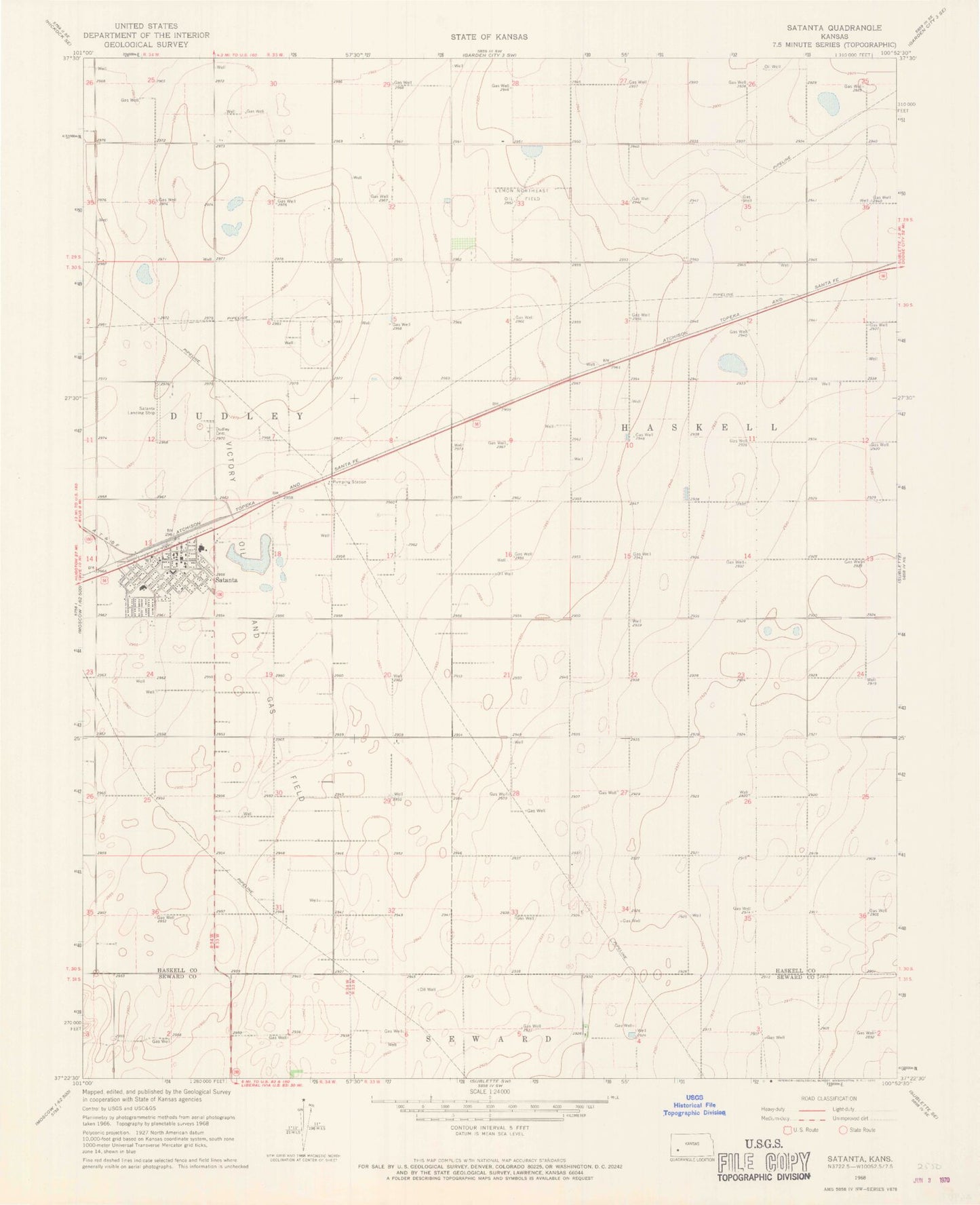
Classic USGS Satanta Kansas 7.5'x7.5' Topo Map
Couldn't load pickup availability
Historical USGS topographic quad map of Satanta in the state of Kansas. Map scale may vary for some years, but is generally around 1:24,000. Print size is approximately 24" x 27"
This quadrangle is in the following counties: Haskell, Seward.
The map contains contour lines, roads, rivers, towns, and lakes. Printed on high-quality waterproof paper with UV fade-resistant inks, and shipped rolled.
Contains the following named places: Anton Flying UV Airport, Church of Christ, City of Satanta, Dudley Cemetery, Dudley Township Library, First Baptist Church, First United Pentecostal Church, Haskell County Ambulance Satanta Station, Lemon Northeast Oil Field, Saint Alphonsus Catholic Church, Satanta, Satanta and Dudley Township Fire Department, Satanta City Hall, Satanta District Hospital, Satanta Grade School, Satanta Happy Agers Center, Satanta Junior / Senior High School, Satanta Municipal Airport, Satanta Post Office, Satanta United Methodist Church, Victory Oil and Gas Field