MyTopo
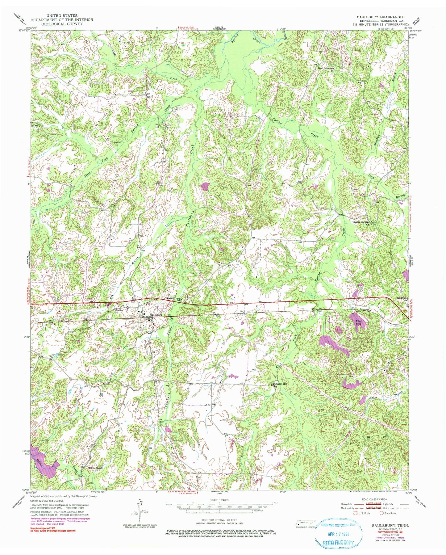
Classic USGS Saulsbury Tennessee 7.5'x7.5' Topo Map
Couldn't load pickup availability
Historical USGS topographic quad map of Saulsbury in the state of Tennessee. Map scale may vary for some years, but is generally around 1:24,000. Print size is approximately 24" x 27"
This quadrangle is in the following counties: Hardeman.
The map contains contour lines, roads, rivers, towns, and lakes. Printed on high-quality waterproof paper with UV fade-resistant inks, and shipped rolled.
Contains the following named places: Antioch Cemetery, Candlewood Dam, Candlewood Lake, Cash Creek, Chancellor and Son Dam, Chancellor and Son Lake, Click Branch, Commissioner District 5, Crystal Lake, Crystal Lake Dam, Dry Branch, East Fork Spring Creek, Elliots Chapel, Fortune Branch, Frese Pond, Grand Junction Division, Indian Creek Watershed Number Seven Lake, Kellyham Branch, Landis Dam, Landis Lake, Old Hickory Dam, Old Hickory Lake, Optimist Club Lake, Optimist Club Lake Dam, Pleasant Grove Missionary Baptist Church, Pleasant Grove School, Pleasant Hill School, Porters Creek Dam Number Nine, Porters Creek Lake Number Nine, Pruette Cemetery, Ramah Church, Rocky Springs Church, Saulsbury, Saulsbury Baptist Church, Saulsbury Cemetery, Saulsbury Creek, Saulsbury Fire Department, Saulsbury Post Office, Saulsbury School, Spring Lake, Spring Lake Dam, Town of Saulsbury, West Fork Spring Creek, West Memorial Church, Wright Cemetery, ZIP Code: 38067